James Cagney’s crime-busting thriller “G” Men (1935) and Buster Keaton’s debut short film One Week (1920) both contain exciting scenes filmed in Inglewood. Cagney portrays a new FBI recruit who helps the bureau capture notorious bank robber Danny Leggett, played by Edward Pawley. During a crime montage Leggett’s gang robs a bank, leading to a blasting machine gun police chase on the streets of Inglewood and beside the Inglewood train station.
This aerial view of Inglewood shows two corners appearing during the “G” Men chase, the “orange” corner and the “yellow” corner (see below). LAPL.
This aerial view above shows two parts of the chase, discussed further below. During the “yellow” turn the cars travel north up La Brea and make a sharp turn west onto Florence Avenue traveling past a building with a curved, 60 degree corner. During the “orange” turn they travel east down Regent Street before turning north up Market Street.
Looking west down Regent from Market.
Matching views above looking west down Regent during the “orange” turn. The corner building had its upper floor removed, but the building west of the alley (red box) remains unchanged.
The start of the “yellow” turn – looking south down La Brea. LAPL.
The “yellow” turn in “G” Men begins with this view above looking south down La Brea towards the corner of Regent, flanked by the corresponding blue and red symbols. The “yellow” turn continues by sweeping quickly past a 60 degree corner building (below) that remains standing.
The 60 degree corner building standing at La Brea and Florence in Inglewood.
The “G” Men chase continues two blocks further west from the “yellow” turn, as the cars turn west from Fir Avenue, at Florence, and drive beside the train tracks that appear prominently during Keaton’s film One Week.
Turning west from Fir towards the former Inglewood train depot. LAPL.
As the cars travel west beside the tracks, the conspicuous rooftop sign for the C. GANAHL LUMBER CO., standing across from the depot, comes into view (red box).
Looking west from “G” Men to the left, and east at Buster, to the right, crossing the tracks on Eucalyptus Avenue during One Week.
Built in 1925, this charming bungalow at 3120 Vera Avenue near Culver City appearing in the 1929 comedy Perfect Day is one of the most popular and easily recognizable of all Laurel & Hardy film locations. Author Randy Skretvedt reports the home belonged to Hal Roach Studios electrician Bailey H. Boone, which I confirmed in the 1931 city directory. Thanks to Google Street View, and the help of location sleuth Jim Dallape, we’ll see that even more locations reveal themselves nearby.
I first learned of this setting reading Pratfall, the 1985 Way Out West Tent filming location guide documenting Bob Satterfield’s many Laurel & Hardy discoveries. You can see at left a large group of happy fans posing in front of the home during a 2009 tour hosted by the Way Out West Tent, the Los Angeles chapter of the Sons of the Desert International Laurel & Hardy Society. (Jim Dallape and Robert Winslow are co-creators of the amazing Hal Roach Studios Backlot Tour, hosted as part of Dave Lord Heath’s astounding Another Fine Mess website, which provides encyclopedic details about nearly the entire output of the Roach Studios.) For a better view, please CLICK TO ENLARGE each image and map below.
Out for a picnic, the family drives past their home.
Stan in front of 3116 Vera Ave. Although situated today on a corner (Regent St.), this home once stood three lots south from the original corner of Vera and Bedford Street. Along with Bedford, the north end of Vera was lost to the Santa Monica Freeway, visible at back.
3115 Vera appears at back. The driveway runs under an arched passage-way (yellow) now closed off with a door.
As Stan dashes up Vera, a hilltop structure appears behind him. The two candidates are the former California Country Club upper left oval on map, or the former Pacific Military Academy, right oval. The upper right photo shows the club circa 1923. USC Digital Library.
Although the movie frame could be more clear, after studying several photos, including the above, I believe the former California Country Club to the left above is the hilltop building appearing behind Stan. The club had a row of trees to the west (oval), and a flat profile. The former Pacific Military Academy had no trees to the west, and a tall five story tower (arrow) that would likely stand out in the movie frame. The home behind Stan is likely 2975 Bedford, now lost to the freeway. HollywoodPhotographs.com
Oh how Ollie suffers. Matching porch details (yellow) of 3121 Vera, and a better view of the once open arched driveway (red) of 3115 Vera.
Turning left from Ivy onto Bedford. Notice the three visible corners in 1929 were all vacant lots. The Boys started their turn from the north dead-end of Ivy. Everything right of the dotted red line is lost to the new Regent Street and the freeway.
Looking SW towards the Hal Roach Studio (red), Sebastian’s Cotton Club (blue), the Vera Ave. primary filming site (yellow oval), the Boys’ left turn from the dead-end of Ivy onto Bedford (arrow), and the Helms Ave. filming site for the film’s sinking car finale (orange oval). The narrow parallel lines mark the route of modern Regent Street that replaced Bedford, the wide lines mark the path of the modern Santa Monica Freeway that subsumed Bedford and the homes alongside it.
The Baldwin Hills and Sebastian’s Cotton Club (blue oval) appear at back looking south down Ivy Ave. LAPL.
The curved arrow on this 1929 Sanborn map shows the Boys’ left turn from the dead end of Ivy onto Bedford. The four corners of this intersection were all vacant at the time of filming. The red boxes mark the Vera Ave (bottom) and Ivy (top) shooting sites. Everything to the right of the vertical line was destroyed by the new Regent Street and the freeway. The Cotton Club stood just steps from the City of Los Angeles border.
Some of the lively “black and tan” acts to appear at the Cotton Club – Creole dancing girls and Leon Herriford and his Orchestra. LAPL and LAPL.
These homes along 3129, 3123, and 3121 Ivy Ave. appear at back as Stan and Ollie make their turn. The ovals mark corresponding details.
Looking east at the Cotton Club (blue) across the street from the Roach Studios (red). The sinking car finale (orange) was filmed on Helms just north of where Jacob Street meets Helms. Marc Wanamaker – Bison Archives.
As the car approaches the Helms Ave. water pit, 3349 and 3341 stand at back, separated by a lot that would remain vacant until 1952. A lamp post beside 3341 appears in both images. Jim Dallape.
Perfect Day concludes with the family car sinking in a watery pit. Jim Dallape contacted me last year with his amazing discovery that this scene was filmed on Helms Avenue, close to the Roach Studio. His matching photos above and below confirm the spot. The non-adjacent homes on 3349 and 3341 Helms appearing during the scene were separated by a vacant lot, clearly visible during the final scene, that remained empty until 1952. While other sites have been suggested as candidates for this final scene, including (i) 3125 and 3127 Curtis Avenue, (ii) 9051 and 9047 Hubbard Street , and (iii) 3155 and 3151 Hutchinson Street, they fail to match visually, and the vintage Sanborn maps prove these pairs of homes were never separated by an empty lot.
The end to a perfect day – the car sinks slowly with 3349 Helms Street at back. Jim Dallape.
Charlie, Buster, and Harold each filmed a masterpiece at an alley you can still visit today. Please help support naming the alley by posting a review on Google Maps. Prototype alley sign design by noted Dutch graphic artist – Piet Schreuders. Download a 4-page brochure about the alley HERE. This video further explains the alley – if you can, please leave a thumbs up and share it with others.
My thanks again to Jim Dallape for sharing his discoveries. Check out his Hal Roach Studios Backlot Tour. Perfect Day (C) Hal Roach Studios, Inc. Color images Jim Dallape. Other color images (C) Google.
Tonight marks the Turner Classic Movie Channel premiere of the 2011 multi-Oscar-winning Best Picture The Artist. Depicting the silent movie era, and filmed on location in Hollywood, the movie has many amazing connections to early Hollywood history and its biggest stars. Here are a few highlights from my series of posts about The Artist.
To begin, Jean Dujardin’s character George Valentine premiered his failed production Tears of Love at the same theater where Charlie Chaplin premiered City Lights (1931) – the Los Angeles Theater. You can read more about this amazing theater’s appearance in The ArtistHERE.
Charlie Chaplin’s The Kid
56 Fremont Place was once home to Mary Pickford. It appears in the background (left) in The Kid, and as Peppy Miller’s home in The Artist (right). The box marks the same corner of the house in each image.
Bérénice Bejo’s character Peppy Miller lives in a mansion located at 56 Fremont Place, occupied for a time in 1918-1919 by America’s Sweetheart, silent film superstar Mary Pickford.
55 Fremont Place in The Kid. This beautiful home, once owned by prize-fighter Muhammad Ali, stands across the street from 56 Fremont Place, the former Mary Pickford home appearing in The Artist.
Across the street from Mary Pickford’s house is the mansion where Edna Purviance abandons her infant son (see above) at the beginning of Charlie Chaplin’s The Kid (1921).
(c) 2011 Microsoft Corporation, Pictometry Bird’s Eye (c) 2010 Pictometry International Corp.
The mansion where George Valentine lives is located at 104 Fremont Place (see above), behind the home Chaplin used when filming The Kid and close to Mary Pickford’s home. Read more about the Fremont Place neighborhood HERE.
Buster Keaton’s One Week
The Lillian Way entrance to the Red Studios was fixed up to appear in the movie. The red box marks the same sliding door and shed in both images. The left yellow oval marks the shadow cast by the modern day rooftop air-conditioning unit (the right yellow oval), replaced with open sky in the movie frame. The Cahuenga entrance to the Red Studios on Cahuenga was used in Who Framed Roger Rabbit ? (c) 2011 Google.
The studio entrance gate and other exterior studio scenes portrayed in The Artist were filmed at the Red Studios, 846 N. Cahuenga Boulevard, two blocks due south from the site of the former Buster Keaton Studios. The block where the Red Studios is situated was used as a backlot for the Metro Studios to build exterior sets. It was here that Buster Keaton constructed his disastrous build-it-yourself two-story home (left) for his debut independent short film One Week (1920). To see vintage aerial photos of the backlot where Keaton filmed One Week, and how the Red Studios portrayed the Maroon Cartoon Studio in Who Framed Roger Rabbit?, you can read more HERE.
The triumphant 1927 premiere of George Valentin’s hit movie A Russian Affair was staged inside the historic Orpheum Theater, located in the heart of the Los Angeles Historic Core, at 842 S. Broadway.
This circa 1928 photo looks up Broadway from Tenth Street (now Olympic). The newly completed Los Angeles City Hall appears as the white tower in the far background. Harold Lloyd filmed the clock stunt from Safety Last! (1923) on the roof to 908 S. Broadway (red oval above), just steps away from the Orpheum Theater that opened in 1926. Today the Art Deco Ninth and Broadway Building, completed in 1930, obscures the painted Orpheum Theater wall sign. The yellow oval marks where Lloyd returned to film climbing stunts for Feet First (1930). USC Digital Library.
As shown above, the Orpheum Theater stands just a few steps north from where Harold Lloyd staged his clock climbing stunt from Safety Last! (1923). You can read more about the Orpheum Theater HERE and many posts about Safety Last!HERE.
Present Day Backlots and Uggie
My other posts show a variety of The Artist filming locations not reported elsewhere, including scenes where Uggie the dog comes to the rescue, where Peppy comes to the rescue, and how the present day Warner Bros. and Paramount Studios backlots were used to replicate silent-era Hollywood.
Click to enlarge each image. 1930 vs. 1958. Stan and Ollie (well, their stunt doubles) ride south down Sunset Blvd. from Grand at the conclusion of Another Fine Mess. Palmer Conner Collection.
In 2001 Piet Schreuders wrote to me from his home in Amsterdam postulating (correctly) about the tunnel appearing at the conclusion of Laurel and Hardy’s 1930 comedy short Another Fine Mess. Apart from being an internationally acclaimed graphic designer, and creator of Furore Magazine, Piet’s amazing list of accomplishments include writing The Beatles’ London, a guide to The Beatles’ shooting and filming locations; co-founding The Beau Hunks music ensemble, which recreates the LeRoy Shield musical scores played during the Hal Roach Studio comedies; and creating a virtual reality computer model of downtown Culver City as it appeared when Laurel and Hardy filmed there so frequently in the 1930s. Piet has also tracked down the filming locations for such classic French films as Mr. Hulot’s Holiday (1951) and The Red Balloon (1956).
The boys turn south from Sunset, past the Croyden Hotel Apartments, towards the north portal of the northern Hill Street Tunnel. Palmer Conner Collection.
Another Fine Mess is a remake of Stan and Ollie’s earlier film Duck Soup (1927), and the first movie to use the background music of Piet’s hero Mr. Shield. The story begins as the Boys hide from the police in what they believe is a deserted mansion.
Stan Laurel’s solo appearance beside the mansion in White Wings (1923) – the mansion at 3500 W. Adams – Stan and Ollie dressed as a goat fleeing the home in Another Fine Mess. LAPL.
The mansion appearing in the film, still standing at 3500 West Adams Blvd., was built in 1910 by Secondo Gausti, and was later owned by film choreographer Busby Berkeley. The mansion is now home to the Peace Awareness Labyrinth & Gardens and is open for tours.
The movie concludes with a cartoon-style joke. Stan and Ollie flee the mansion dressed in a two-person wildebeest costume (don’t ask), then quickly commandeer a tandem bicycle. The police chase the bicycling duo into a tunnel when a trolley approaches. The speeding trolley car strips the police of their clothing, while Stan and Ollie emerge from the other end of the tunnel relatively unscathed, but now riding unicycles, suggesting their tandem bike was torn in two.
The Boys pass a distinctive billboard for Mt. Lowe as they continue towards the northern Hill Street Tunnel portal. Palmer Conner Collection.
Piet wrote to me with an enticing anecdote from Randy Skretvedt’s classic book “Laurel and Hardy: The Magic Behind the Movies,” where stunt person Joe Mole recalled that he and his brother rode the unicycles for the scene “down by the old Hill Street tunnel.” Based on the series of maps and other materials he provided, Piet correctly concluded that the scene must have been filmed where the Pacific Electric Railway veers south from Sunset into the tunnel running beneath Fort Moore Hill.
Views of the tunnel portal before and after it was closed over. Inset Mark Forer.
Click to enlarge. The north portal (top arrow) to the northern Hill Street Tunnel running from Sunset to Temple beneath Fort Moore Hill (dotted line). The bottom arrow points to the Broadway Tunnel north portal. LAPL.
Los Angeles was a very different place in 1930. Originally cut off to the northwest by a series of hills, downtown LA was difficult to reach from Hollywood and parts west until a series of tunnels were built starting in 1901. By 1930 a series of six tunnels provided access to downtown; the 3rd Street Tunnel, the Broadway Tunnel, the twin-bore Hill Street Tunnel under Court Hill, the single-bore northern Hill Street Tunnel under Fort Moore Hill, the 2nd Street Tunnel, and the Hollywood subway tunnel running from Beverly/Glendale Boulevards south of Echo Park into the basement of the Subway Terminal Building. Although there were 11 tunnel portals to choose from, given the layout and other characteristics present during the scene, I agreed with Piet’s conclusion. But at the time there were so few reference photos available it was difficult to sense what the area looked like.
Harold Lloyd and the Mt. LOW_ RAPID Electric
One thing that struck me watching the scene is that Stan and Ollie pass a billboard advertising the Pacific Electric railway to Mt. Lowe. Mt. Lowe had been on my radar ever since I became aware that Harold Lloyd once modified a trolley advertisement appearing in Hot Water (1924) to read “Mt. Low_” on the “RAPID Electric.” It’s baffling why Lloyd bothered to revise the Pacific Electric ad, but then only alter it slightly, and so this oddity was something I always remembered.
A closer view, riding south down Sunset from Grand (top arrow) then turning right towards the tunnel (bottom arrow). Hill Street snakes around from the lower left corner to join Sunset in the middle of the photo.
A great number of vintage photos have become available for online searching since Piet wrote to me in 2001, and one particularly exciting collection is the Palmer Conner Collection of Color Slides of Los Angeles hosted by the Huntington Digital Library. While browsing the collection I noticed a billboard advertising Mt. Lowe. Remembering the Laurel and Hardy billboard, I pulled up the movie frame and found it was a match, confirming the tandem bike entered from Sunset Boulevard into the north portal of the northern Hill Street Tunnel. Likewise, comporting with geographic reality, the unicycles were filmed emerging from south portal of the tunnel, riding towards Temple Street.
Another view of the northern Hill Street Tunnel (dotted line) running from Sunset to Temple. The Boys entered at the Sunset portal (arrow). The trolley tracks continued right to left, crossing Temple Street (running down the photo center) until reaching the north portal of the Hill Street Tunnel that passed under Court Hill (yellow box). The tunnel under Court Hill had a second bore just for automobiles. The oval marks the south portal of the Broadway Tunnel. USC Digital Library.
The tunnel ran diagonally SE beneath Fort Moore Hill roughly from Sunset and Grand to Temple and Hill, passing underneath the playground of the Los Angeles High School. For decades after the tunnel was taken from service and the portals were sealed, a central section of the tunnel was used for storage by the Los Angeles Unified School District. This lasted until 2004, when construction of the current Los Angeles High School No. 9 on Fort Moore Hill necessitated filling in the remaining stretch of the tunnel.
The Boys exit the southern portal riding towards Temple Street.
For more locations earlier in the film (below), Steven J. Margaretic has posted photos of the Boys filming along West Adams in front of the mansion, and riding their tandem bicycle north on 5th Avenue crossing 25th Street, a block from the mansion.
Other locations from Another Fine Mess identified by Stephen J. Margaretic at ClassicVideoStreams.com.
You can purchase Piet’s wonderful study of Laurel and Hardy filming on Main Street in Culver City, complete with street view maps and diagrams, together with fascinating articles about LeRoy Shield and other topics, at his website, HERE. You can purchase Piet’s meticulous study of the Paris
Piet Schreuder’s amazing map of Court Hill, the area within the yellow box three images up.
locations appearing in The Red Balloon, HERE, and can purchase his Beatles guide to London HERE. In closing, I also want to thank Piet for the remarkably informative 3D aerial maps that he contributed to my Harold Lloyd book Silent Traces that depict some of LA’s long lost neighborhoods. These elegant illustrations provide clarity and context to those seeking their way into the past. Thank you Piet for your beautiful work.
Check out Piet’s virtual reality model of 1930s Culver City here, starting at 3:17.
Charlie, Buster, and Harold each filmed a masterpiece at an alley you can still visit today. Please help support naming the alley by posting a review on Google Maps. Prototype alley sign design by noted Dutch graphic artist – Piet Schreuders. Download a 4-page brochure about the alley HERE. This video further explains the alley – if you can, please leave a thumbs up and share it with others.
Another Fine Mess (C) Hal Roach Studios, Inc. HAROLD LLOYD images and the names of Mr. Lloyd’s films are all trademarks and/or service marks of Harold Lloyd Entertainment Inc. Images and movie frame images reproduced courtesy of The Harold Lloyd Trust and Harold Lloyd Entertainment Inc.
Site of the Another Fine Mess former tunnel portal today
Then (1925) and Then (1932) – Super- Hooper-Dyne Lizzies (l) and Taxi for Two (r), both directed by Del Lord.
The 1932 Hal Roach Studio comedy Taxi for Two provides a fascinating glimpse of early Washington Blvd., and the mid-city neighborhood that sprung up south of Hollywood halfway between Culver City and downtown Los Angeles. Directed by Del Lord, one of Mack Sennett’s top directors, Taxi for Two re-stages some of the classic visual gags and car stunts Lord had made famous working for the Keystone Studio in the 1920s.
The highlight of the film comes when the Taxi Boys (Billy Gilbert and Ben Blue) run out of gas, and start pushing the rear of their taxicab blindly forward. The men are so intently focused on their task that they don’t notice when they push their cab into the rear of another vehicle, and continue forward pushing both cars. The boys soon push the two cars into a third vehicle, adding it to the chain, and then a fourth car, until finally a stalled trolley car joins the mix. The image of Billy and Ben pushing an undulating train of autos and trolleys down a city street recalls the Sisyphean image of Billy Bevan pushing a similar train of cars (above, right) in the Del Lord-directed Keystone comedy Super-Hooper-Dyne Lizzies (1925) (available as part of The Mack Sennett Collection, Vol. One from Flicker Alley).
Click to enlarge each image. Looking east down Washington Blvd. toward the corner of West View Street.
I found the many locations from Taxi for Two by first noticing a sign for the Beacon Market appearing in the background, above. Although I couldn’t find such a market in the online City Directories at the Los Angeles Public Library, I did find a newspaper story in the library’s online Los Angeles Times newspaper archive that placed the market at the corner of W. Washington Blvd. and S. Rimpau Blvd.
Looking east towards 4748 W. Washington Blvd. from Rimpau.
Once I had my bearings, I poked around the area using Google Street View and found the other filming spots along Washington Blvd.
4818 W. Washington Blvd. just east of West View Street.
Looking east towards the Union Public Market at the SE corner of W. Washington Blvd. and West View Street.
The caravan turns right from Washington Blvd. on to West View Street, beside The Citizens National Trust and Savings Bank (now the site of a nursing home), a small architectural gem that once stood on the SW corner. USC Digital Library.
I found the remaining locations, again, by snooping around adjacent streets on Google Street View. My big break came when I noticed that West View Street (pictured above looking north) seemed to drop off below grade, as if Washington Blvd. ran along a hill. So I searched the steep hills situated north of Washington Blvd. until I found the remaining shots.
Ben and Billy run down steep Pickford Street towards Rimpau, steps away from Washington Blvd. The oval marks the back entrance way to 4175 Mascot Street appearing in both images.
4710 Pickford Street (a temporary structure has been added above the garage).
The first car stunts, where Billy and Ben chase the cars, were filmed on Pickford Street, a very steep hill just steps from Washington Blvd. where the earlier commercial street scenes were filmed. The later car stunts, where Billy and Ben dodge the cars, were filmed a few blocks further north on W. 17th St. at S. Rimpau Blvd., where the hill was less steep, and presumably safer for the actors. The director helped to disguise the shift in streets by showing only the south side of Pickford and the north side of 17th. The concluding scenes were filmed at 17th and Rimpau as well.
The remaining stunts were performed on nearby W. 17th St., which was less steep. The duplex at 4723-4725 appears to the upper left.
Ben and Billy prepare to dodge the speeding cars. Behind them is the corner of S. Rimpau and W. 17th St.
Looking towards the NE corner of S. Rimpau (l) and W. 17th St. (r).
The taxi comes to rest between 4813 and 4807 W. 17th St.
4813 W. 17th St. appears behind Ben in this reaction shot.
The detached garage to 4807 W. 17th St.
You can read about how three other Taxi Boys shorts solved a Laurel & Hardy filming location mystery at this post HERE.
Taxi for Two (C) 1932 Hal Roach Studios, Inc. Color image 4818 W. Washington Blvd. (C) 2014 Microsoft Corporation, all other color images (C) 2014 Google.
During Speedy Harold Lloyd chases after his errant taxi by jumping on a passing car in front of 339 E. 57th St in New York. The four identical apartments to the east are now all lost to much taller buildings.
Harold Lloyd’s final silent comedy Speedy, filmed on location in New York during the summer of 1927, is a goldmine of vintage Manhattan locations. While my book Silent Visions devotes 100 pages to the dozens of NYC (and Los Angeles) appearances in the film, and my other posts cover Speedy in great detail, there always seems to be one more setting awaiting discovery.
Momentarily stunned, Harold watches his taxi being towed east down E. 57th St. towards 1st Ave. Of the long row of five identical apartments depicted in the topmost image, only 339 E. 57th St. survives.
Harold’s first day as a taxi driver is a complete disaster. His troubles begin when he mistakes a construction site supervisor, waving to a land surveyor, as a customer flagging down a cab (below). As Harold pulls over beside the active construction site, a painted wall at back advertises a number of 4-6-7 room apartments that will become available. Try as I might, this setting eluded my detection, but that 4-6-7 wall sign stayed with me.
Looking to the NE, Harold parks beside the construction site for the 410 E. 57th St. apartments. The Queensboro (59th St.) Bridge appears at back.
I recently had the honor of spending a few hours looking through the Harold Lloyd film storage vault, studying the photos on file. Aside from the thousands of 8×10 publicity stills taken to promote his films, Harold’s team also took a number of smaller 4×5 glass negatives, some candid shots, some location shots, to assist with production issues. Although I only had time to glance at a few of these 4×5 negatives, by complete chance I pulled a slide that had a 4-6-7 sign painted on a wall. When my friend Richard Simonton arranged to send me a “positive” scan of the shot, I could instantly see that this was the setting where Harold filmed. What’s more, the image revealed the future apartment’s complete address, 410 E. 57th St.
Helping a customer with his luggage in front of the 410 construction site, Harold at first does not notice his cab being towed away. The red lines in each image above depict the same buildings along 419-433 E. 57th.
I had hoped to solve this mystery early on by focusing on the modest scale Corn Exchange Bank branch visible on the SW corner of 1st Avenue and E. 57th St. during the scene (see left), but the bank once had twenty or more offices around New York, and so many Manhattan corner properties have since been upgraded that the spot eluded detection. A modern Chase Bank branch stands at the spot today.
As Harold chases after his cab, his customer notices that the bottles of illegal booze hidden in his valise are now broken. The red box marks the same extant buildings in each image.
The world depicted by Speedy does not match geographic reality. Harold first chases after his taxi by running east along E. 57th St, from 1st Ave. Yet in the next shot (see left) he chases his taxi by jumping on a car going east along E. 57th St. towards 1st Ave. (see scenes at the top of this post). Thus, this later shot (left) looks east towards the prior spot where Harold filmed, revealing common details as shown below.
The same apartment for rent sign appears in both movie shots.
The movie frame looking east towards 1st Ave. also captures the apartment awnings appearing in the still photo.
The view looking east towards 1st Ave. shows the same short building standing on the NE corner of E. 57th St. A tall modern apartment in the color view (X) stands where shorter buildings once stood.
The scene with Harold chasing after his taxi continues with a sequence filmed in Los Angeles (!) looking towards the Mayfair Hotel where scenes from the noir thriller Edge of Doom (1950) and the hit television comedy The Office were filmed. You can read more about this location at this post HERE.
Harold’s chase after his taxi continues next in downtown Los Angeles! You can read about it HERE.
With this latest discovery on E. 57th St, fewer and fewer locations from Speedy remain undetected.
HAROLD LLOYD images and the names of Mr. Lloyd’s films are all trademarks and/or service marks of Harold Lloyd Entertainment Inc. Images and movie frame images reproduced courtesy of The Harold Lloyd Trust and Harold Lloyd Entertainment Inc. Color images (C) 2014 Google.
Small-town America (Orange, Calif.) swept up with patriotic fervor – The Big Parade.
Although most of The Big Parade (1925) is set in the war-torn villages and battlefields of France, the acclaimed World War I drama also provides historic views of early downtown Los Angeles and Orange County. Told from the soldier’s point of view, the epic movie directed by King Vidor follows a trio of men from different walks of life brought together by combat.
Set in the Spring of 1917, the movie intertitles describe America then as a nation occupied in peaceful progression. Mills were humming with activity while buildings climbed skyward, monuments to commerce.
America’s buildings climbing skyward – the extant Barker Brothers Building at 7th and Flower. LAPL.
The three male leads are introduced by their professions. Construction worker “Slim” (Karl Dane) is one of labor’s millions, building a nation, Bowery saloon-keeper “Bull” (Tom O’Brien) is a man of another trade, while idle “rich man’s son” James Apperson (John Gilbert) scoffs at ever taking over the helms of his father’s mill. Together these unlikely friends bond through the horrors of war.
Slim (Karl Dane) at work beside the Hall of Justice.
A matching Los Angeles Public Library photo taken from above the Broadway Tunnel. LAPL
The effect of Slim working high in the air was created by building a simple construction set overlooking the south portal of the former Broadway Tunnel. The star marks where the set stood. USC Digital Library.
The effect of Karl Dane working high in the air was created by building a simple construction set on the terrace overlooking the south portal of the Broadway Tunnel. The camera captured the city streets far below in the background, but cut off the bottom of the set standing on the terrace. This technique was used repeatedly during the silent era, especially for stunt climbing comedies. At the time downtown Los Angeles had five major tunnels; the “upper” Hill Street Tunnel that ran under Fort Moore Hill between Temple and Sunset, the “lower” Hill Street Tunnel that ran under Court Hill between 1st and Temple, the 2nd Street Tunnel, the 3rd Street Tunnel alongside the Angels Flight incline railway, and the Broadway Tunnel that also ran under Fort Moore Hill from between California Street (near Temple) and Sunset, as shown here. The south portal of the Hill Street Tunnel is where Harold Lloyd filmed three of his stunt comedies, as described in this post. Other posts shows how the tunnels are situated to each other, and how they fit in with film noir classics such as Criss Cross (1949). The Broadway Tunnel was demolished in the 1950s. Only the 2nd Street and 3rd Street Tunnels remain.
This 1940 model of downtown Los Angeles on display at the Natural History Museum shows the view from the former Broadway Tunnel overlook towards the Hall of Records Building (arrow), now demolished. The star marks where Karl’s construction site set was built.
The movie kicks into gear when John Gilbert’s character James witnesses a parade around his home town square. Caught up in the fervor, tapping his feet to the militaristic music, John is easily persuaded to enlist by a group of his enthusiastic friends. The parade scenes were filmed in the heart of Orange County at Plaza Square in Orange, California, marking the intersection of Glassell Street and Chapman Avenue, named for the two founders of the city.
John Gilbert drives west on Chapman Avenue towards Plaza Square. At back is the Odd Fellows hall under construction at the NE corner of Chapman and Orange. The yellow box marks the upper floor balcony. The red box shows the corner of the former First Christian Church, discussed further below, that once stood on the SE corner of Grand and Chapman.
An aerial view of Plaza Square. John Gilbert drives west along E. Chapman Avenue, top arrow, and stops at the oval. The other arrows show the fields on view presented in the movie. The corner of the former First Christian Church (red box) appears in the movie frame above. LAPL.
A view towards the Dittmer’s Mission Pharmacy building. The building once had a circular corner tower that was removed when the building was upgraded with an Art Deco style. The side window patterns remain unchanged.
This elaborate fountain once stood at the center of Plaza Square. It appears behind the drummer in this shot. The fountain has since been relocated to the NW corner of the Orange Public Library. USC Digital Library.
John Gilbert beside the former bank building at 107 E. Chapman Avenue. A more modern bank building stands at this corner today. Orange Public Library and History Center.
The Big Parade would prove to be one of the biggest hits of the silent-film era. Although remembered for humanizing the tragedy of war, it also preserves a bit of Southern California history as well.
Inspired by his buddies, John Gilbert decides to enlist – The Big Parade.
For more images of the square you can visit Nathan Masters’s post How the City of Orange Circled Its Towne Square. The Big Parade (C) 1925 Metro-Goldwyn-Mayer. Color street images (C) 2014 Google.
Click to enlarge each image. Then and now – Charlie Chaplin strolls to work in The Bank beside the Trinity Auditorium. NOTE: after first posting this story with DVD images Flicker Alley has since released its Blu-ray restorations, and the new picture quality is amazing! You can now see bystanders inside the building (see below) watching Chaplin perform.
Charlie Chaplin’s Essanay comedy The Bank (1915) marks his final cinematic footsteps in downtown Los Angeles. While Broadway, and other nearby Historic Core streets appear in several of his early Keystone films, including Making A Living, His Favorite Pastime, The New Janitor, and especially His Musical Career, discussed in this post, Chaplin would never again stroll these urban sidewalks to make a movie [note: City Lights (1931) includes scenes of Charlie and the drunken millionaire, perhaps stunt doubles, driving around several downtown corners, as shown in this PDF tour].
[Here’s a frame grab from the new Blu-ray release. You can see a man at the far left watching Chaplin.]
Click to enlarge. Matching elements of the Trinity Auditorium, 851 S. Grand Avenue. USC Digital Library.
The Bank opens with bank janitor Chaplin strolling to work beside the Trinity Auditorium Building, later known as the Embassy, located at 851 South Grand Avenue near Ninth Street. The first three stories were dedicated to the Trinity Church, while the upper six floors housed a men’s dormitory containing 330 rooms and a rooftop garden capped by a 70-foot diameter dome. The complex featured a library, a gymnasium, tennis and handball courts, a cafeteria, a cafe, and a barbershop. The church’s goal was to satisfy the requirements of mind, body, and soul. “We can take a man from the shower bath to the pearly gates” said Rev. C.C. Selecman when the facility opened.
The 2,500-seat, three-tier auditorium, with elegant reception halls, and a banquet hall that could seat 1,000, was once the center of Los Angeles culture. The September 21, 1914 opening night concert featured basso opera singer Juan de la Cruz. The Los Angeles Philharmonic, the city’s first permanent symphony orchestra, made its debut here in 1919, playing Dvorzak’s New World Symphony. By the 1930s the hall was known as the Embassy, a celebrated venue for jazz concerts featuring Duke Ellington and Count Basie, while rock concerts played here in the 1960s.
Located in the burgeoning South Park entertainment district, a few blocks from the massive Los Angeles Convention Center and Staples Center complex, the Embassy is being converted into an Fen Hotel.
The Trinity was a popular early filming location. Here it appears behind Harold Lloyd during Bumping Into Broadway (1919).
Jovial inebriates Harold Lloyd and Roy Brooks stagger near The Trinity during High and Dizzy (1919).
Work was Chaplin’s last Essanay project completed at the Bradbury mansion atop Court Hill (see post HERE). In June 1915, Chaplin and company moved to larger quarters at the rented Majestic Studios located at 651 Fairview Avenue in Boyle Heights, where The Bank was filmed on a large open-air shooting stage pictured below.
Chaplin (2nd from left) and crew posing at the Majestic Studio. David Kiehn.
This wonderful shot below shows most of the cast and crew during The Bank‘s production. Notice the muslin light diffusers hanging over the open-air stage. Essanay historian David Kiehn’s book Broncho Billy and the Essanay Film Company identifies nearly every person in this shot. Producer Jesse Robins appears at both ends of this panoramic photo. He accomplished this simply by walking behind the camera from one end of the group to the other during the exposure, as the camera slowly pivoted from left to right.
The arrows identify matching details of the bank set as they appear in the film and in the group photo.
The desk, bank vault, checkerboard floor tiles, and grand staircase evident in the movie frames appear in the right part of the photo.
Click to enlarge each image posted. Barbara Stanwyck and Ben Lyon watch Clark Gable’s ambulance pass by at the conclusion of Night Nurse. The Dominguez Building tower stands in the far distance.
Directed by William Wellman, Night Nurse (1931) is a classic pre-Code Warner Bros. production, loaded with gratuitous scenes of women undressing, men slapping women around, drunken mothers ignoring their children, women innocently sharing a bed, and a bootlegger who not only escapes the law but literally gets away with murder to expedite the “happy” ending. Barbara Stanwyck stars as a scrappy nurse with a heart of gold, who roommates with another nurse played by Joan Blondell. Barbara hooks up with a jovial but lethal bootlegger, played by Ben Lyon, to rescue two children from a wealthy, derelict mother, whose chauffeur/lover “Nick,” menacingly played by Clark Gable, plots to kill the children for their trust fund.
The movie concludes with Barbara and Ben driving west down Wilshire Boulevard from the corner of Dunsmuir (above), the same spot where James Cagney drops off Jean Harlow in Public Enemy (1931) (see below). You can read all about how Harlow and Cagney filmed many Public Enemy scenes along Wilshire Boulevard at this post HERE.
Night Nurse was filmed across from the Wilshire Tower Building, aka Desmond’s, at 5500-5528 Wilshire Boulveard, the same spot where James Cagney drops Jean Harlow off in Public Enemy (1931). The Oscar Balzer store (oval) appears in each image. California State Library.
While driving along during the closing scene, Ben explains to Barbara that he told a couple of pals that he didn’t like Clark Gable’s character Nick very much, implying he had Nick taken for a ride. Just then, they stop to watch an ambulance race by, unaware that it is taking Nick’s lifeless body to the morgue.
As Clark Gable’s ambulance turns east from Burnside onto Wilshire, upper right, we get a clear view west down Wilshire towards the Ralph’s Market building on Hauser. The Pig ‘N Whistle restaurant’s roof top sign (oval) appears during the shot, above a painted “Ralph’s” sign on the wall. Jean Harlow and James Cagney drive by the same Pig ‘N Whistle restaurant (see awning sign, oval) in Public Enemy. LAPL.
Night Nurse begins with a frantic point of view shot filmed from within an ambulance as it races home, turning wildly right, then left, then right, then left and right again, until the vehicle comes to rest at the emergency room back entrance of California Hospital, located at 1414 South Hope Street. The brick building appearing in the movie was completed in 1926, and demolished in 2000 after being damaged by the 1994 Northridge earthquake. A modern facility stands at the site today.
Traveling west along Venice Boulevard, the ambulance turns right at Grand, left at 15th Street, right at Catesby Lane, then left into the hospital receiving area. The top left image looks west down Venice, the middle image looks north up Grand, and the bottom image looks west down 15th.
Click to enlarge. Looking west down Venice Boulevard we see the extant Frank Dillin Building at 1601 S. Hope Street, and the back of the extant Essex Apartment building (box). USC Digital Library.
This view looks west up 15th Street (arrow) towards Hope Street before the ambulance turns right onto Catesby Lane, running behind the hospital. The same palm tree standing at the corner is marked in each image. LAPL.
Looking north, this 1960s aerial view shows the ambulance’s path. The box marks the extant Frank Dillin Building and the Essex Apartments standing on opposing corners on Hope Street. USC Digital Library.
A contemporary view – California Hospital has been greatly remodeled. The box marks the Frank Dillin Building and Essex Apartments on opposing corners on Hope Street. (C) 2014 Nokia. (C) 2014 Microsoft Corporation. Pictometry Bird’s Eye (C) 2012 Pictometry International Corp.
Click to enlarge this image and each image below. Which three of these buildings survive?
Eight downtown Los Angeles landmarks appear behind James Cagney during the opening scenes of Lady Killer (1933), yet only three survive to tell their tale. In this delightful pre-Code comedy/drama, Cagney plays Dan Quigley, a wise-cracking New York movie theater usher who falls in with a gang of crooks, and then flees to Los Angeles seeking a new life. Once there he stumbles into the movies and becomes an unlikely star, prompting the old gang to seek him out for blackmail and revenge. The movie opens with dozens of uniformed Warner Bros. movie theater ushers lining up for inspection on an open downtown rooftop. Jimmy arrives late as usual, but charms his way out of trouble.
Who’s late for roll call? Cagney (arrow) and the WB ushers on the roof of the former Arnold Building auto dealership and parking garage at 7th, Figueroa, and Wilshire, (5) above on the map. LAPL.
The movie begins with the ushers lining up for inspection. The existing Barker Brothers Building, 818 W. 7th Street, (4) above, appears to the right. LAPL.
The Fine Arts Building, 811 W. 7th Street, (3) above, also known as the Signal Oil Building, also appears. LAPL.
Cagney runs past Los Angeles Fire Department Engine Co. No. 28, at 644 S. Figueroa, (6) above, now a restaurant. LOC.
When Jimmy dashes onto the roof from the stairwell shed, the former Bible Institute Building at 6th and Hope Street, (1) above, appears at back. LAPL. The building later installed a pair of large neon “JESUS SAVES” rooftop signs that became a downtown landmark. The orange oval marks the Bible Institute wall sign – the yellow oval marks the Pacific Finance Building wall sign discussed below.
The side of the former Pacific Finance Building, (2) above, appears at back. The building originally stood facing an alley that later became part of Wilshire Boulevard, when Wilshire was extended east from Figueroa to Grand during 1930-1931. The Pacific Finance Building was replaced by the 62 story First Interstate Bank Building, completed in 1973, and now called the Aon Center. LAPL.
The former Gates Hotel at 6th and Figueroa, (7) above, and former Richfield Building at 6th and Flower, (8) above, appear at back. The yellow oval marks the same letter “S” on the GATES rooftop neon sign. The Richfield Building, clad in black and gold terra cotta tile, was recognized as one of the great Art Deco masterpieces of modern architecture, but was sadly demolished in 1969. LAPL. LAPL.
This broad reverse view shows the stairwell shed on the roof of the Arnold Building garage (yellow box) from which Cagney emerges, as well as matching details on the back of the Gates Hotel (narrow yellow box). The red arrow marks the back of the LAFD Engine Co. No. 28 building, as it appears in the main photo, and the front as it appears in the movie. Directly above the red arrow stands the former St. Paul’s Cathedral that stood on Figueroa (1923-1980). LAPL.
Click to enlarge. This later aerial view shows the various buildings in relation to the Arnold Building roof (5), and the tower of the Los Angeles Public Library Building (circle). Note on the circa 1928 map that Wilshire Boulevard, to the left of the pink Arnold Building, then terminated at Figueroa. The aerial photo shows Wilshire (dotted yellow line) extending three blocks further from Figueroa to Grand, as completed during 1930-1931. USC Digital Library.
The Arnold Building was demolished to make way for the ultra-modern Statler Hilton Hotel that opened in 1952, at the time the largest hotel built in the US since the Waldorf Astoria in 1931. The massive hotel, once a downtown landmark, was recently obliterated to make way for the new 70 story Wilshire Grand Center currently under construction and set to open in 2017. You can read all about the Statler Hotel’s demise at Steve Vaught’s entertaining and informative Hollywood architecture blog Paradise Leased.
Jimmy and Mae Clark flee “New York” for sunny California, as touted by this brochure (right), only to arrive by train during a thunderstorm. The establishing shot of their arrival, below, shows the back of the Santa Fe Depot that was used perhaps more often than any other station as a filming location. Harold Lloyd used the same station for scenes from both Girl Shy (1924) and Movie Crazy (1932), while this post shows how the station appears with Max Linder and Laurel & Hardy.
The gang fixes for Jimmy to be arrested on trumped up charges so they can follow and kill him after he is released from jail. Mae Clark posts Jimmy’s bail, and picks him up beside the Hall of Justice in downtown Los Angeles, the true setting where criminals were jailed at the time.
Cagney’s car pulls away from the Hall of Justice, on the corner of Broadway and Temple, towards the south face of the Broadway Tunnel. Completed in 1925, the recently refurbished Hall of Justice building reopened in 2014 after being shuttered for decades. While the building looks good as new, the Broadway Tunnel and its supporting hill were removed in 1949. USC Digital Library.
Despite initially being in on the plot to have Jimmy killed, Mae Clark warns him they are being followed, touching off a chase around Hollywood.
The action skips to Hollywood. Cagney and Mae Clark are chased down Vine Street from Hollywood Boulevard past what is now the Montalban Theater located at 1615 Vine Street (red box). LAPL.
A companion contemporary view looking north up Vine towards Hollywood Boulevard and the Montalban Theater (red box).
Next, the killers chase Cagney north up Wilcox, where he turns left, west, onto Sunset Blvd. The extant Hotel Wilcox appears up the street in each image (yellow box). Notice that Wilcox was not yet a through street when this aerial view at left was taken in 1928. Marc Wanamaker – Bison Archives; USC Digital Library.
Looking north up Wilcox from Sunset Boulevard today. The Hotel Wilcox is still standing up the street.
Following a prolonged chase and gun battle, the movie ends in true Hollywood fashion – the crooks are vanquished, Mae the gun moll is rehabilitated, and Jimmy resumes his film career and weds a movie star.
Wrapping up, Harold Lloyd filmed a number of early street scenes in Hollywood for his thrill comedy short Never Weaken (1921). The isolated shot below, edited to match with those filmed in Hollywood, was for some reason also filmed in downtown beside the Arnold Building, the same spot where Cagney would film on the roof a dozen years later.
Looking east along 7th Street toward the corner of Figueroa, with a matching view (inset) from Harold Lloyd’s Never Weaken. The Arnold Building, where Cagney filmed on the roof, stands to the left. The prominent Fine Arts Building, at the center, and the tall Barker Brothers Building, to the right, remain standing. USC Digital Library.
Lady Killer (C) 1933 Warner Bros. HAROLD LLOYD images and the names of Mr. Lloyd’s films are all trademarks and/or service marks of Harold Lloyd Entertainment Inc. Images and movie frame images reproduced courtesy of The Harold Lloyd Trust and Harold Lloyd Entertainment Inc.
Click to enlarge each view. Haystack Rock then and now – The Jeffrey Vance Collection (l) – David Totheroh (r)
Here’s Charlie
Decades before Bugs Bunny delighted audiences by tunneling into madcap predicaments, escaped convict Charlie Chaplin tunneled to freedom in The Adventurer (1917) on a Malibu beach within the shadow of Castle Rock and Haystack Rock, prominent coastal landmarks that stood near the dusty dirt road that would one day become the Pacific Coast Highway. The Adventurer, and Chaplin’s other eleven short comedies prepared for the Mutual Film Corporation, have all been lovingly restored on Blu-ray, available from Flicker Alley.
Chaplin filmed early scenes near the mouth of Topanga Canyon, and the related swimming scenes in Venice.
When Chaplin filmed here in 1917, most of Malibu remained privately owned by May Rindge, widow of wealthy ranch owner Frederick Ringe. The public coastline road only traveled as far west as Topanga Canyon before it was forced to turn inland. Ms. Rindge battled in court for decades to protect her massive land holdings, bankrupting herself in the process, but in 1923 the US Supreme Court upheld California’s eminent domain powers, leading to the construction of the Roosevelt Highway (later Pacific Coast Highway) along her coastal land, that opened in 1929. As explained in greater detail in my book Silent Traces, Chaplin filmed the initial beach scenes here, and the later scenes where he rescues Edna Purviance and others from the water in Venice to the south.
Looking east to the Castle Rock filming site. The Pacific Coast Highway traversing Malibu (see Charlie’s dirt road at left) would not be built for years. Castle Rock towers at center – Haystack Rock appears to the right. USC Digital Library
Another view of the filming area after the road was paved. This was likely taken before the Pacific Coast Highway opened in 1929. The coast road originally had to turn inland at Topanga Canyon because the Malibu shore was privately owned. USC Digital Library
The Adventurer – then and now. Jeffrey Castel De Oro
A side view of Haystack Rock (l) as it appears in Chaplin’s Burlesque on Carmen (1915), and as it appears today (r). Chaplin’s publicity shot for The Adventurer (center) was staged in front of Haystack Rock. Current view Jeffrey Castel De Oro.
The Castle Rock beach was an extremely popular place to film. Now looking west, in the opposite direction toward Castle Rock, is a “Bathing Beauty” beach scene from the Mack Sennett comedy Hearts and Flowers (1919) available on the new CineMuseum Blu-ray release The Mack Sennett Collection available from Flicker Alley. USC Digital Library
Looking west, Charlie eludes the police likely where Coastline Drive meets the Pacific Coast Highway. (C) Microsoft Corporation.
A modern view showing Coastline Drive (l), Haystack Rock (center), the former Castle Rock site (it was leveled in 1945 as a safety measure), and the Chaplin filming site (r). At center, overlooking the site with its red tile roof and grand terrace, stands the Villa de Leon (C) 2014 Google
The action jumps from Malibu to the Abbot Kinney Pier in Venice. The tower of the Venice Auditorium (USC Digital Library) appears behind Edna Purviance and Eric Campbell. Marc Wanamaker – Bison Archives
Click to enlarge. With clever editing, Charlie dumps Eric into the water from the Center Street Pier (lower left), yet Eric hits the water beside the Abbot Kinney Pier (upper left).
A reverse view of Eric’s bifurcated spill into the water. The Abbot Kinney Pier would burn almost completely a few days after this photo was taken in 1920. It was quickly rebuilt in 1921. Marc Wanamaker – Bison Archives
The front of the Venice Auditorium appears in both images, along with a “MUIRAUQA” sign, the back of the illuminated sign for the Venice AQUARIUM. LAPL
This view from Harold Lloyd’s 1920 short comedy Number Please? shows the same AQUARIUM sign as it appeared to the public strolling down the pier. The inset view looks the other way. LAPL
The Abbot Kinney Pier burned in late 1920, but was quickly rebuilt in 1921. The re-built pier appears prominently during Chaplin’s 1928 feature comedy The Circus. Following years of decline, and subsequent fires, the pier was closed and demolished in 1946. Chaplin also filmed Kid Auto Races at Venice Cal. (1914) (see blog post HERE) and By The Sea (1915) in Venice. All three films are also discussed in my book Silent Traces.
Click to enlarge each image. James Cagney slows down to check out Jean Harlow. The view looks east down Wilshire Boulevard from Detroit Street towards the E. Clem Wilson Building on the corner of La Brea. LAPL
Thanks to the Turner Classic Movie Channel’s Pre-Code Festival this past month, I’ve been able to catch many great films for the first time, including the topic of this post, The Public Enemy (1931). Much has been written about this film, including the shocking scene where Cagney smashes a grapefruit into Mae Clarke’s face. I’ll leave the commentary to others, but as a fan of early Los Angeles, I was intrigued to discover a key scene, where Cagney picks up Jean Harlow on the street, was filmed along a couple of blocks of the Wilshire Boulevard shopping district known as the “Miracle Mile.”
Cagney and his buddy played by Edward Woods drive south down Detroit Street crossing Wilshire. The Wilshire Manor Apartments (oval) stand at back.
This aerial view shows Cagney’s path down Detroit across Wilshire. USC Digital Library
Cagney slows down to check out Jean Harlow. The view looks east down Wilshire from Detroit. The right image shows detail of the E. Clem Wilson Building. LAPL
This front view of Harlow, supposedly on the same corner of Detroit, was filmed one block further west, at the corner of Cloverdale Avenue, in front of the Dominguez Building. The real estate ad behind Jean also appears in this vintage view. USC Digital Library
Why, if Cagney met Harlow on the corner of Detroit, was she was first filmed at the corner of Cloverdale? Because at the time the Detroit corner was an un-photogenic parking lot. The parking lot curb (oval) appears in the movie frame looking east, and in this 1932 view looking west, taken from the E. Clem Wilson Building. LAPL
Cagney stopped at the corner of Detroit (above). Harlow is introduced in closeup standing on Wilshire, near the same corner. Behind her, looking to the NW, are buildings (callout box) on the north side of Wilshire. USC Digital Library
The Tip Top Sandwich shop (oval) behind Jean, formerly occupied 5367 Wilshire. The remodeled building now hosts a Subway sandwich shop nearby. USC Digital Library
Cagney convinces Jean to allow him to give her a ride. These views show details on the building standing on the SE corner of Wilshire and Detroit. USC Digital Library
A modern view of the same corner. The window and door patterns of the brick building remain the same, so apparently it is the same building, stripped of all ornamentation.
Edward Woods plays chauffeur, driving Cagney and Harlow along side this beautiful building now lost to history. Notice the matching “NUTS” sign detail. The view looks toward the NE corner of Wilshire and Hauser, six blocks west of Detroit. A Pig ‘N Whistle restaurant stood on this corner during filming – the words barely appear on the awning as they drive by. LAPL
Continuing driving west along Wilshire from Hauser, the car passes an existing store, home to a Safeway at the time of filming, and to a “Pay n Takit” store in the vintage photo. It is now an IHOP restaurant. California State Library
Cagney drops Harlow off at Wilshire, west of the corner of Dunsmuir, with the Wilshire Tower Building in the background. California State Library
Delighted to get Jean Harlow’s phone number, Cagney dances a little jig, sadly blocked from view by extras walking in front of the camera. The Oscar Balzer shop appears in both images. California State Library.
Click to enlarge. 1940 view looking NW at the Miracle Mile – (1) driving past Hauser, (2) dropping Jean off across from the Wilshire Tower Building, (3) Jean’s close-up, (4) crossing Wilshire on Detroit, and (5) Jean’s intro shot by the Dominguez Building. The E. Clem Wilson Building on La Brea stands to the lower right. USC Digital Library
A 1930 view west of the filming sites along Wilshire – LAPL.
Click to enlarge. Buster and crew stayed at the Bartell Hotel (1), steps from the Union Camp set (2) built north of the tracks and filmed looking north, (3) the half-mile length of parallel train tracks (dotted line) used for all of the tracking shots, all filmed looking south, (4) the open field (green outline) between Main Street and the tracks, used for the Confederate army retreat, filmed looking south, and (5), the Marietta and Chattanooga town sets, built south of the tracks and filmed looking south. (C) 2014 Nokia (C) 2014 Microsoft Corporation Pictometry Bird’s Eye (C) 2012 MDA Geospatial Services Inc.
I had the honor of introducing Buster Keaton’s 1926 masterpiece The General at the San Francisco Silent Film Festival’s inaugural “A Day of Silents Festival.” Presented below are the informational slides prepared for that screening by festival Artistic Director Anita Monga, that ran on a loop as people took their seats. The link above is to my more recent YouTube video, presenting new visual discoveries not covered in this original post.
Although Keaton traveled 900 miles north from Hollywood to Cottage Grove, Oregon to film The General, the vast majority of the location shooting took place just steps from the hotel where Buster stayed (above). My brief speech about how Buster had the time of his life making The General follows at the end of this post.
This brief video hosted by A.M.P.A.S. from a talk I gave there further explains how Buster filmed The General in Cottage Grove. You can read all about filming The General in my Keaton film locations book Silent Echoes.
Please help support naming the Chaplin Keaton Lloyd alley in Hollywood by posting a review on Google Maps. Prototype alley sign design by noted Dutch graphic artist – Piet Schreuders. Download a 4-page brochure HERE. This video further explains the alley – if you can, please leave a thumbs up.
My introductory speech – Buster Had the Time of His Life Making The General. “Much has been said about Buster Keaton’s favorite movie, The General, long recognized as a masterpiece. To begin, it’s an epic, fact-based, historical, action-adventure, romantic-comedy. Almost purely visual, the story plays out as nearly one continuous chase, comprised of remarkably elegant tracking shots. Buster wanted it to be so authentic that it hurts, and watching it is like seeing Mathew Brady photographs come to life.
But I like to think of just how much fun Buster must have had when making The General. Buster loved trains. As a child star in his family’s vaudeville act, Buster grew up traveling the country by rail. Buster used trains in many films, and in his later years he built a model train equipped with special cars to run hot dogs and sodas from his kitchen out to the pool.
Buster filmed The General on location in Cottage Grove Oregon during the summer of 1926. He’d been a feature film star for years, was at the top of his game, and was just 30 years old. Buster spent that summer doing what he loved best; fishing, playing baseball, and making movies.
You can imagine how exciting it must have been for Cottage Grove, a small town, to host a major Hollywood production for an entire summer. The majority of the filming took place just steps from the hotel where Buster stayed, so people were constantly stopping by to watch the filming.
Buster’s antics were well-documented in the local paper. Described as a kindly monarch at work, and quick, nimble, and alert on the ball field, Buster played charity baseball games with several teams, both in town and in nearby Eugene, and would halt production for a quick game whenever he was stuck for an idea. Buster’s co-star Marion Mack endeared herself to the locals by riding around town between takes on her bicycle, reportedly to maintain her trim figure.
Love blossomed during the production when a member of Keaton’s crew proposed to a local girl and they were promptly married. During the reception Buster hid the couple behind a screen, and raised money for them by charging guests $.25 a peek to watch them kiss.
As filming wound down, the Lions Club hosted a farewell picnic and dance at the city park, lighted with Chinese paper lanterns. So much home-cooking was provided that even a ravenous film crew couldn’t devour it all. In turn, the cast and crew, many of whom were veterans of the stage, including Buster’s father Joe, entertained the crowd for hours with spontaneous songs and dance. In an era preceding television, and even broadcast radio, it’s charming to imagine the town and crew sharing simple fellowship through music.
And lastly, with a display of orchestrated carnage that puts the Mythbusters to shame, Buster capped the production by building a special 300 foot long trestle just so he could crash a real locomotive through it. The entire town closed down to watch the shoot, and when the complicated scene went off without a hitch, Buster was reported to be as happy as a kid.
So when I think about The General, I don’t think about the accolades, the top ten lists, the critical analysis. As a fan I just smile, knowing Buster had the time of his life making The General that magical summer.”
Below, the Bartell Hotel building in Cottage Grove where Keaton and crew stayed during the production.
The San Francisco Silent Film Festival special one-day “Silent Autumn” event opens Saturday morning, September 20, 2014, with a trio of classic Laurel & Hardy silent shorts, and features a 7:00 p.m. screening of Buster Keaton’s 1926 Civil War masterpiece The General, accompanied by the Alloy Orchestra.
Keaton filmed The General nearly 90 years ago on location in Cottage Grove, Oregon. Not only do many locations that appear in the movie remain unchanged, but as explained in this brief video hosted by A.M.P.A.S., you can see that most of the filming took place within steps of the hotel where Keaton and crew stayed during production.
Then and Now – 221 South 16th Street in Cottage Grove, Oregon, appears behind Buster during filming.
The Silent Autumn festival also includes Rudolph Valentino in The Son of the Sheik, a typical cinema program from 1914, the year Charlie Chaplin began making movies, and the influential German horror film The Cabinet of Dr. Caligari.
You can read more about how Keaton filmed The General and his other classic comedies in my book Silent Echoes.
The Generalis available on Blu-ray from Kino International, and includes a bonus program that I prepared. Below, a Google Street View of the above filming site.
Attached to this post is a self-guided written tour to Hollywood silent film locations and studios that I have prepared in connection with the “Hollywood’s Silent Echoes” presentation I will be giving Friday, August 29, 2014, at 10:55 a.m. at the Egyptian Theater, 6712 Hollywood Boulevard, as part of the Cinecon 50 – Classic Film Festival. With this tour you can follow a number of points I will cover during my presentation.
The written tour starts at Hollywood and Vine, and encompasses nearly 50 filming locations and historic sites associated with Charlie Chaplin, Buster Keaton, Harold Lloyd, Douglas Fairbanks, Mary Pickford, Stan Laurel, and Harry Langdon, including several new discoveries not found in my books or previously posted tours.
Aside from early Hollywood, my talk this year will focus on Chaplin’s origins and some interesting connections between D.W. Griffith and Buster Keaton.
During the lunch break after my talk I will lead a quick walking tour from the theater of the historic 1600 block of Cahuenga nearby. I look forward to seeing you at Cinecon 50!
Cruel, Cruel Love – Charlie’s handyman races up the steps to 1629 Park Avenue (center), also appearing behind Chaplin (oval) as he stands at the NE corner of Echo Park.
Mabel Normand, Chaplin, Mack Swain, and Eva Nelson in Mabel’s Married Life (1914) beside the Echo Park bridge.
As I explain in my book Silent Traces, Charlie Chaplin filmed several early comedies in Echo Park, just a few blocks south of the Keystone Studio where he began his film career 100 years ago. Perhaps unsurprisingly, it turns out that Chaplin and other Keystone stars also filmed beside homes that are still standing directly across the street from the park. As shown above and elsewhere below, Chaplin’s home in Cruel, Cruel Love (1914) is located at 1629 Park Avenue, at the NE corner of Logan Street. Other remaining homes along Park Avenue appear in Keystone films too (see below), standing just a few blocks east from where Chaplin filmed on Sunset Boulevard 100 years ago, as reported HERE. (Once again, these discoveries are possible due to the wonderful image quality of the Chaplin at Keystone DVD collection from Flicker Alley).
Looking west along Park Ave. from Logan St. – scenes from A Film Johnnie (left) and A Flirt’s Mistake (right).
I began paying attention to the front porches appearing in early Keystone films after noticing that a dozen other movies were shot beside the front porch where Chaplin filmed the initial scene of his career (as reported HERE).
The porch in the Chaplin/Mabel Normand comedy Mabel at the Wheel (1914) reveals a “1629” address and an array of distinctive potted plants that clearly matches Chaplin’s porch in Cruel, Cruel Love (see below).
Click to enlarge. Four views of the 1629 Park Ave. porch, now closed over; clockwise from upper left, Roscoe Arbuckle in A Flirt’s Mistake, Mabel Normand in Mabel at the Wheel, today, and Cruel, Cruel Love.
I also noticed a group of small bungalows that appears both in Cruel, Cruel Love and in Chaplin’s A Film Johnnie (1914), that reveal a street corner consistent in appearance to a corner appearing in the Roscoe Arbuckle comedy A Flirt’s Mistake (1914). The Arbuckle corner reveals a street sign reading “Park Ave” (see below).
Click to enlarge. Matching views from Cruel, Cruel Love (top), A Film Johnnie (bottom) and A Flirt’s Mistake (right). The street sign (orange oval) reads “Park Ave.”
Although hard to spot at first, I finally noticed that Chaplin’s “potted plant” porch also appears in A Flirt’s Mistake (see above), tying the pieces together. So on a hunch, I researched “Park Ave” in connection with the 1629 “potted plant” address, and found that Chaplin’s Cruel, Cruel Love home is still standing due north of Echo Park at 1629 Park Avenue.
Cruel, Cruel Love – Chaplin’s handyman runs along the north edge of Echo Park. The home on the NW corner of Park and Logan (oval) is still standing.
Remarkably, a second home appearing both in Cruel, Cruel Love and in A Flirt’s Mistake, at the NW corner of Park and Logan, is also still standing (see above), as is the group of bungalows, just up the street, at what was originally 1711 – 1715 Park Ave (see below).
Cruel, Cruel Love (top), A Film Johnnie (bottom). Between the bungalows and the corner home, on what was a vacant lot during the 1914 filming, is an apartment block (oval) built in the 1920s.
Two views from A Flirt’s Mistake keyed to north up Logan Street. 1629 Park Ave. stands to the right.
Below is a broad overview of the filming sites related to the north end of Echo Park. The arrow points west along Park Avenue past the corner of Logan.
Click to enlarge. Three views from Cruel, Cruel Love; looking west past Logan from Park, looking at the porch of 1629 Park Ave., and a view from the corner of Echo Park towards 1629 Park Ave.
Click to enlarge. Perhaps most remarkably, when an ambulance arrives at Charlie’s home during Cruel, Cruel Love, the camera looks due west along Park Avenue, past Echo Park to the left (south), towards vintage homes on a hill in the far background (yellow ovals) that are still standing on N. Bonnie Brae Street. I can’t identify the homes positively, but they are likely among the four pictured here at the upper right.
Chaplin at Keystone from Flicker Alley: Copyright (C) 2010 by Lobster Films for the Chaplin Keystone Project. Today photos Copyright (C) 2014 Google Inc.; Bing Maps Bird’s Eye – (C) 2014 NAVTEQ, Pictometry Bird’s Eye (C) 2014 Pictometry International Corp., (C) 2014 Microsoft Corporation.
Please help support naming the Chaplin Keaton Lloyd alley in Hollywood by posting a review on Google Maps. Prototype alley sign design by noted Dutch graphic artist – Piet Schreuders. Download a 4-page brochure HERE. This video further explains the alley – if you can, please leave a thumbs up.
Chaplin’s on-screen debut. Movie theater audiences first set eyes on Chaplin, this image of Chaplin, on February 2, 1914, 100 years ago.
One of my earliest posts (reprinted below), reports that the site of Chaplin’s first scene, from his initial movie Making a Living (1914), was discovered by Kevin Dale to have been filmed in front of a residential porch adjacent to the Keystone Studio that is now the site of a drive-way for a Jack-In-The-Box restaurant. Upon further study, I realized that this porch appeared in FIVE other Chaplin Keystone films, and that the same porch appeared in many other Keystone films as well. Here, below, are these five other Chaplin films, followed by five more Keystone titles, all filmed on the porch of the home that once stood due north of the Keystone Studio, where Chaplin filmed his very first scene.
[Reprint of original post] Following the release of the Chaplin at Keystone DVD Collection, for which I prepared a bonus feature program, Kevin Dale contacted me wondering if Chaplin had filmed the opening scene from his inaugural film Making a Living in front of the home adjoining the Keystone Studio. The Keystone Studio environs frequently appear in Keystone productions, and after close study I am convinced Kevin is correct. Assuming they shot Making a Living in sequential order, this marks the very first scene of Chaplin’s entire career. It also means that when the film opened on February 2, 1914, 100 years ago, it was through this scene that movie audiences were first introduced to young Mr. Chaplin. The site is now a driveway to a Jack-in-the-Box restaurant, while the main filming stage remains in use today as a Public Storage warehouse.
Click to enlarge – Max Linder in 1921 beside the extant home at 1366 E Palm in Altadena
Dapper Max Linder, the pioneering French silent film comedian affectionately dubbed “The Professor” by Charlie Chaplin, will be taking the spotlight soon. Max’s 1921 feature comedy Seven Years Bad Luck will be screened at the San Francisco Silent Film Festival, and will be released by Kino-Lorber on video along with three other Linder films as part of The Max Linder Collection. Preservationist and
Although born in France, Linder moved to the United States in 1918, and was soon filming across Los Angeles and Hollywood at the same spots favored by his American contemporaries. Below, Max races north up Cahuenga across Hollywood Boulevard.
Looking toward the SE corner of Cahuenga and Hollywood Boulevard. Max (red oval) races up Cahuenga while the yellow oval marks where Buster Keaton grabbed a passing car one-handed in Cops (1922).
The intersection of Cahuenga and Hollywood Boulevard, depicted in Max’s movie, upper left, above, has appeared in dozens of films and in several of my prior posts, including this one about Mary Pickford HERE.
Lost to the Santa Monica freeway, this home once stood at 15 Berkeley Square. Comedy producer Hal Roach lived on the same gated block at No. 22.
Seven Years Bad Luck includes scenes filmed at the Santa Fe Depot, an extremely popular place to film, including the Stan Laurel and Oliver Hardy comedy short Berth Marks (1929) (below).
Ollie and Stan in Berth Marks (left) – Max at right. The same Western Union sign (oval) appears in each shot.
Below, a view of Max at the front of the former Santa Fe depot.
There are many more locations to report, but I’ll close with a connection between Max and the D.W. Griffith 1916 masterpiece Intolerance. Both movies include scenes filmed on Buena Vista Street beside the former L.A. County Jail.
Click to enlarge. Max hides behind a car in Seven Years Bad Luck (upper left) – the Dear One desperately races to halt the execution of an innocent man in Intolerance (upper right). The car in both movie images is pointed the same direction east up Buena Vista Street, standing near the oval in the photo, by the side of the L.A. County Jail fronting Temple Street.
Seven Years Bad Luck restoration (C) 2014 Lobster Films.
Buster Keaton in The Navigator looking north up Divisadero towards the corner of Broadway, in San Francisco.
The San Francisco Silent Film Festival’s upcoming A Day of Silents, February 2, 2025, begins with a screening of Buster Keaton’s 1924 classic The Navigator, a personal favorite of Buster, and one of his most successful films.
Early on The Navigator features a joke involving a U-turn. I won’t spoil the punchline, but it’s striking that the sequence was filmed hundreds of miles from Hollywood in the luxurious Pacific Heights neighborhood of San Francisco. As I explain with three examples in this post, Keaton the filmmaker went to great lengths to capture perfect scenes for this movie.
Click to enlarge – portraying Buster’s mansion, the residence of Mr. A.D. Moore stood at 2500 Divisadero, once the only home on the east side of the street. The entrance-way to Buster’s mansion appearing in the movie has no flight of steps down, and thus was filmed elsewhere.
Although two Keaton biographies mention Buster filming scenes from The Navigator in San Francisco, neither cites a source for this detail, and neither provides a rationale for deciding to shoot so remotely.
(Click to enlarge) Then and Now – at the far left, the red brick home that portrays Buster’s girlfriend’s home, 2505 Divisadero, has lost its front portico, while the neighboring white portico home has been torn down and replaced with two smaller homes. At back, the homes on the SW and NW corners of Broadway remain standing. The chimneys on the back NW corner home have been relocated from exterior to interior walls. At right, four homes now replace the Moore residence.
Bonus! 2505 Divisadero, that portrays Kathryn McGuire’s home, appears in this 1920 photo – posted by one of my favorite sites, Shorpy – the home of the high def historical photos.
Keaton was both pragmatic and uncompromising as a filmmaker. He filmed dozens of prosaic insert shots for his movies, such as scenes of people walking along sidewalks, or crossing streets, directly across the street from his small studio. But as shown above, he would travel hundreds of miles to find the perfect setting for a gag.
As I ponder in my book Silent Echoes, Keaton could have staged this U-turn scene from The Navigator at any number of posh Los Angeles neighborhoods. But as you watch the scene, instead of seeing rows of mansions on either side of the street receding into the distance, you’ll notice you don’t see anything at all.
By filming from a low angle on the crest of a hill, Buster eliminated the background, focusing our attention on the foreground action. We may never know whether Keaton used this gag as a ploy to take a fun trip to San Francisco he could write off as an expense, or whether instead he thought the setting was so perfectly configured for portraying the joke that it justified an excursion north, but either way Buster carefully exploited San Francisco’s unique topography to full effect.
A second example of Keaton’s determination when filming The Navigator occurs early on as well. As a visual storyteller, Keaton wanted to show in a single shot both the conspirators planning to destroy an ocean liner and the ship itself. To do so, in an era preceding the rear-screen projection special effect (see convincing example at left!), Keaton built a special set on a bluff overlooking the Redondo Beach pier (see below). Notice that the temporary set had no roof, but was instead covered with muslin to diffuse the natural sunlight for filming.
The conspirators hatch their evil plan from within a tiny set overlooking Redondo Beach.
The Black Pirate
The Navigator’s stunning underwater sequence provides a third example of Keaton’s uncompromising dedication to his craft. It was common practice at the time for movies to depict underwater scenes by placing a narrow aquarium, filled with bubbles and live fish, between the camera and the actors, hoisted on wires to appear buoyant while working on a dry set. Filming the dry actors through the “window” of the aquarium created a serviceable underwater image. Douglas Fairbanks used this technique to great effect for a brief “swimming” shot of marauding thieves in The Black Pirate (1926).
And yet for The Navigator Keaton donned a deep-sea diving suit, and spent a month filming in the clear but frigid waters of Lake Tahoe. He didn’t have to do this. Buster could have used The Black Pirate effect (above), or easily hired a stunt man to take his place in the identity-concealing suit. Instead Buster built a diving helmet with a special glass panel large enough to reveal his entire face, so the audience would always know it was really him beneath the waves. Buster knew the audience could tell the difference between a true and staged effect, and thus did his utmost to film things without fakery throughout his career. The resulting scene completely captures your attention, and ranks among the best (and perhaps only) true underwater sequence from the entire silent film era.
Was there ever a more heroic filmmaker than Buster Keaton? Buster clambered around trains, paddle-wheelers, and sailing ships; navigated white-water rapids and the open ocean; outran hordes of police and herds of cattle; rode horses; worked with lions and bears; braved cyclones, dodged collapsing buildings, and plunged off of waterfalls. And for a month he donned a 200 pound claustrophobic suit to film at the bottom of Lake Tahoe. Buster put his heart and soul into every movie he made, and as a result, ninety years later they still continue to amaze and entertain.
Day Dreams
PS – as I explain in my book, Keaton previously staged a chase scene from his short film Day Dreams (1922) in San Francisco, while ingeniously cutting back and forth with scenes filmed in Hollywood. You can read about these North Beach/Financial District locations at this link below.
My YouTube video reveals every SF locale where Buster filmed Day Dreams and The Navigator, with then and now views, intercut with scenes where sneaky Buster actually filmed in Hollywood and Oakland instead.
Here’s The Navigator U-turn setting as it appears today.
Caught in the Rain (1914) – looking east down 2nd Street from near Bolyston Street towards Bunker Hill.
Charlie Chaplin’s lucky 13th Keystone Studio movie Caught in the Rain was released May 4, 1914, one hundred years ago today. Although Chaplin credits this film in his autobiography as his first directorial effort, Chaplin biographer David Robinson suggests otherwise, due to the handwritten filmography Charlie sent to his brother Syd in August 1914, citing a prior film, Twenty Minutes of Love, as one of Charlie’s “own.”
Looking east towards the Hotel Stanley at the SE corner of 2nd and Flower. The left box marks the uphill slope of 2nd Street that was excavated reaching towards where the west portal of the tunnel (right box) was built at Flower St.
In either case, the clarity of Caught in the Rain (part of the Chaplin at Keystone collection from Flicker Alley, restored by Cineteca di Bologna and the British Film Institute in association with Lobster Films), provides a rare view of early Los Angeles, looking east down 2nd Street towards Bunker Hill, with the downtown Los Angeles core, out of sight, on the other side of the hill.
East view towards the west portal of the tunnel under construction, with the Hotel Stanley (box) looking down. A comparable view of the finished west portal appeared in the Mack Sennett comedy Circus Today (1926).
November 7, 1920 – Los Angeles Times
2nd Street had long been a major transportation bottleneck, as traffic from Hollywood and Glendale had to be diverted south from 2nd Street, around Bunker Hill, before entering the city. Construction of the 2nd Street Tunnel began in 1921, nearly seven years after Chaplin had filmed.
The 2nd Street Tunnel was hailed as the greatest undertaking of its kind that Los Angeles had put through, both longer and wider than the city’s first tunnel, built at 3rd Street in 1900. Completion of the tunnel, which commenced April 11, 1921, was optimistically projected to take 15 months. By the time it officially opened on July 25, 1924, more than 39 months had passed. The photo at right shows the east portal during the tunnel’s opening celebration.
The trolley tracks appearing in the movie frame at top turned right (south) at Figueroa, to avoid going over the hill. The Hotel Stanley at the SE corner of 2nd and Flower Street (highlighted above and at left) overlooked the west portal of the completed tunnel.
Chaplin at Keystone: Copyright (C) 2010 by Lobster Films for the Chaplin Keystone Project.
Update – a rare clear view of the back of the 2nd Street Tunnel and the Hotel Stanley Apartments matching in the Chaplin frame. (C) The J. Paul Getty Trust – The Getty Research Institute Los Angeles.
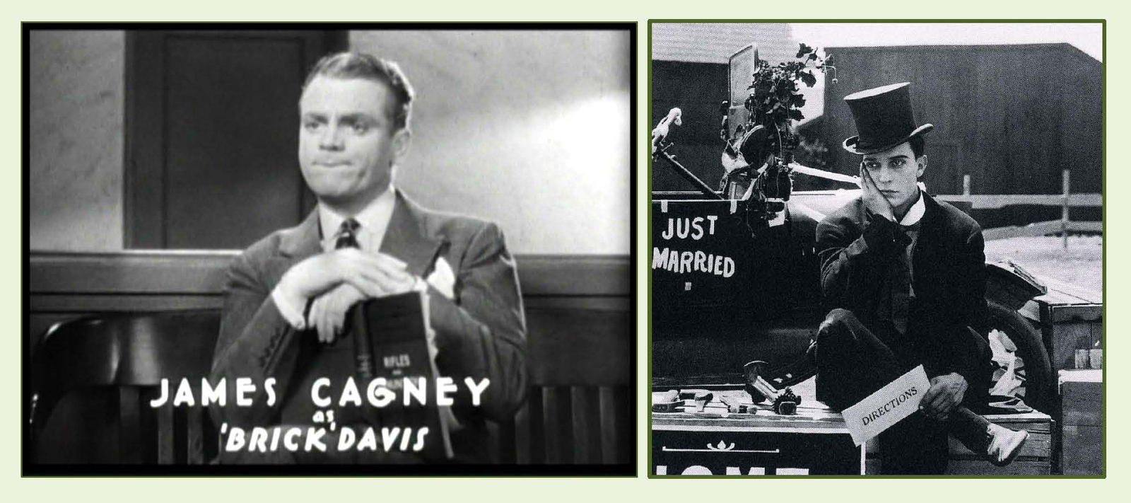 James Cagney’s crime-busting thriller “G” Men (1935) and Buster Keaton’s debut short film One Week (1920) both contain exciting scenes filmed in Inglewood. Cagney portrays a new FBI recruit who helps the bureau capture notorious bank robber Danny Leggett, played by Edward Pawley. During a crime montage Leggett’s gang robs a bank, leading to a blasting machine gun police chase on the streets of Inglewood and beside the Inglewood train station.
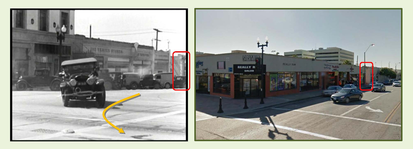
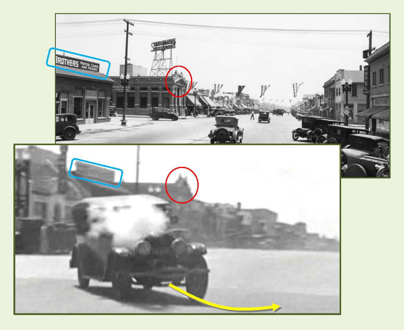
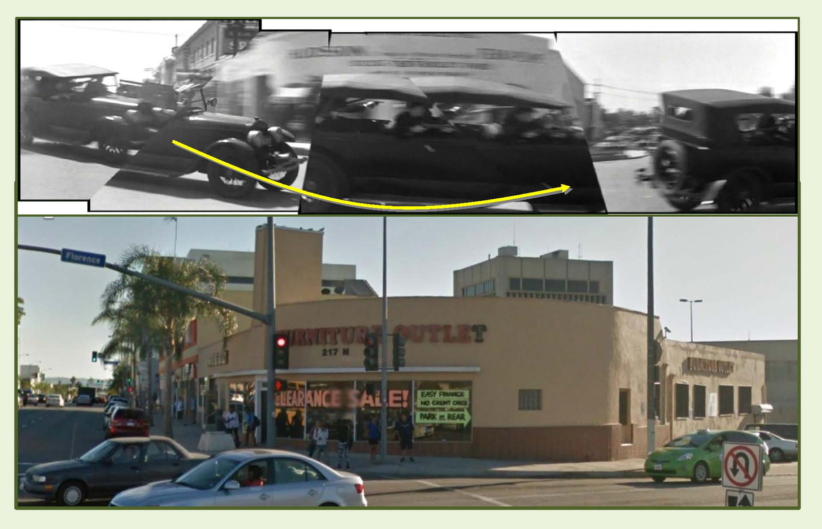
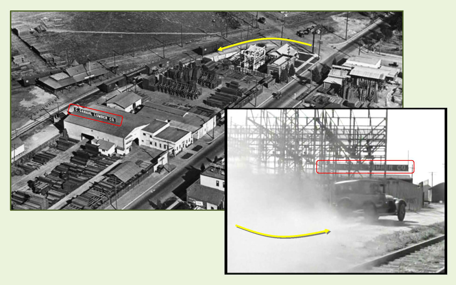
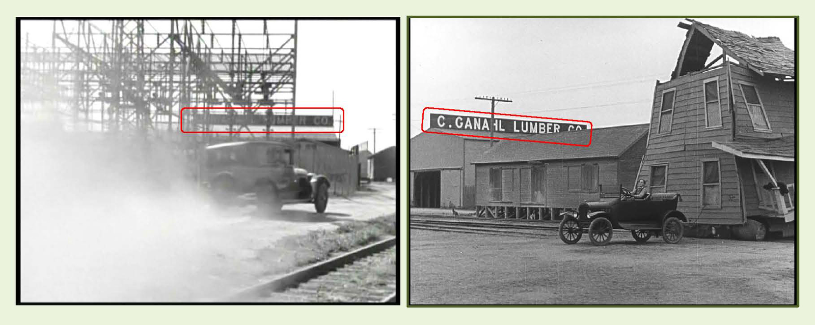
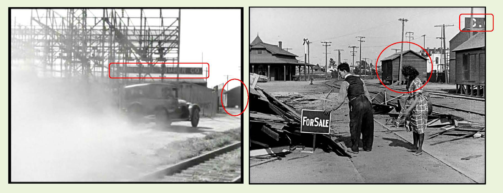
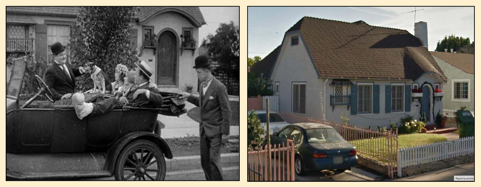
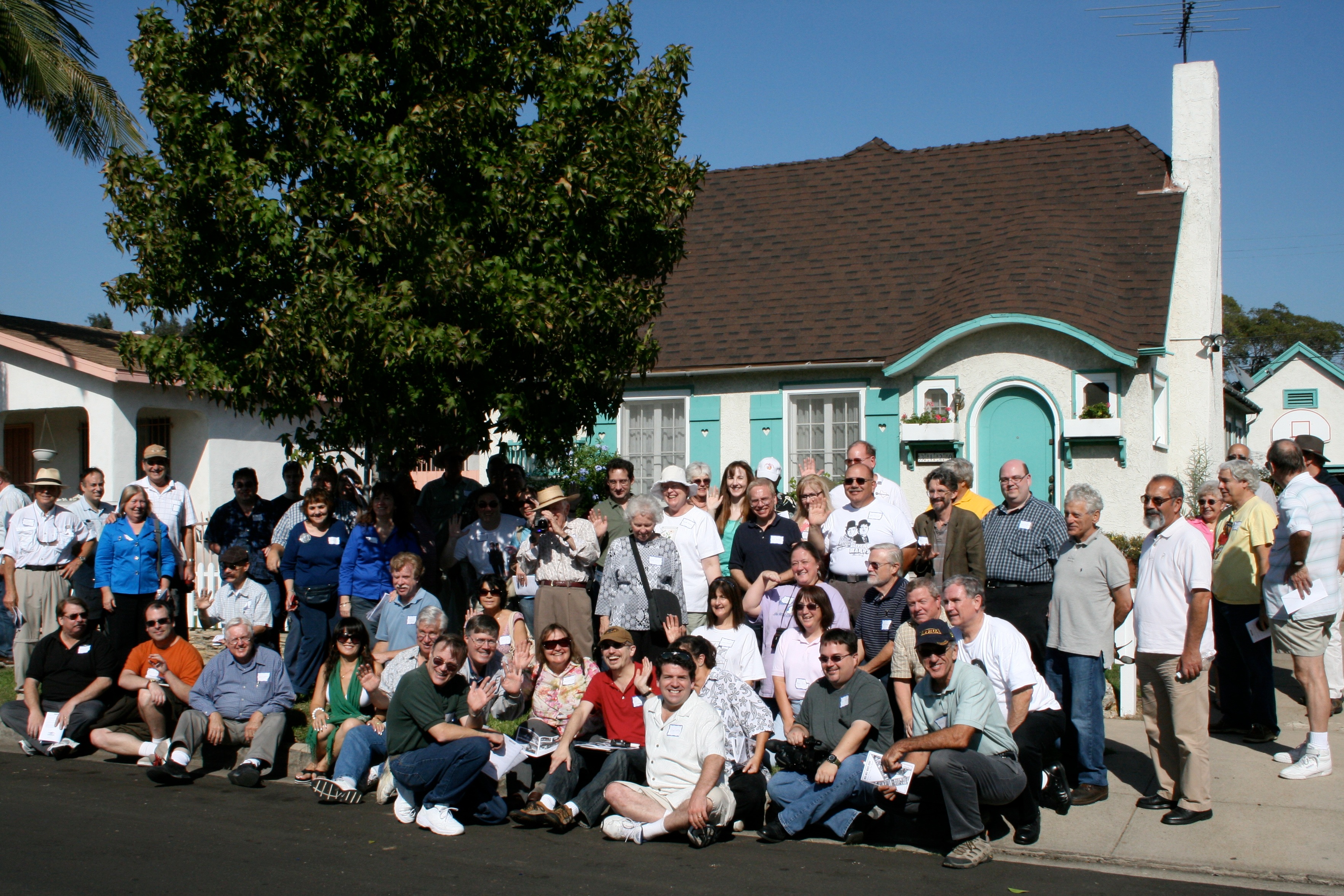

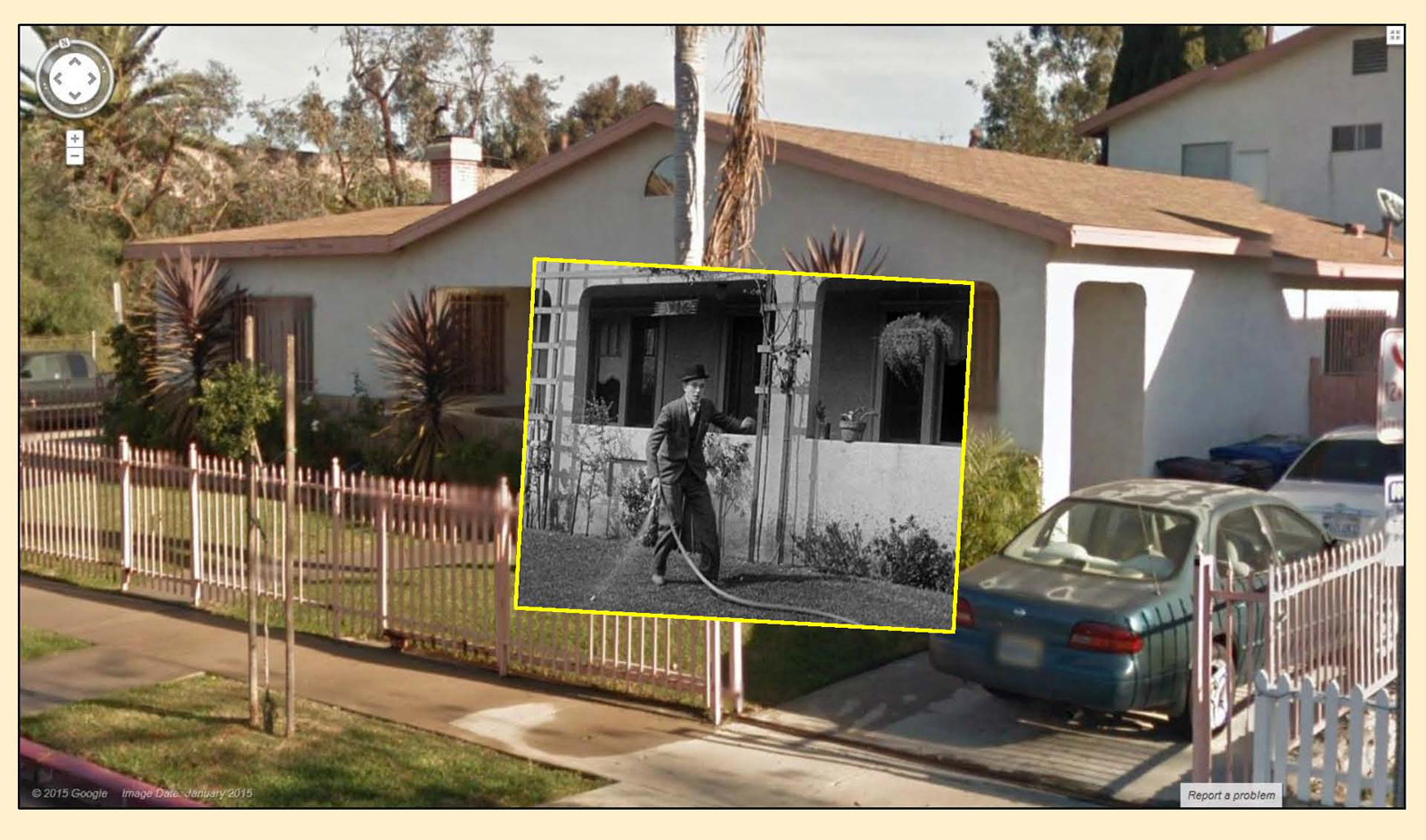
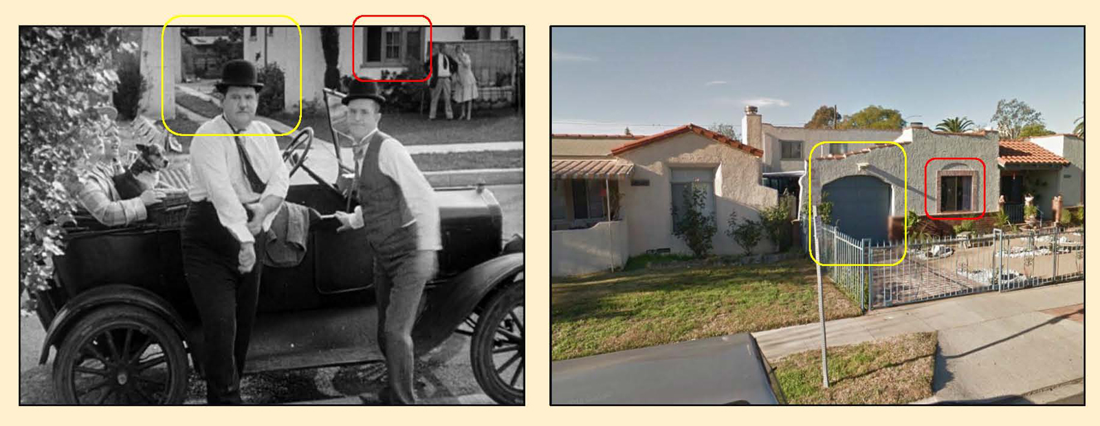
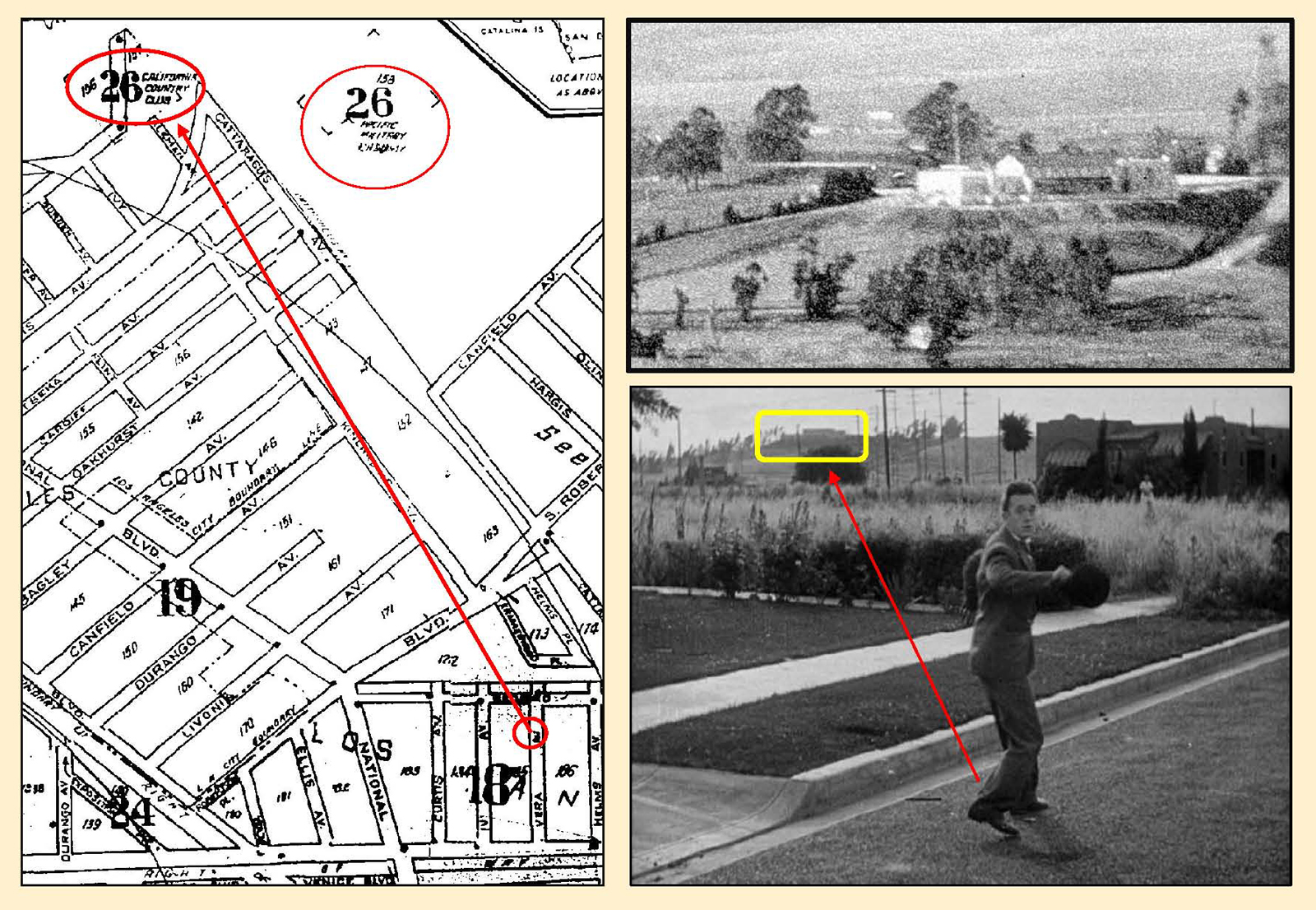
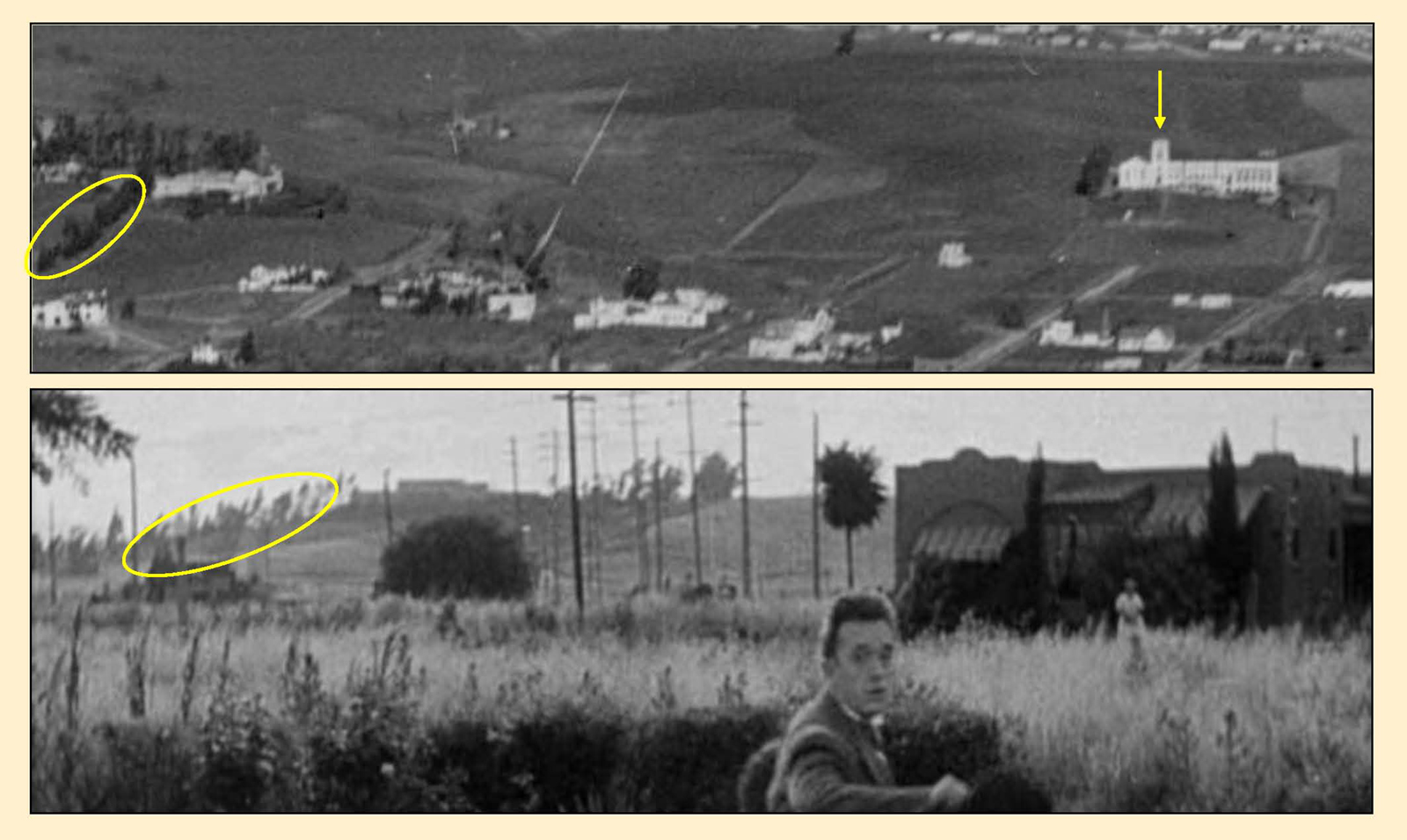
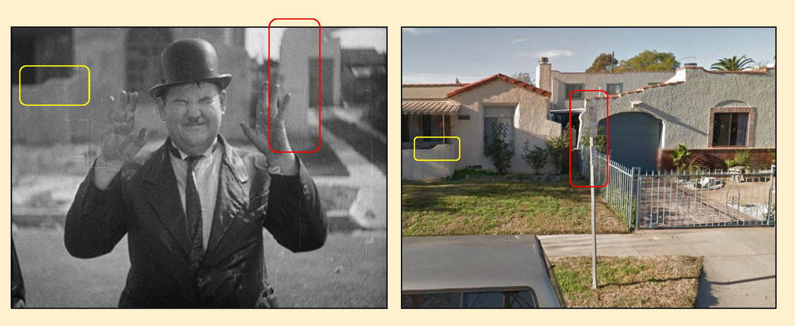
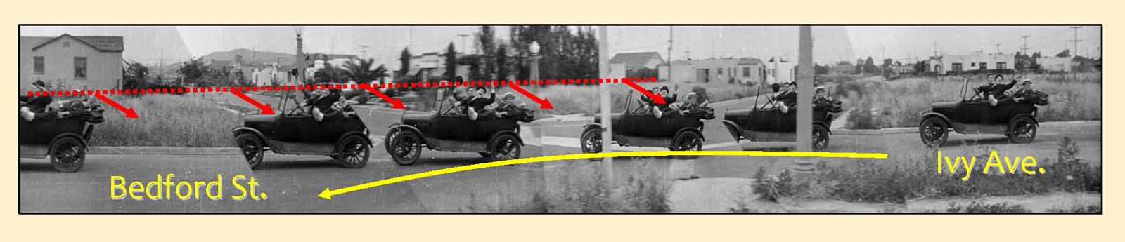
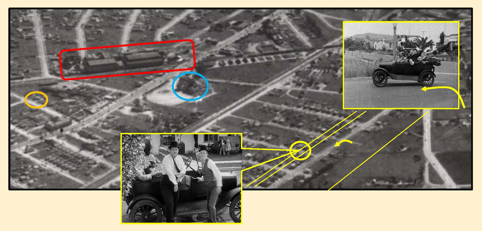
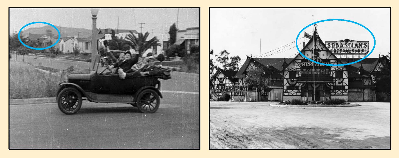
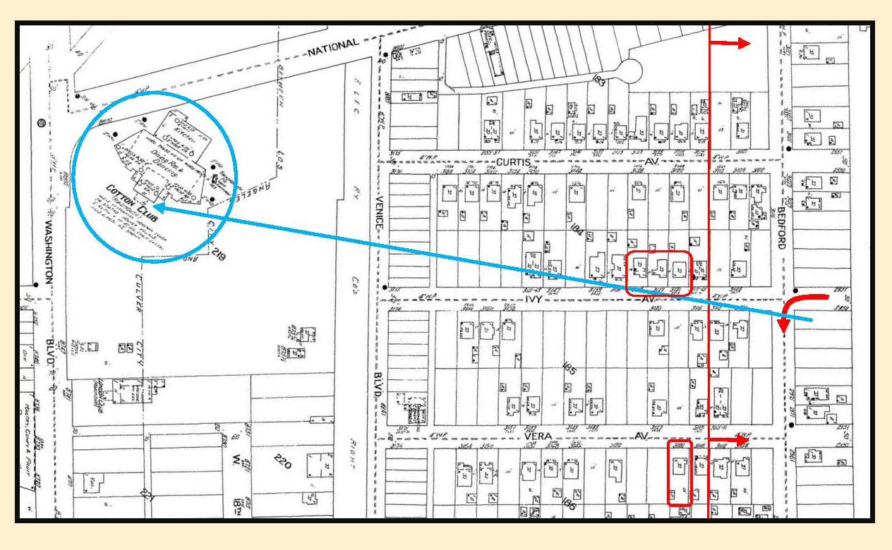
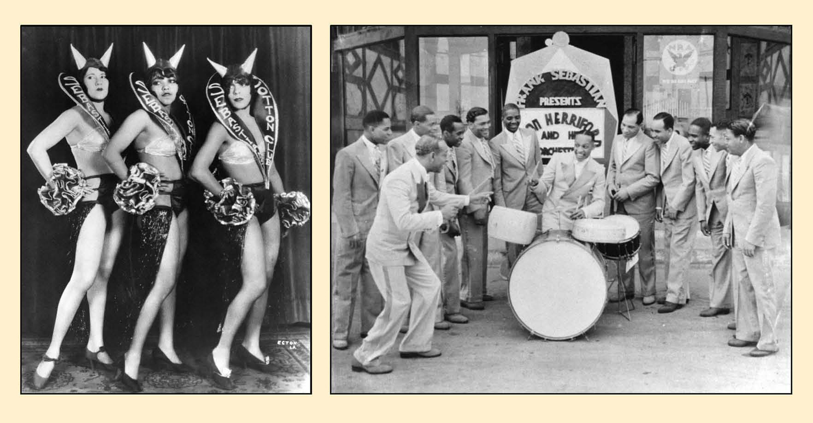
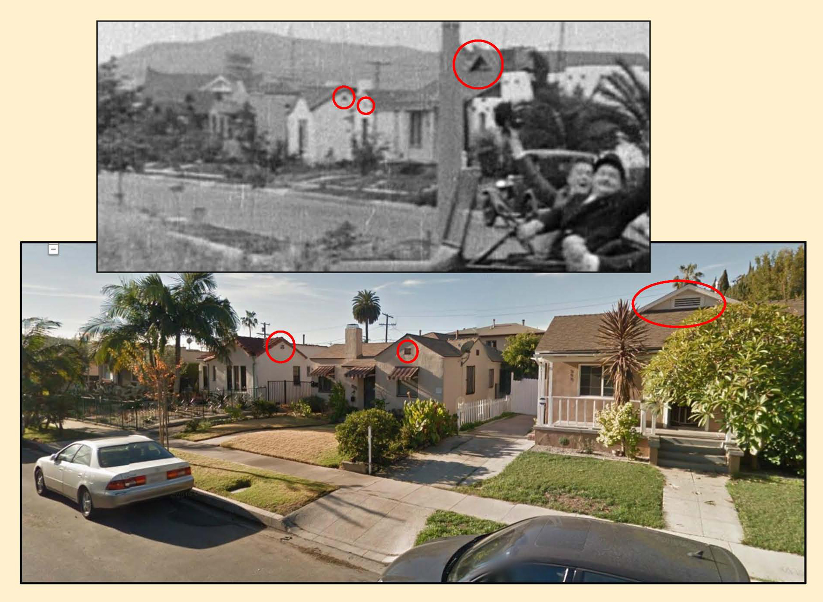

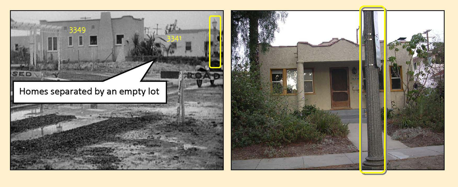
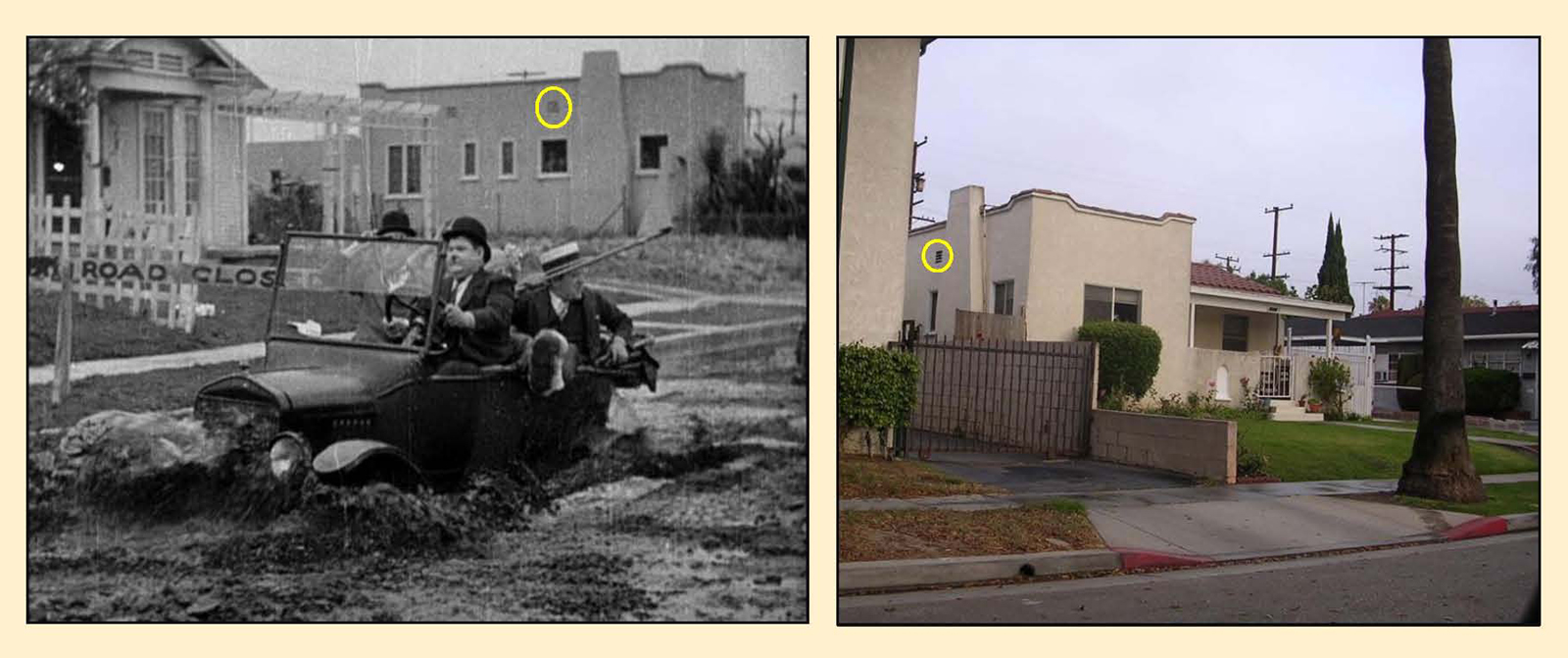
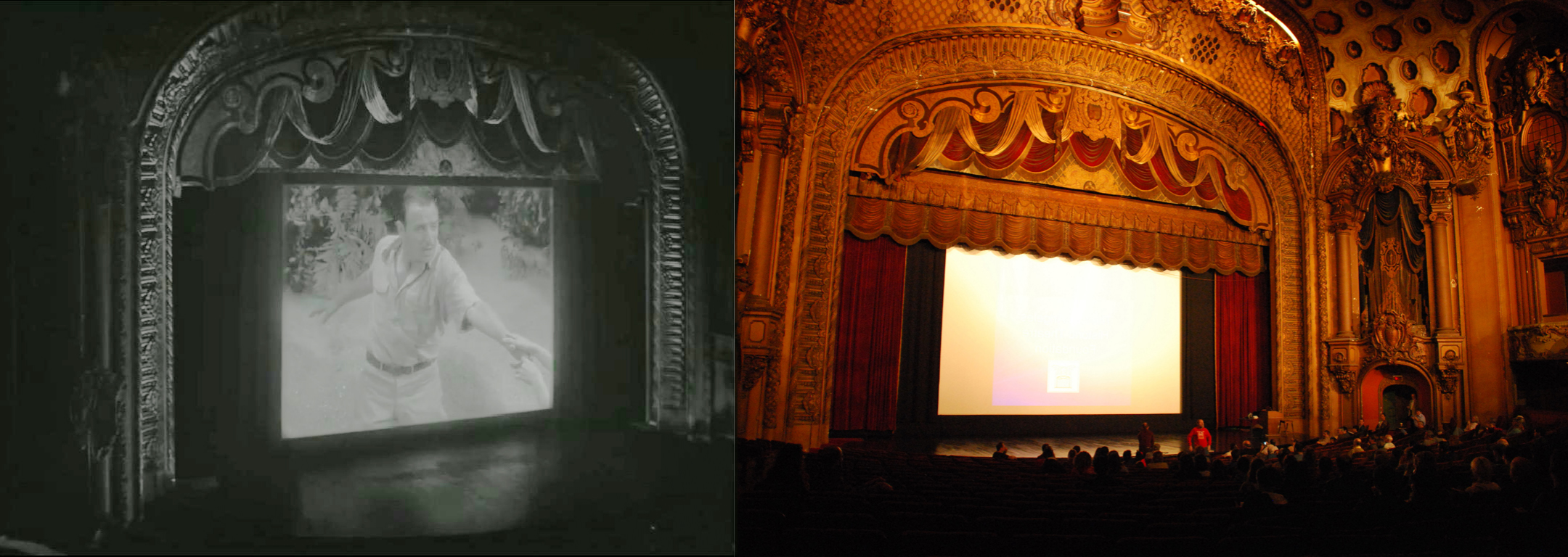

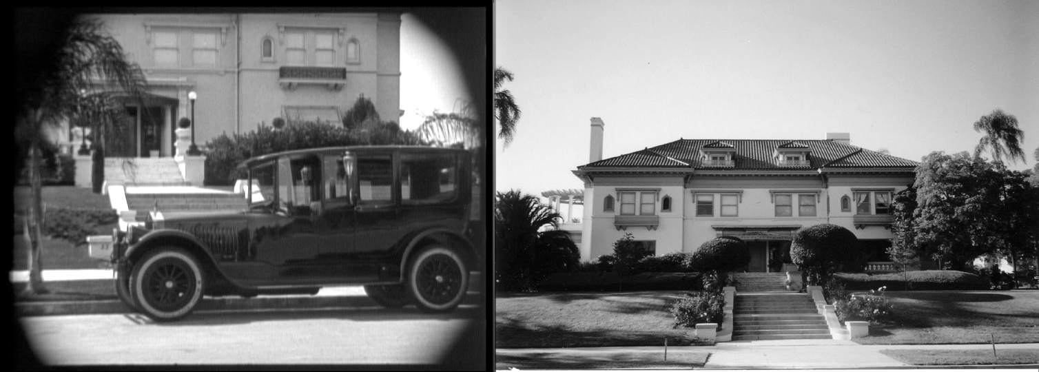
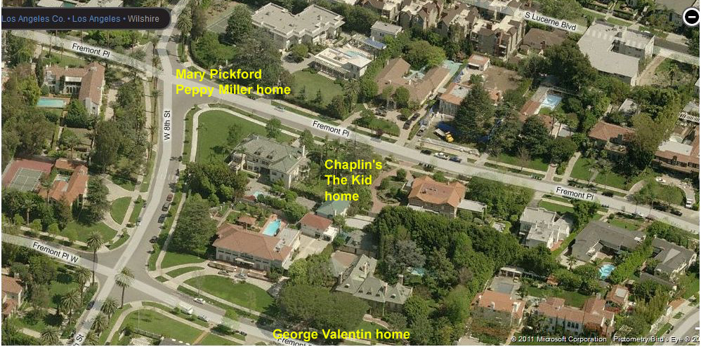
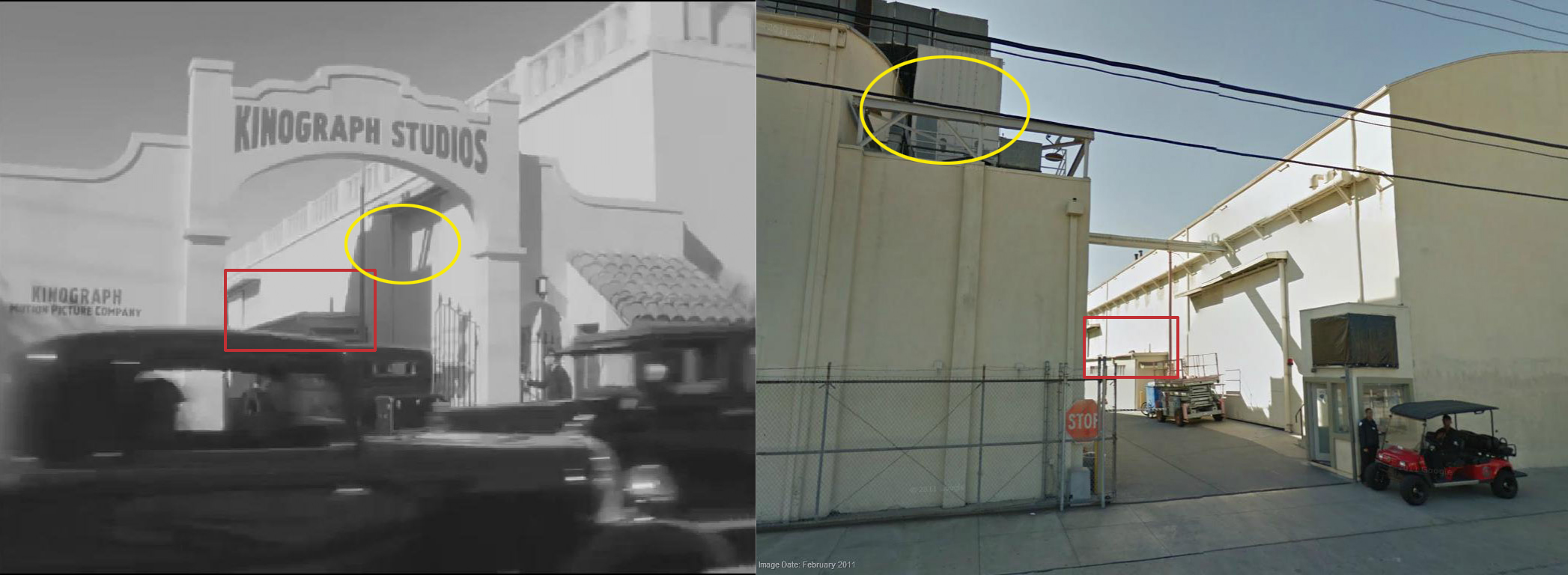
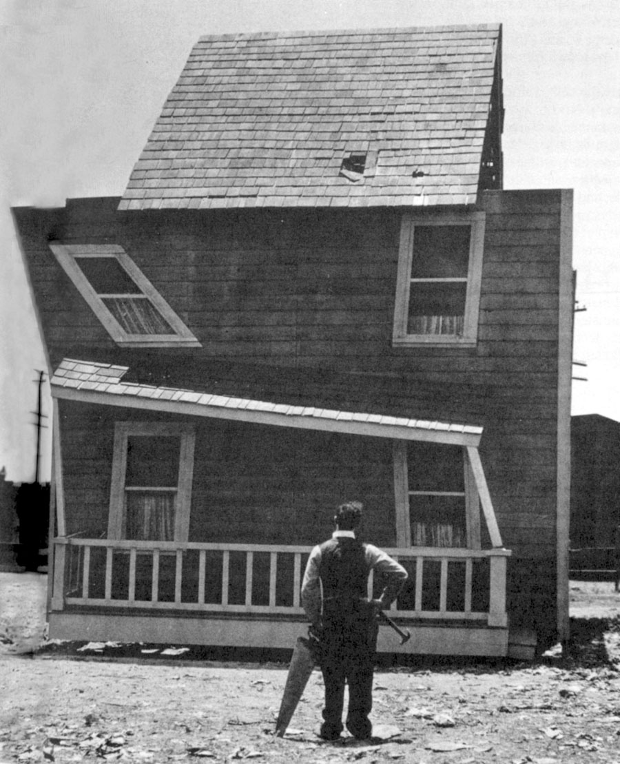
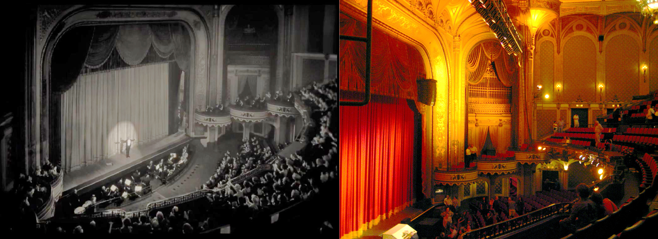

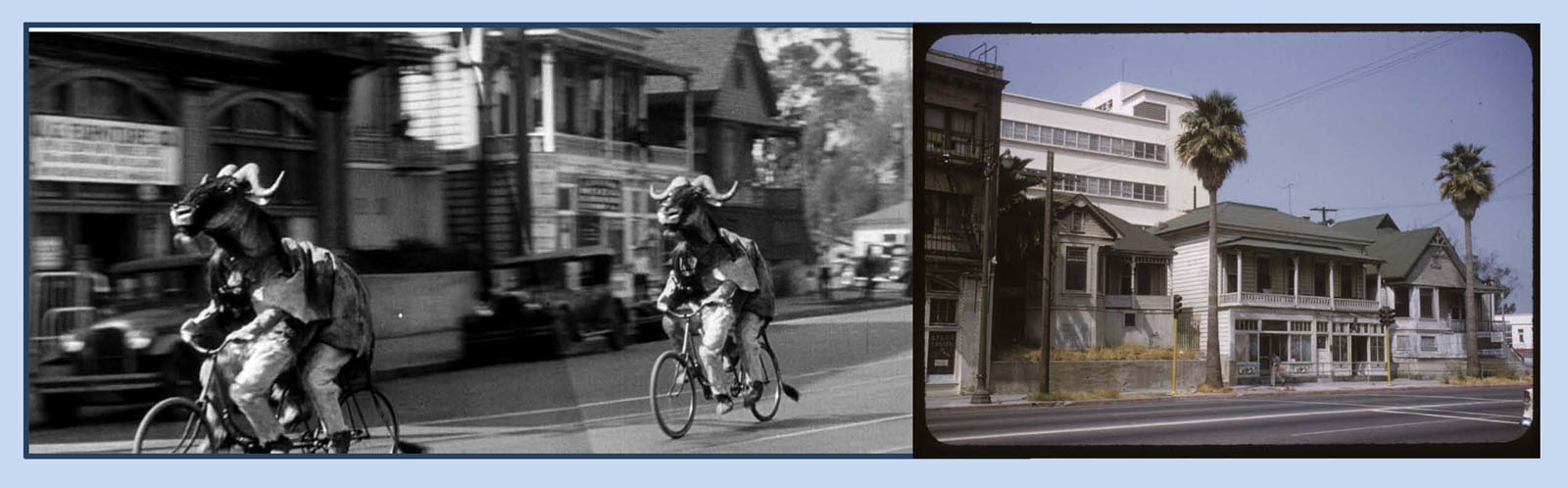
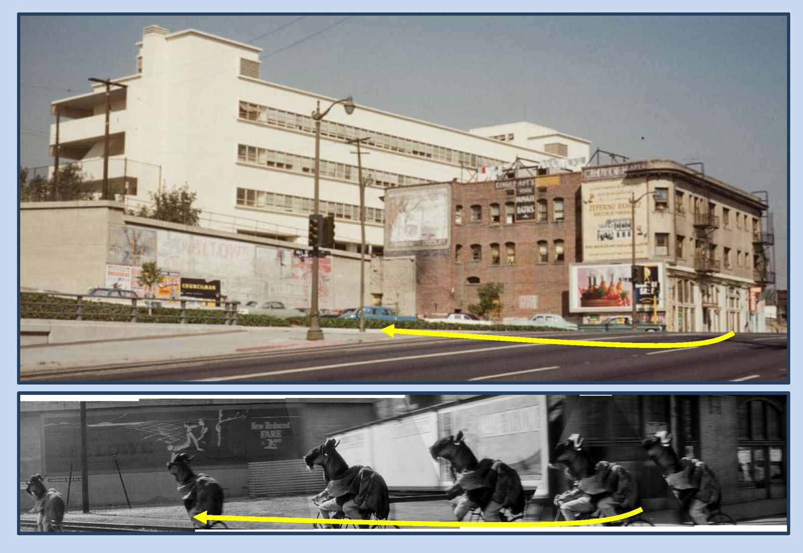
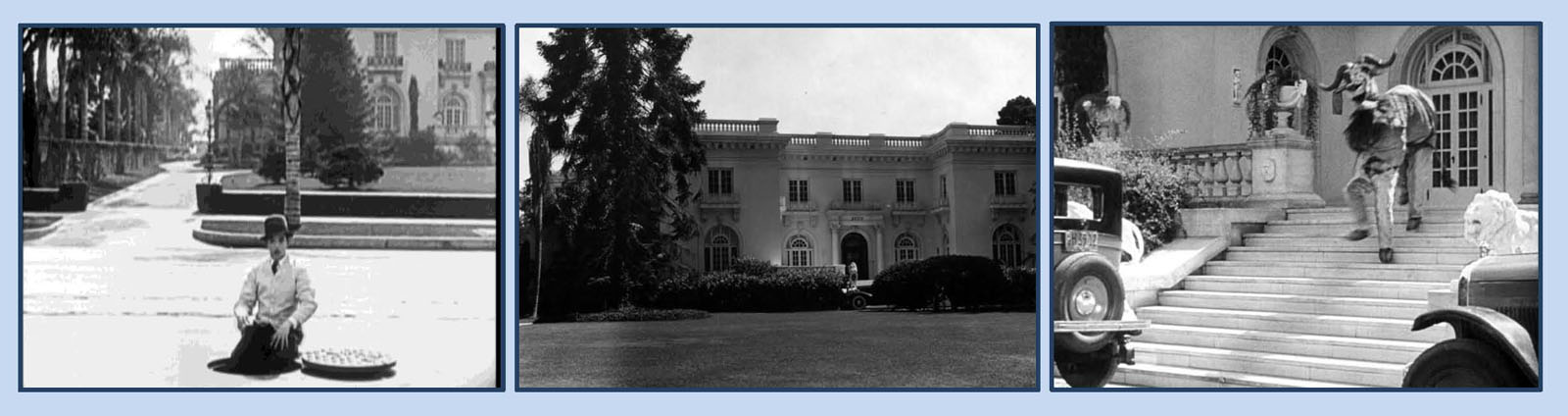
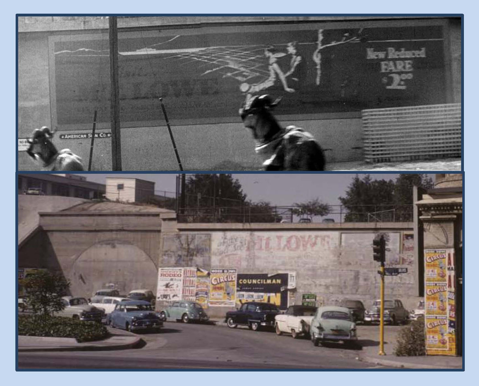
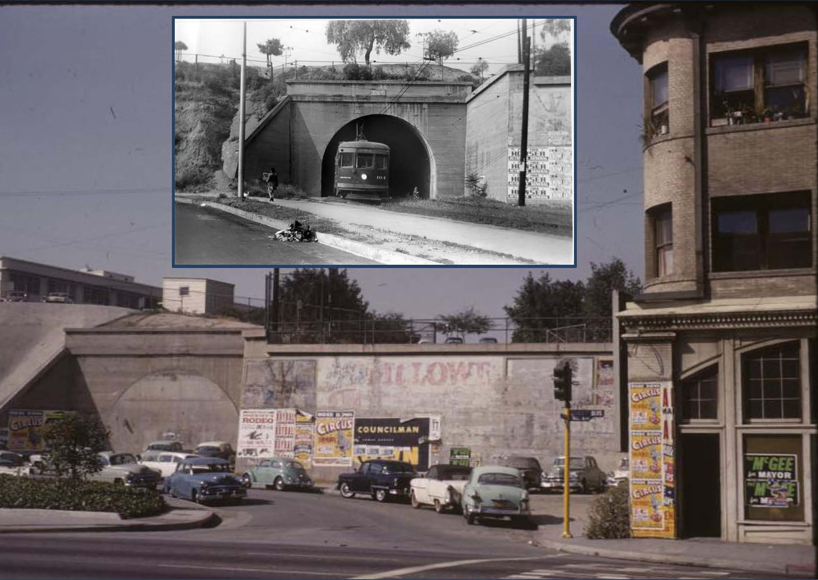
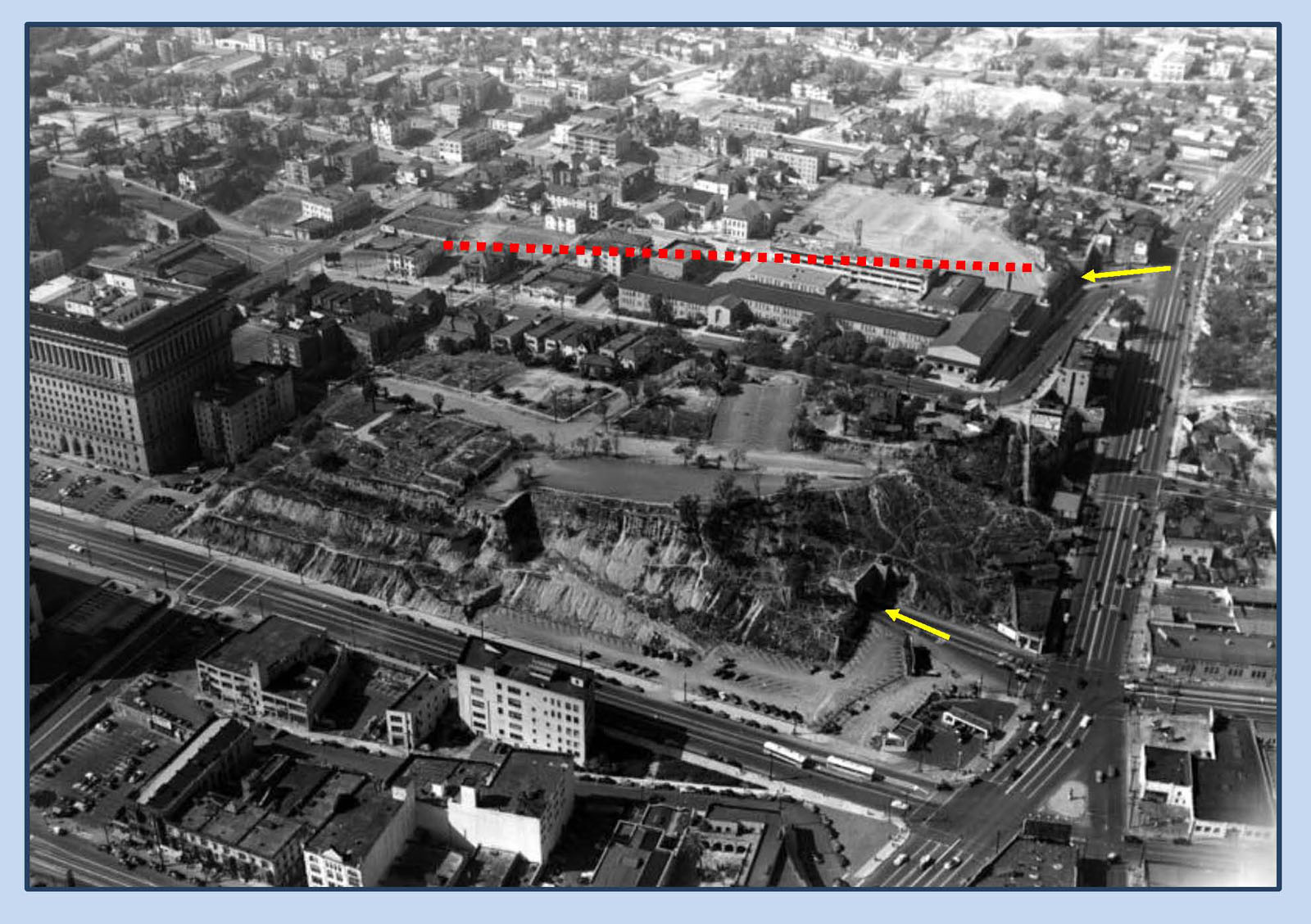
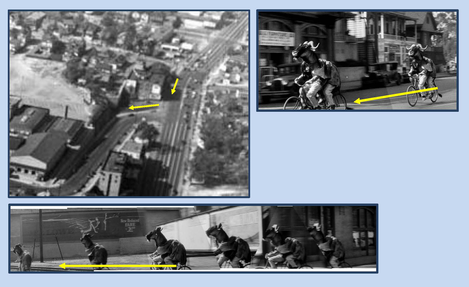
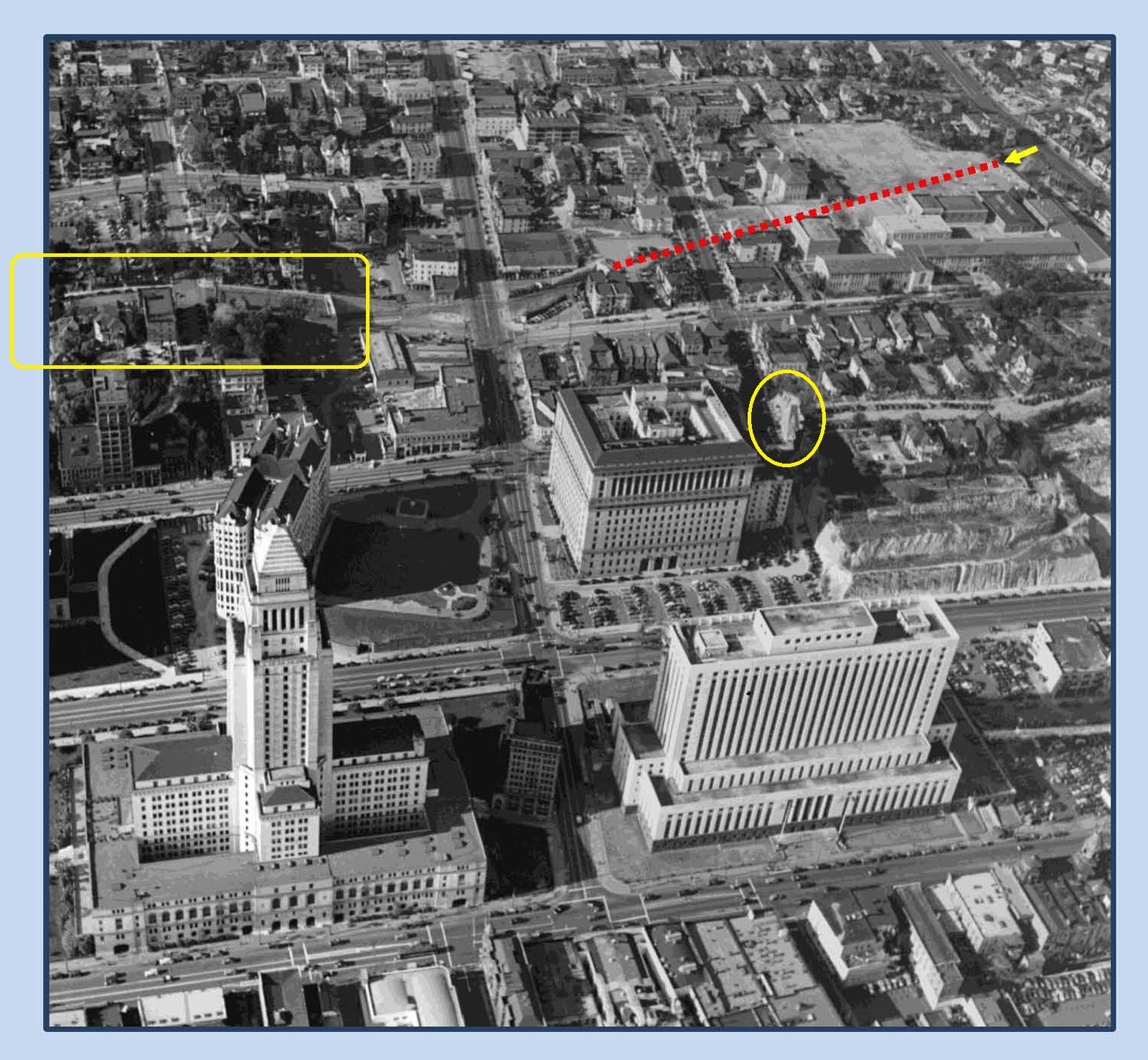
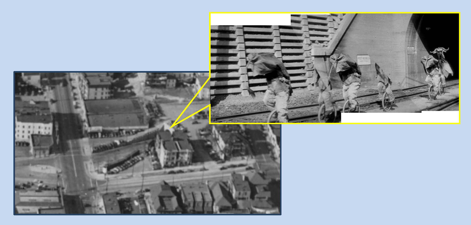
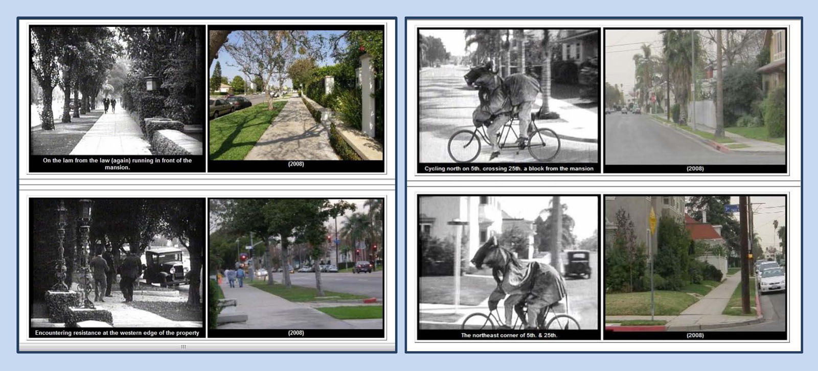

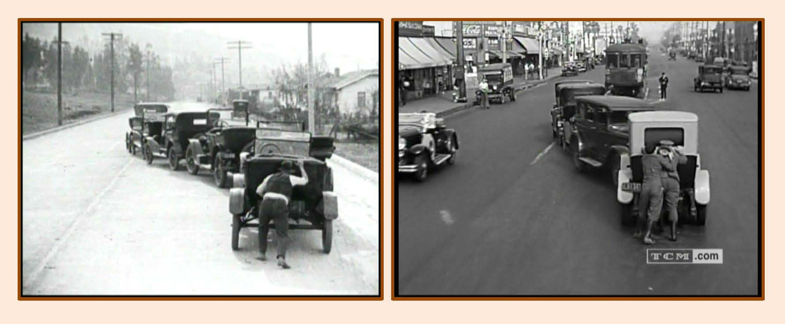
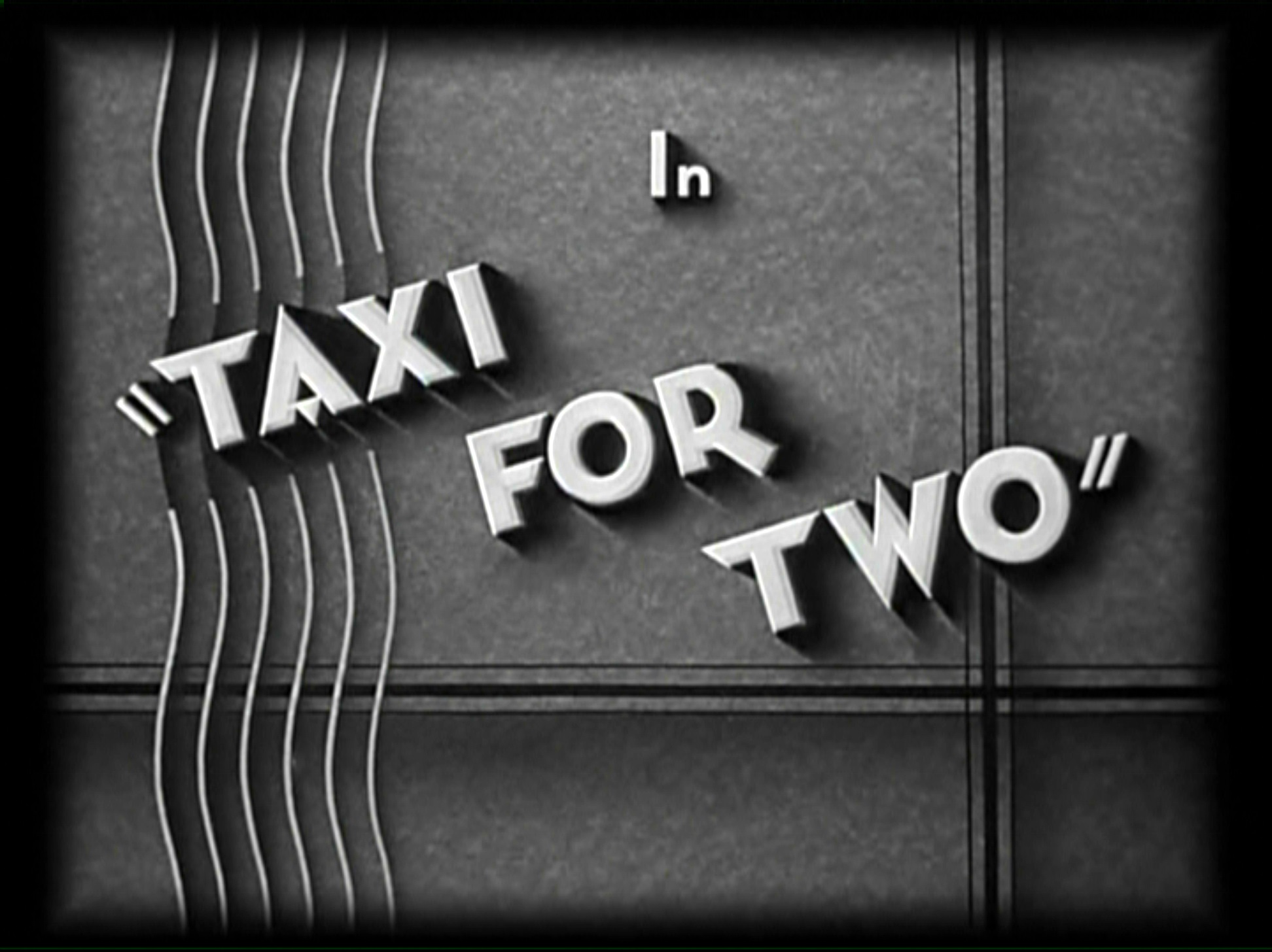
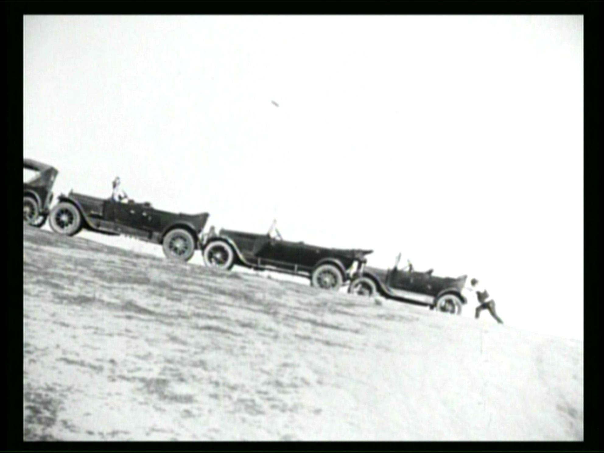
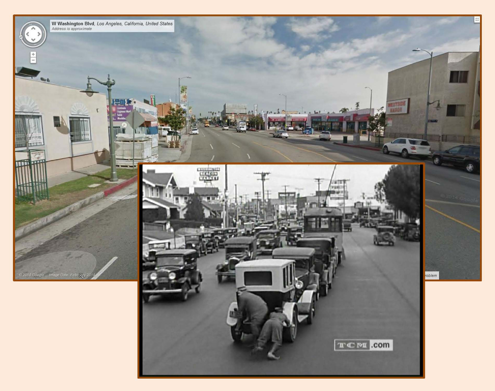
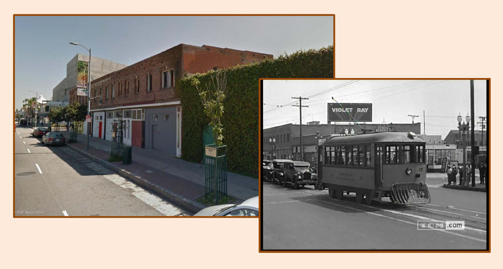
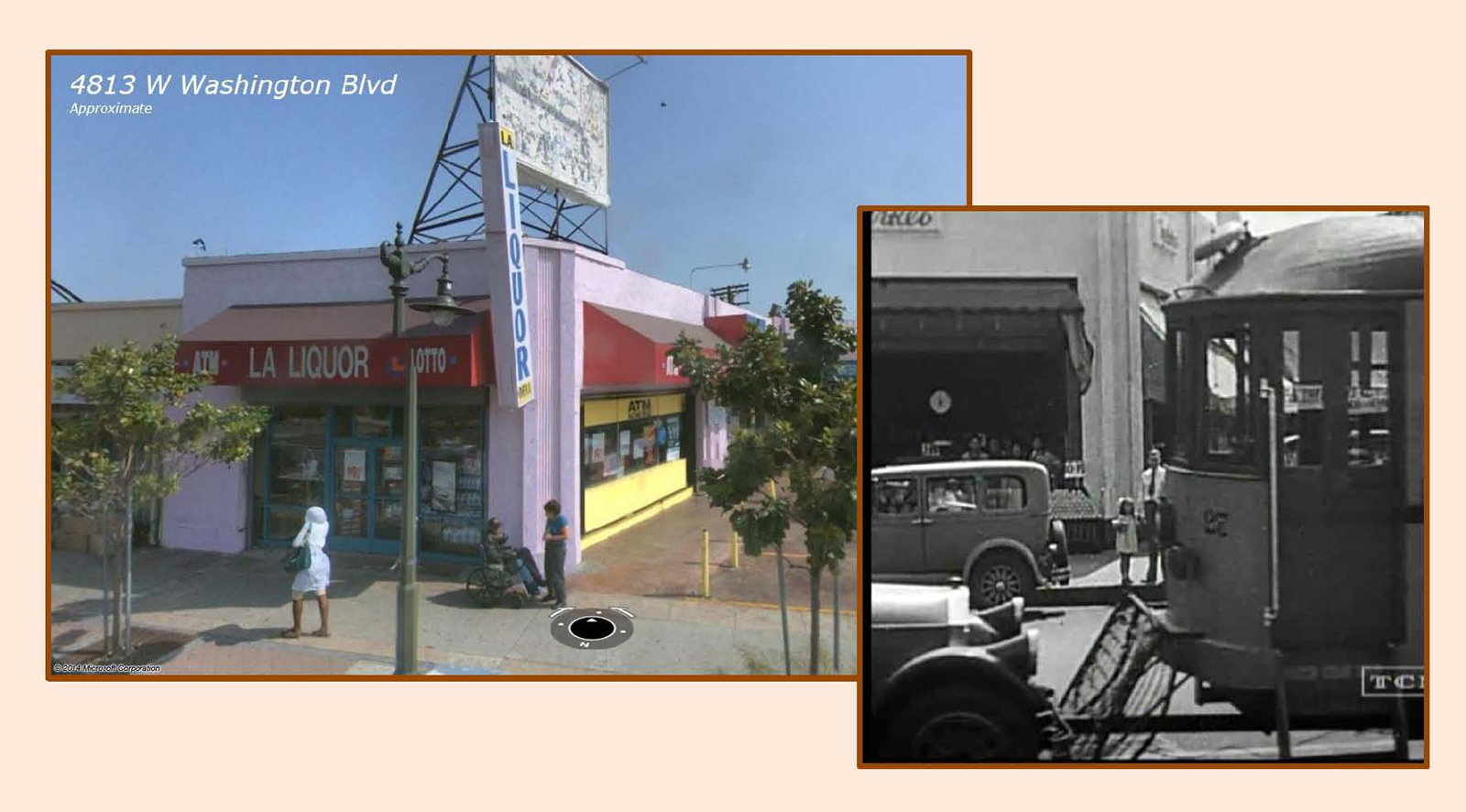
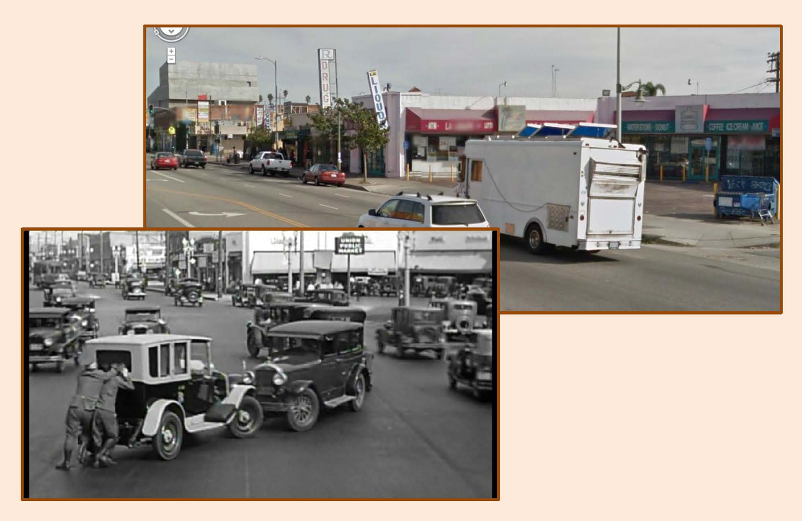
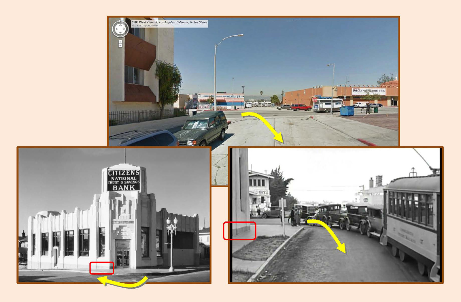
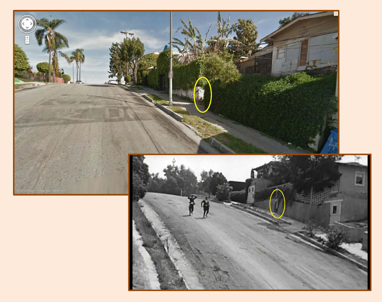
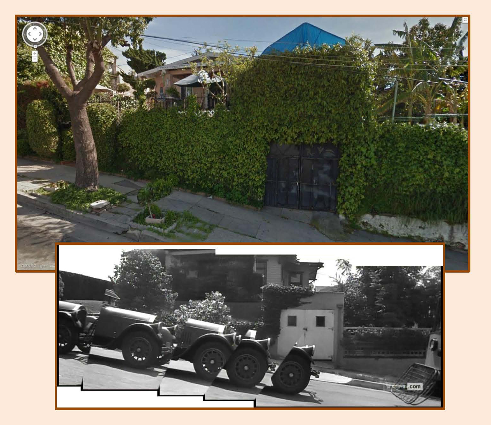
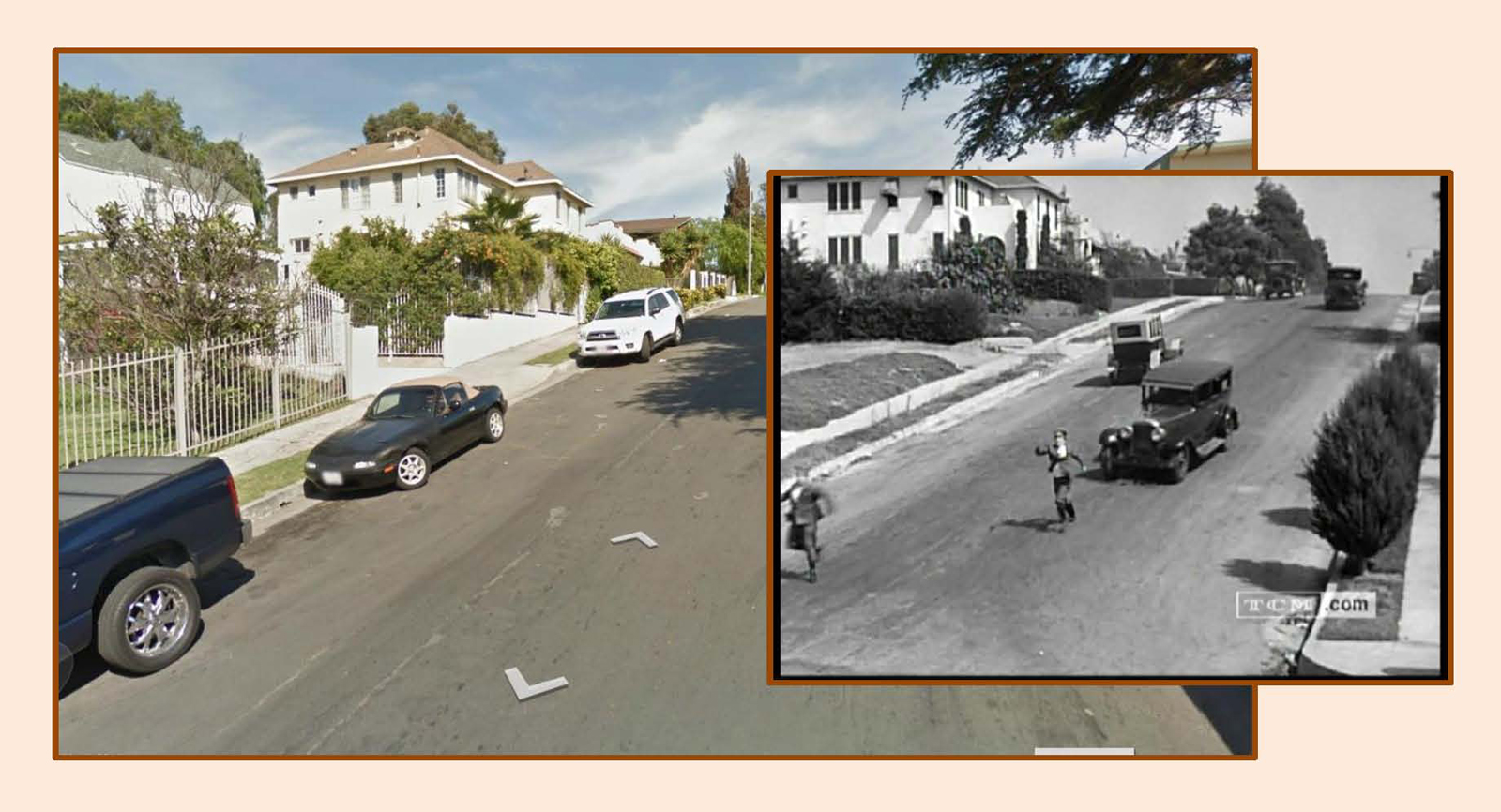
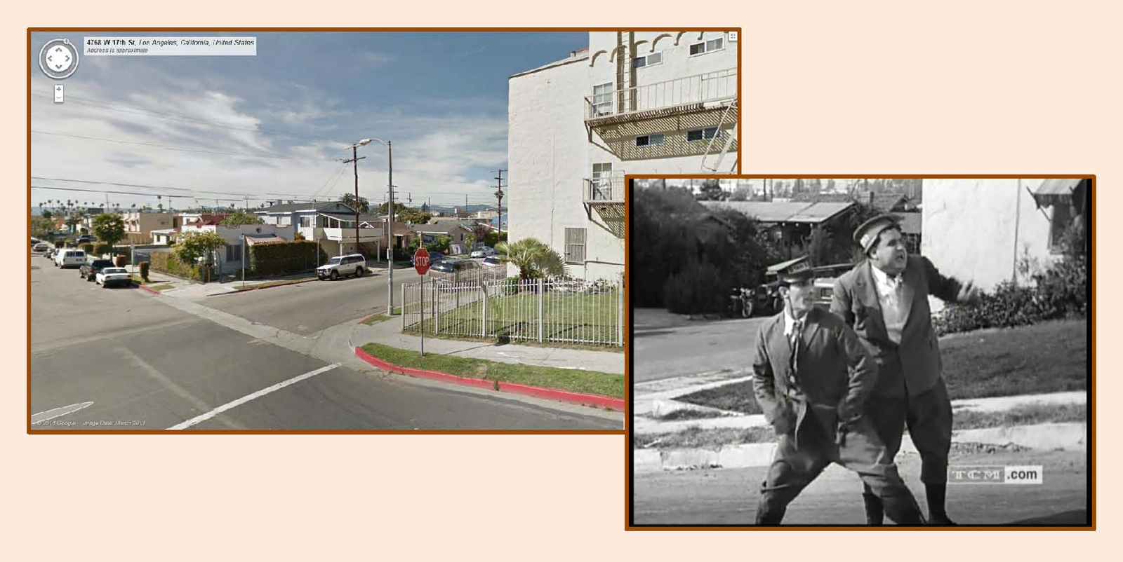
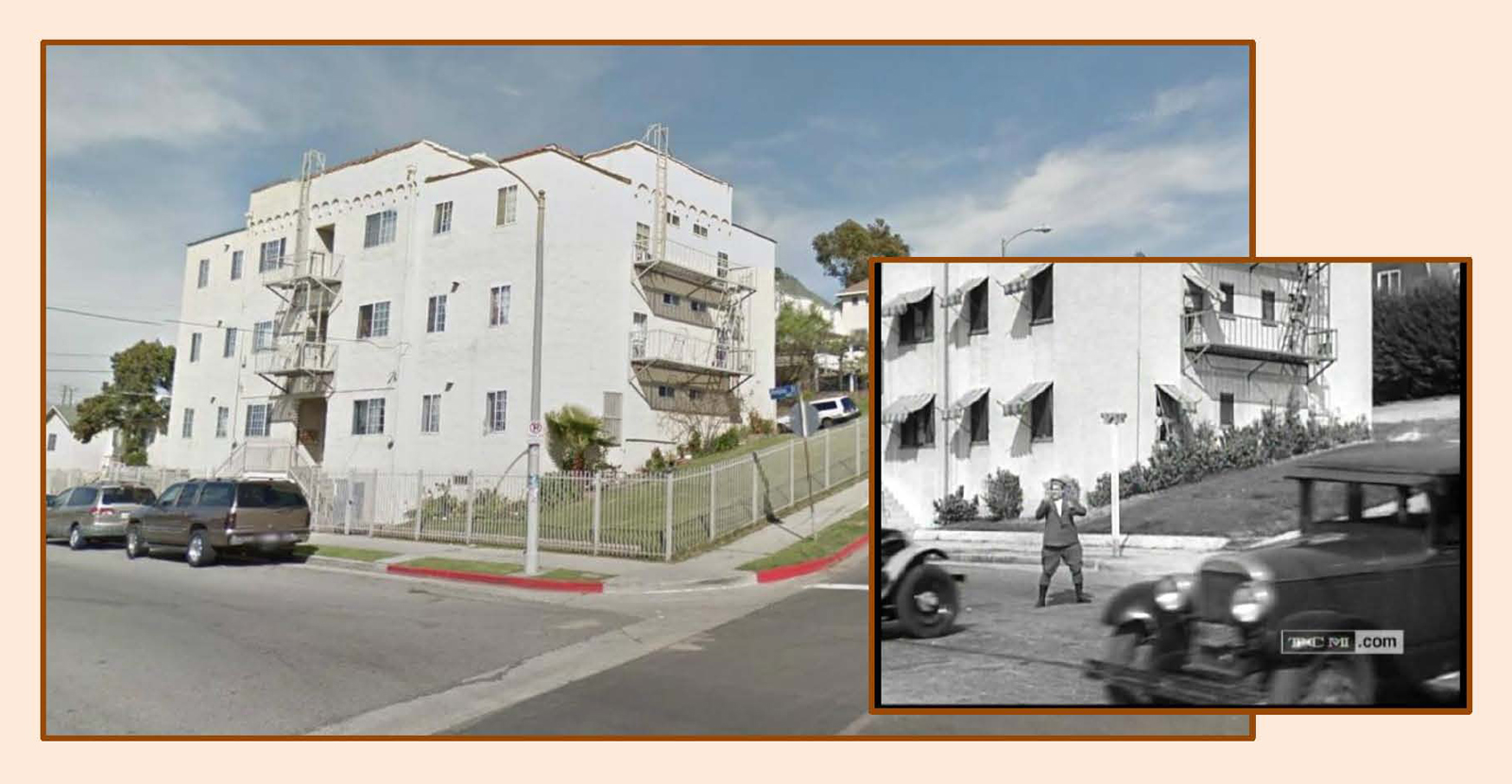
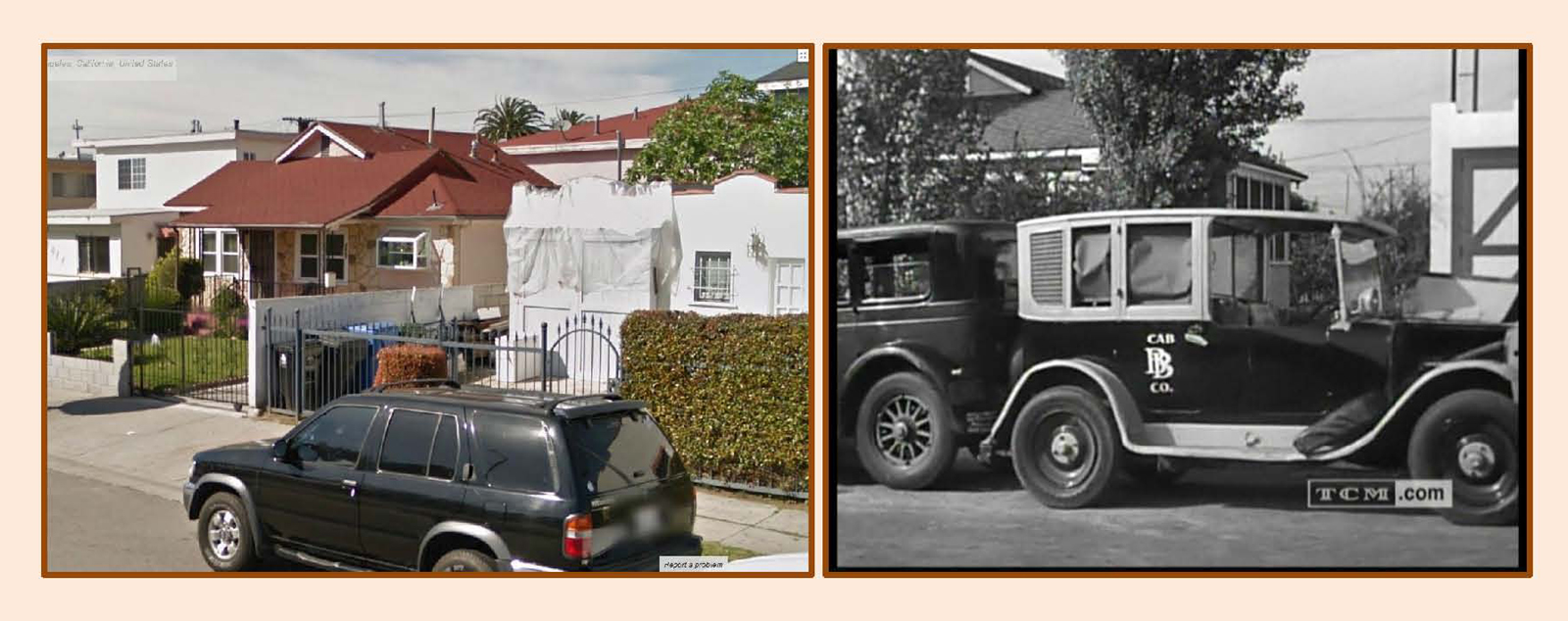
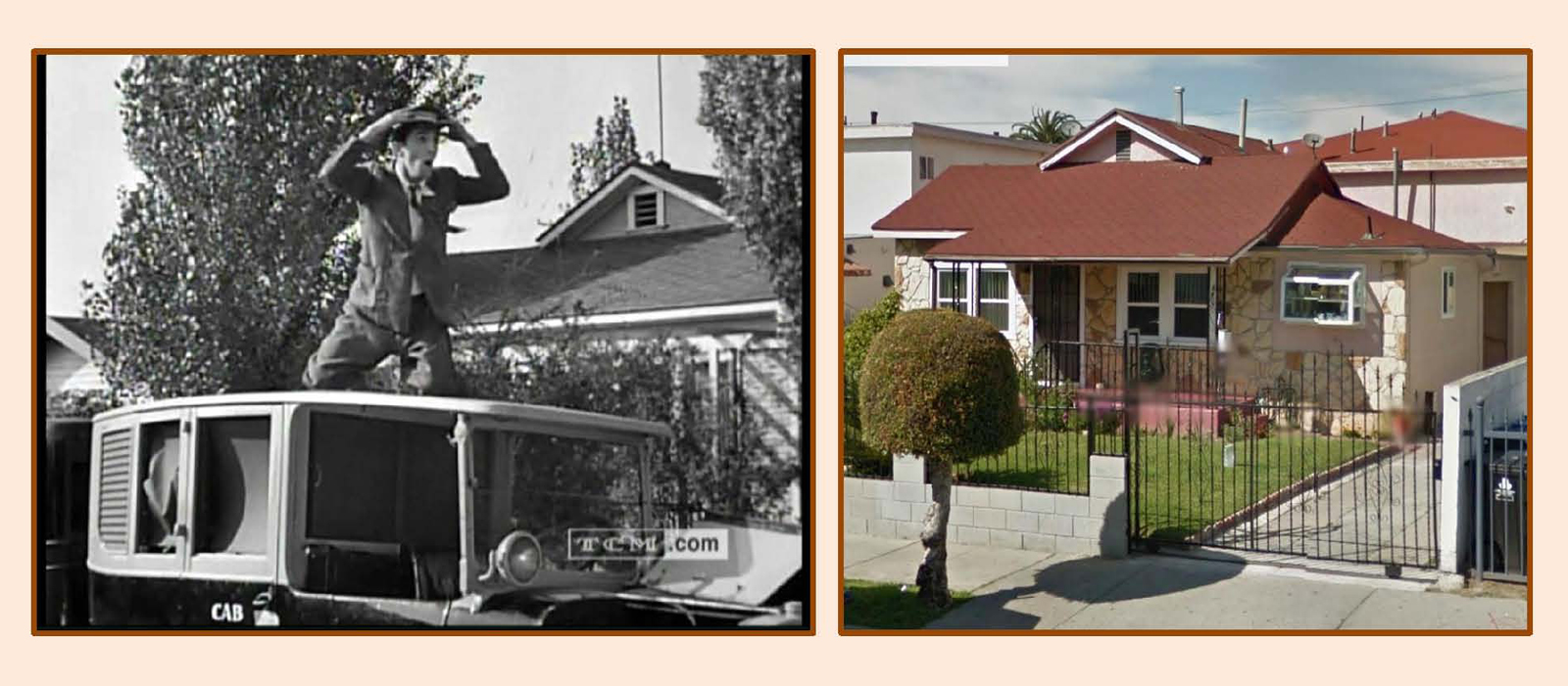
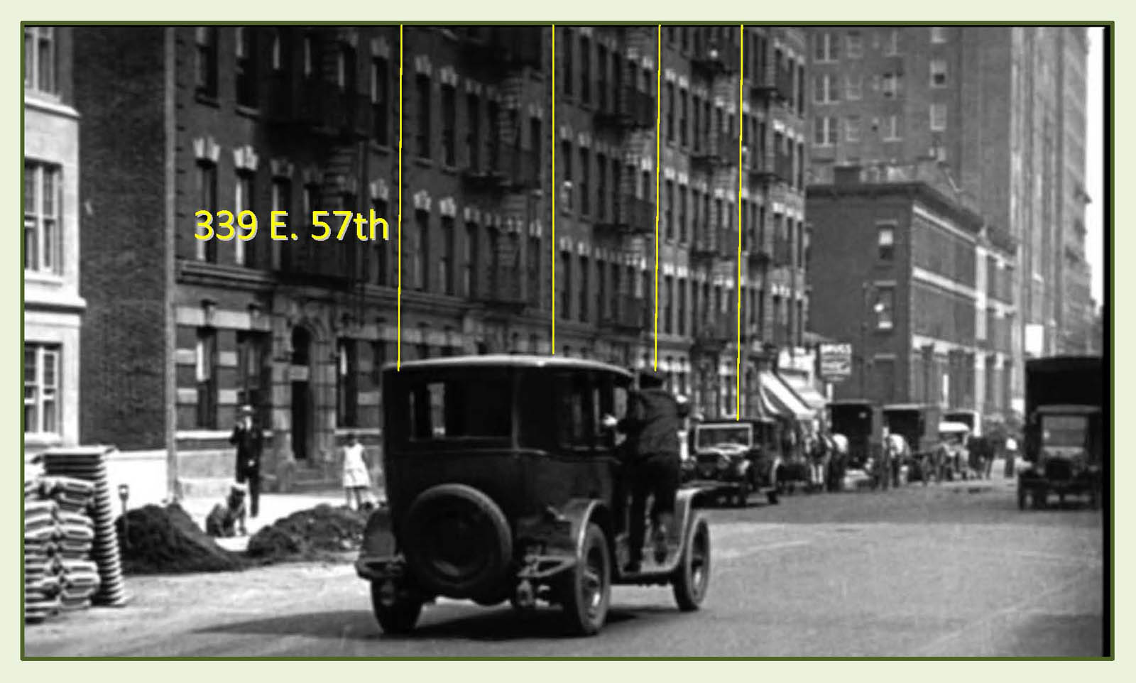
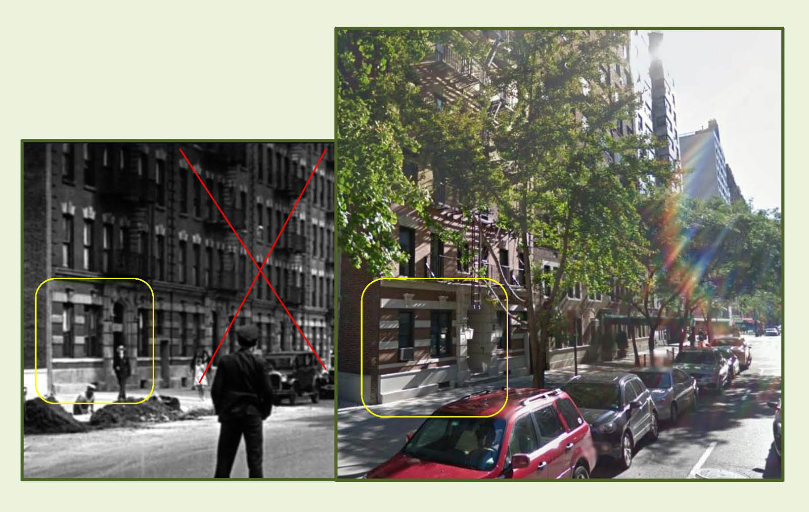

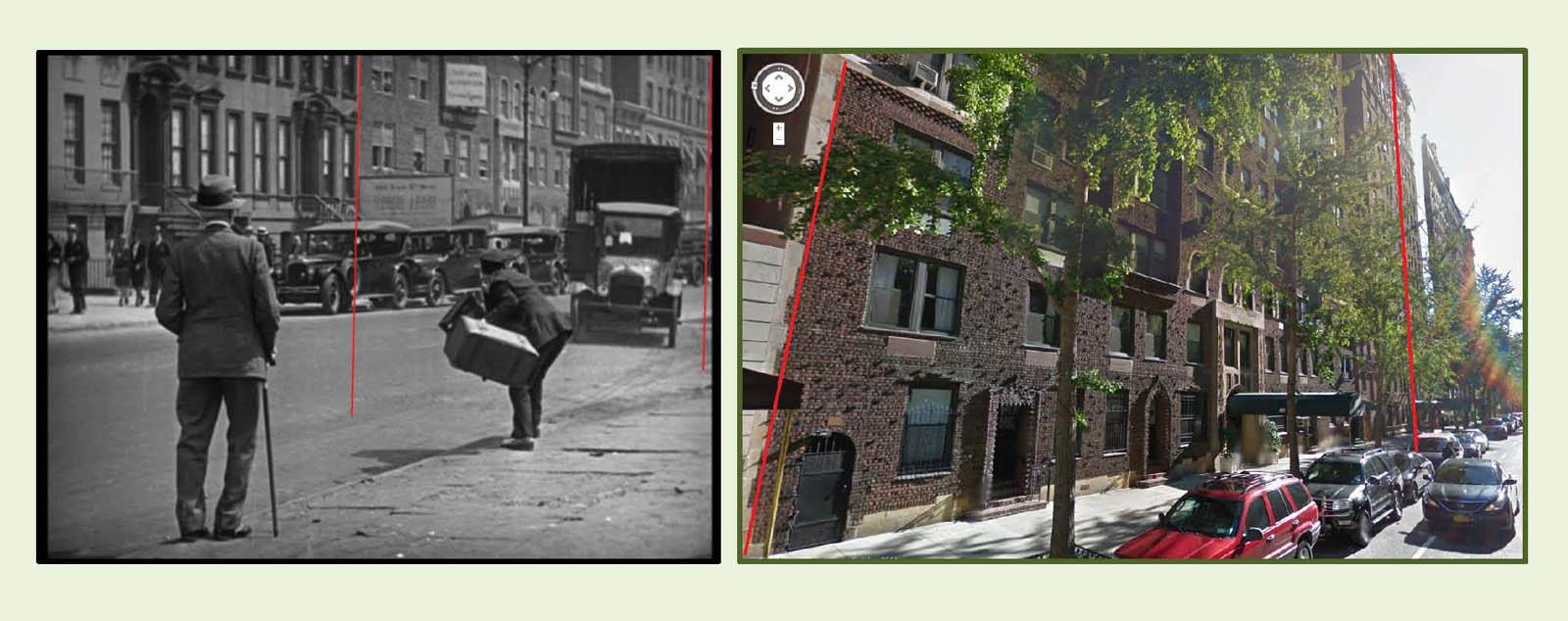
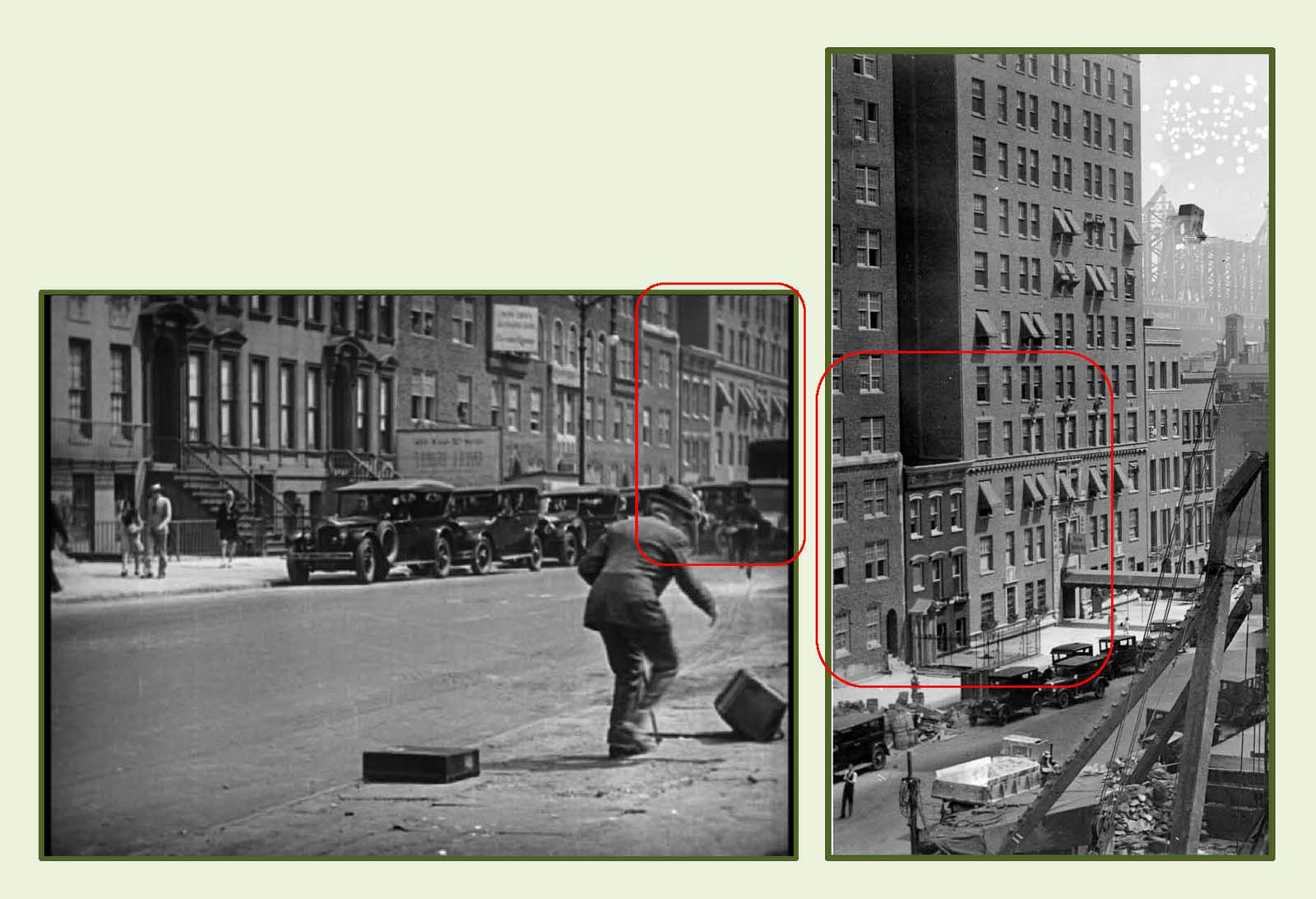
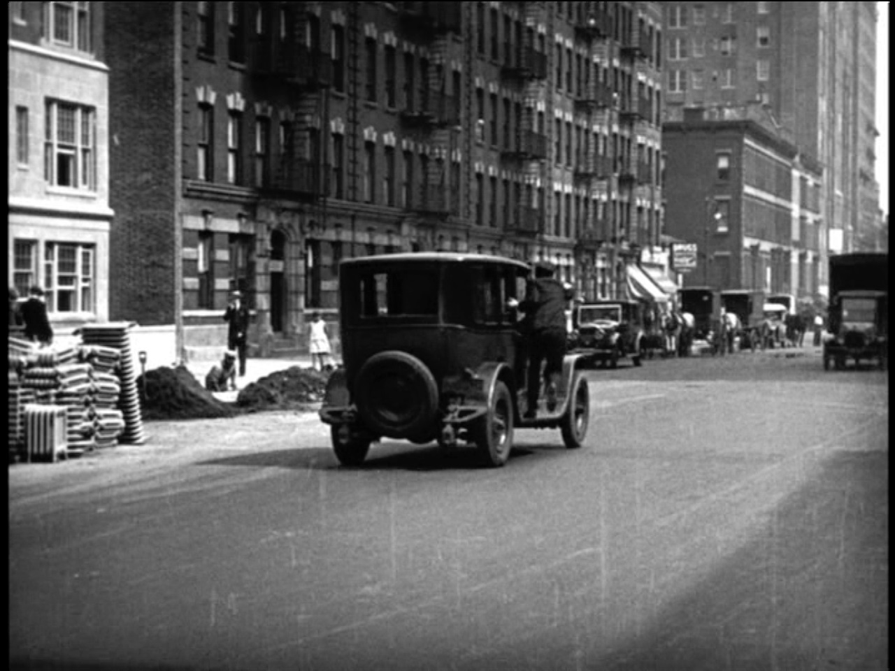
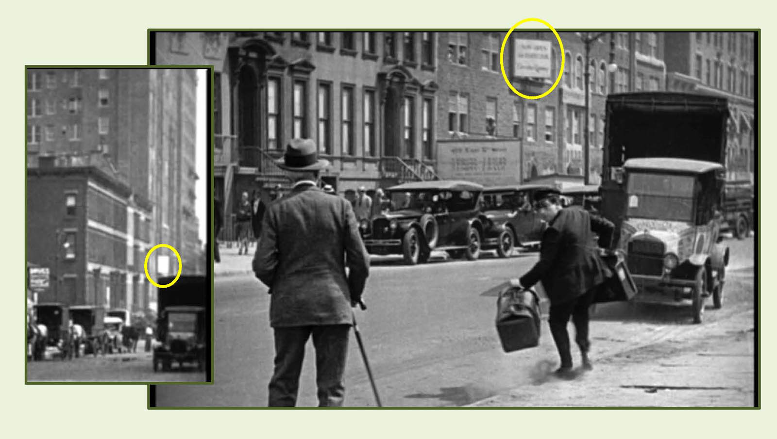
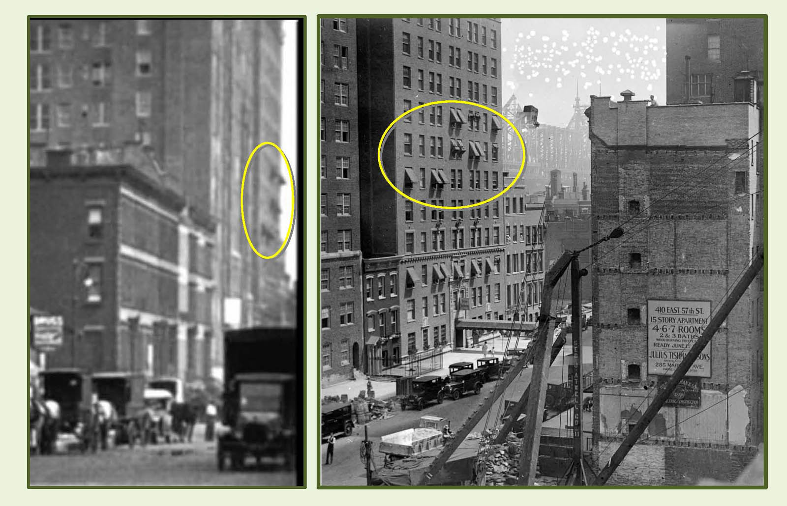
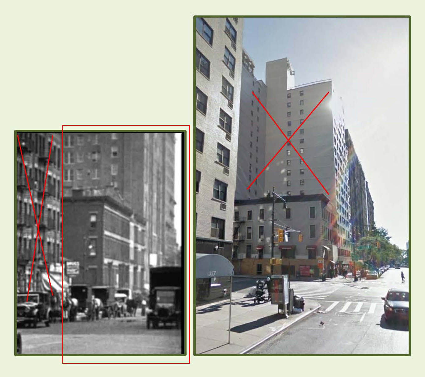
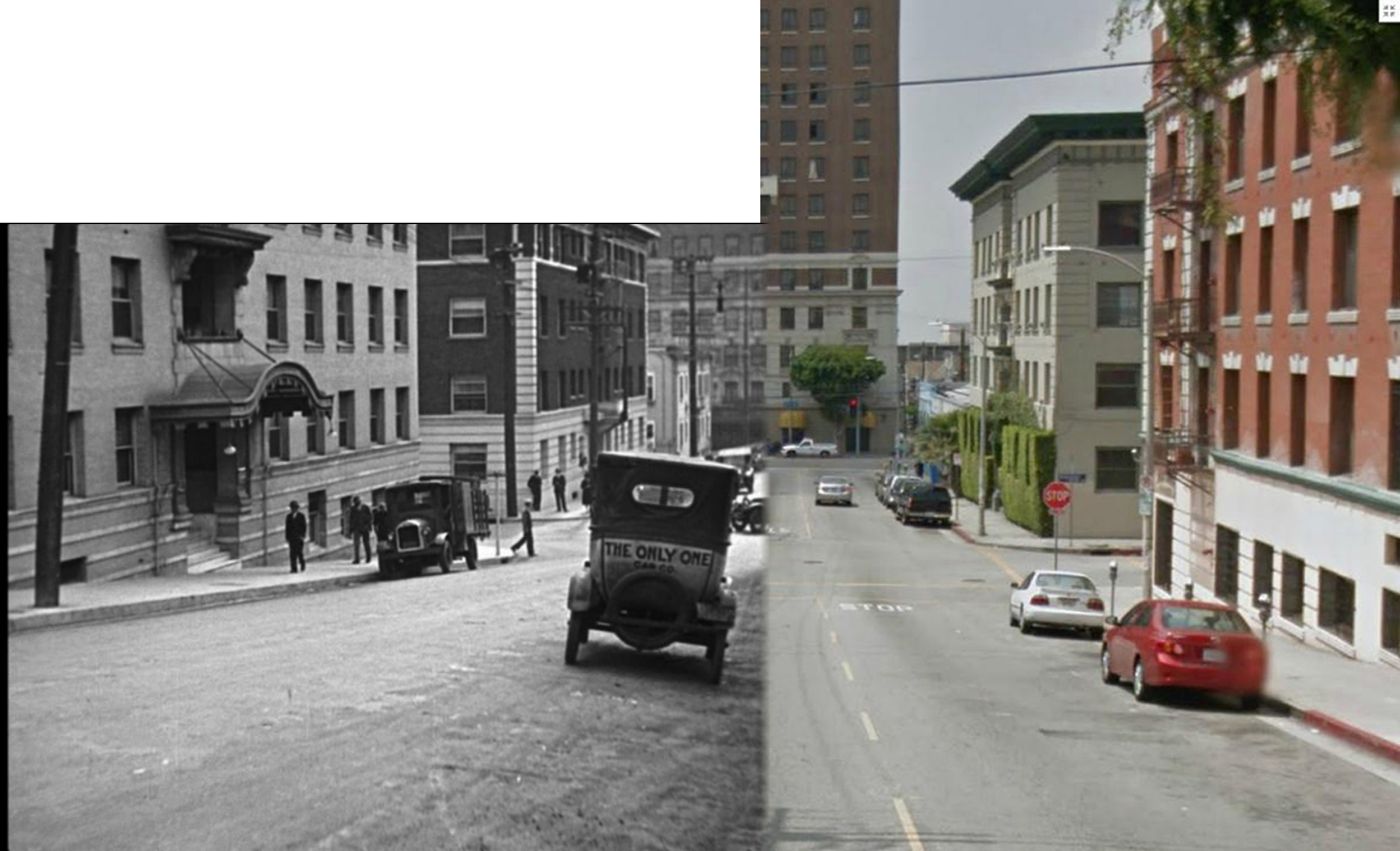
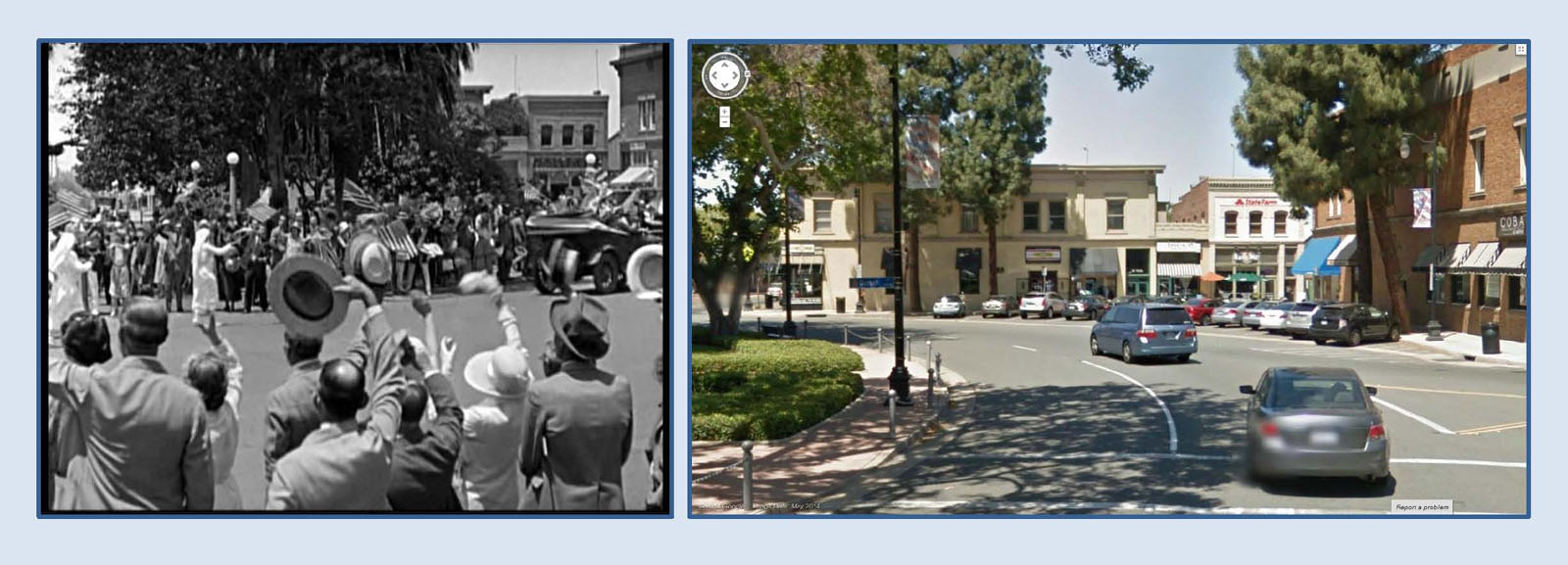
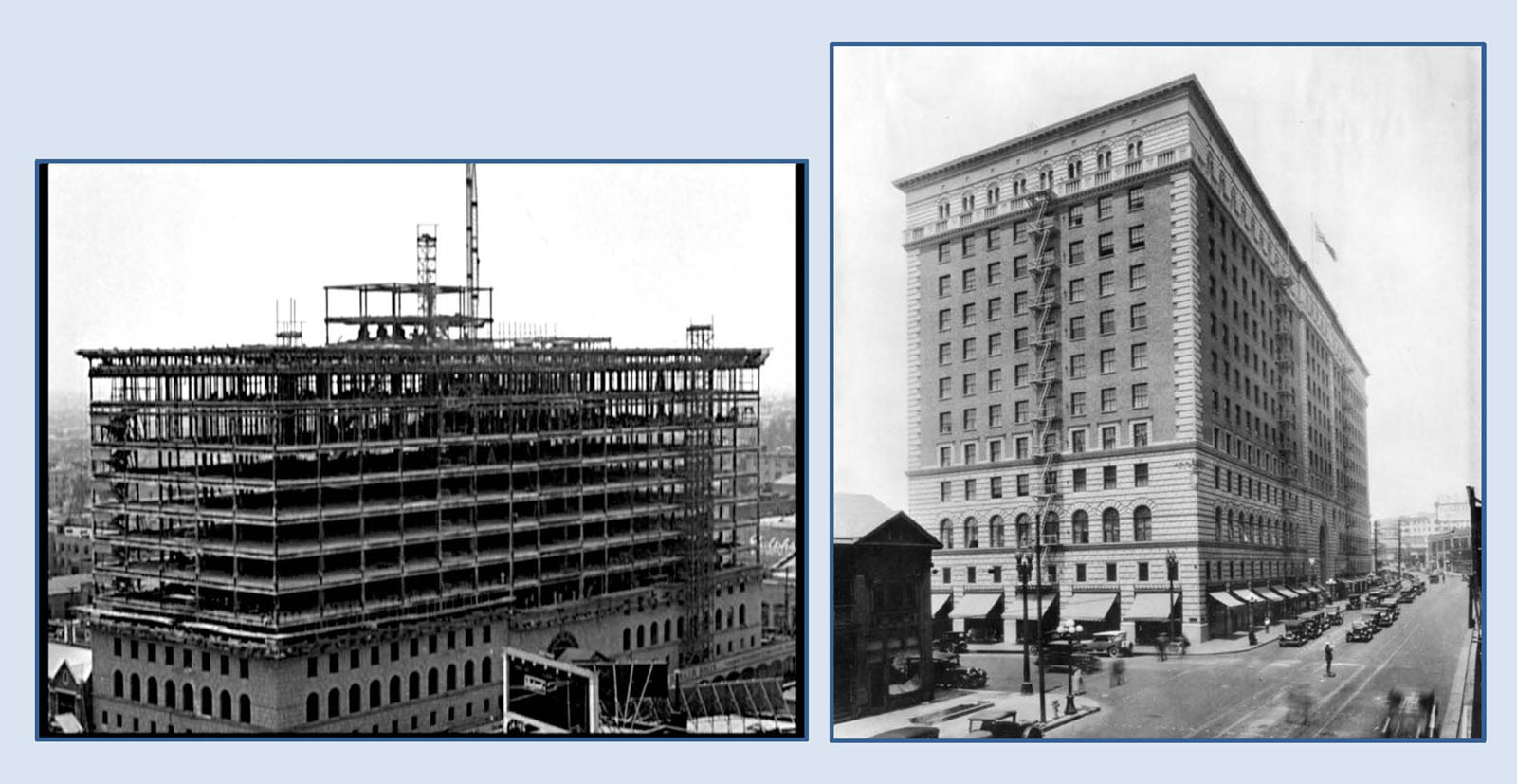
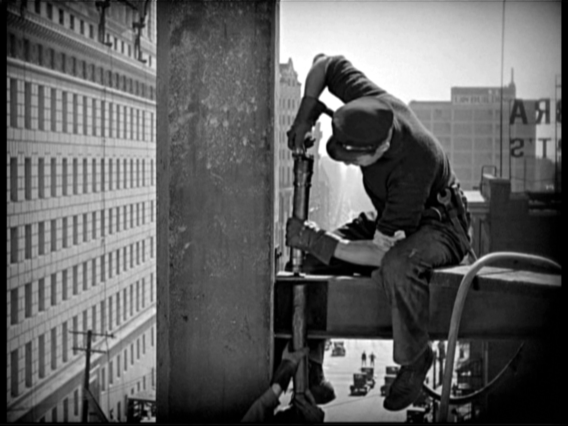
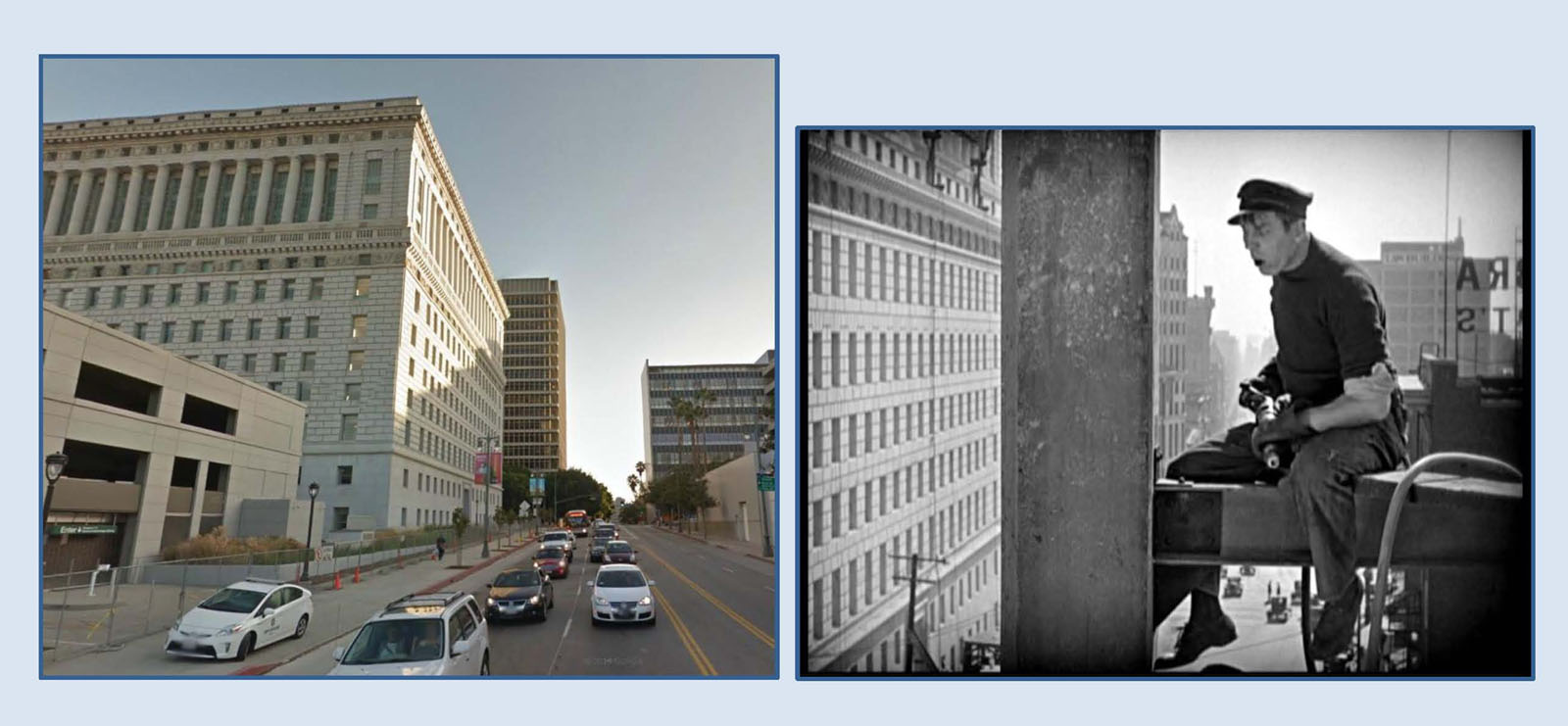
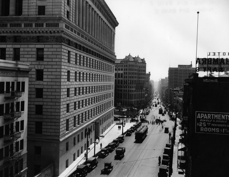
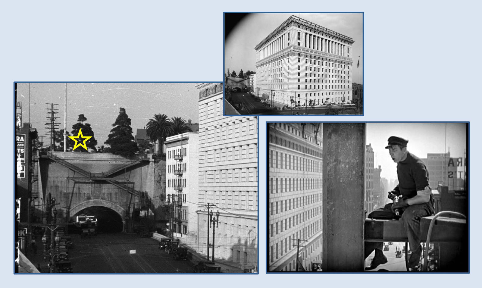
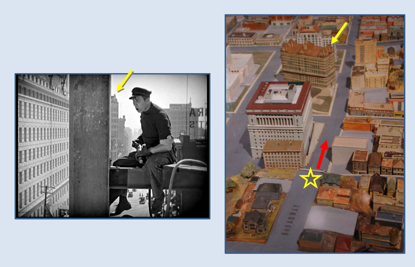
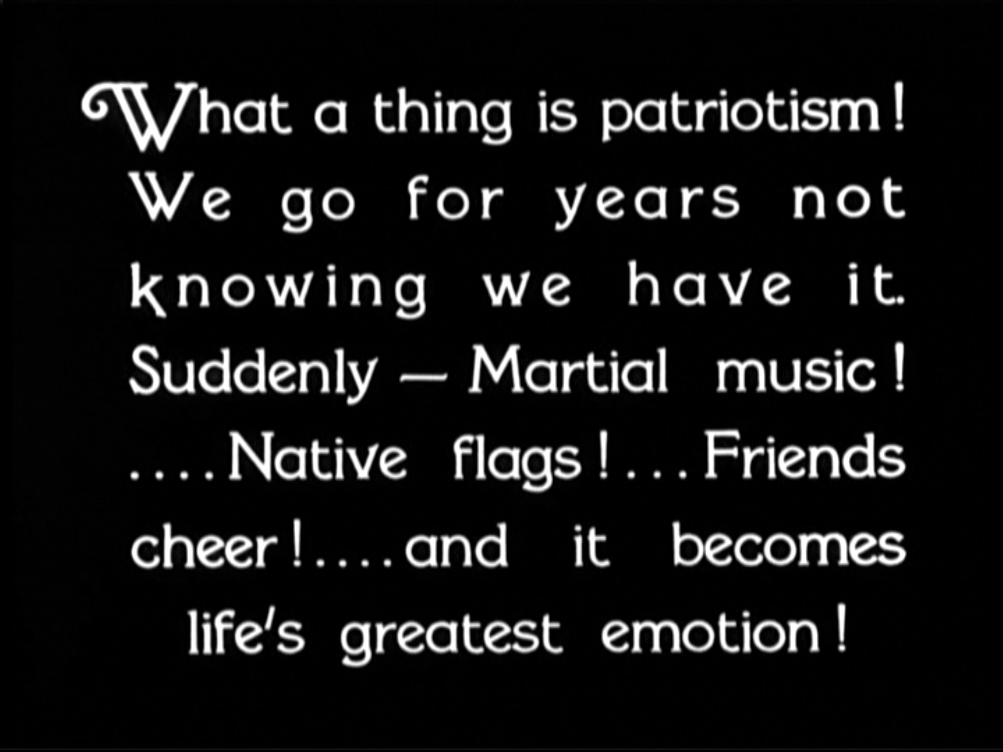
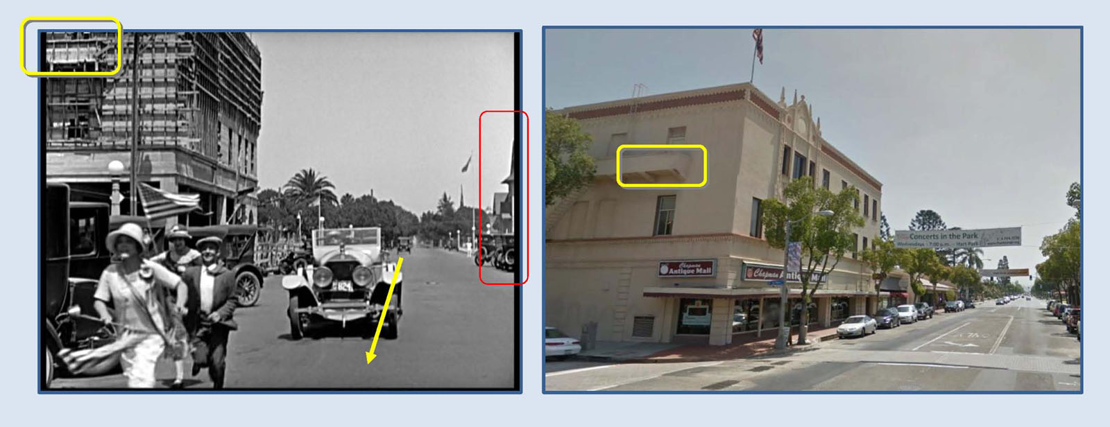
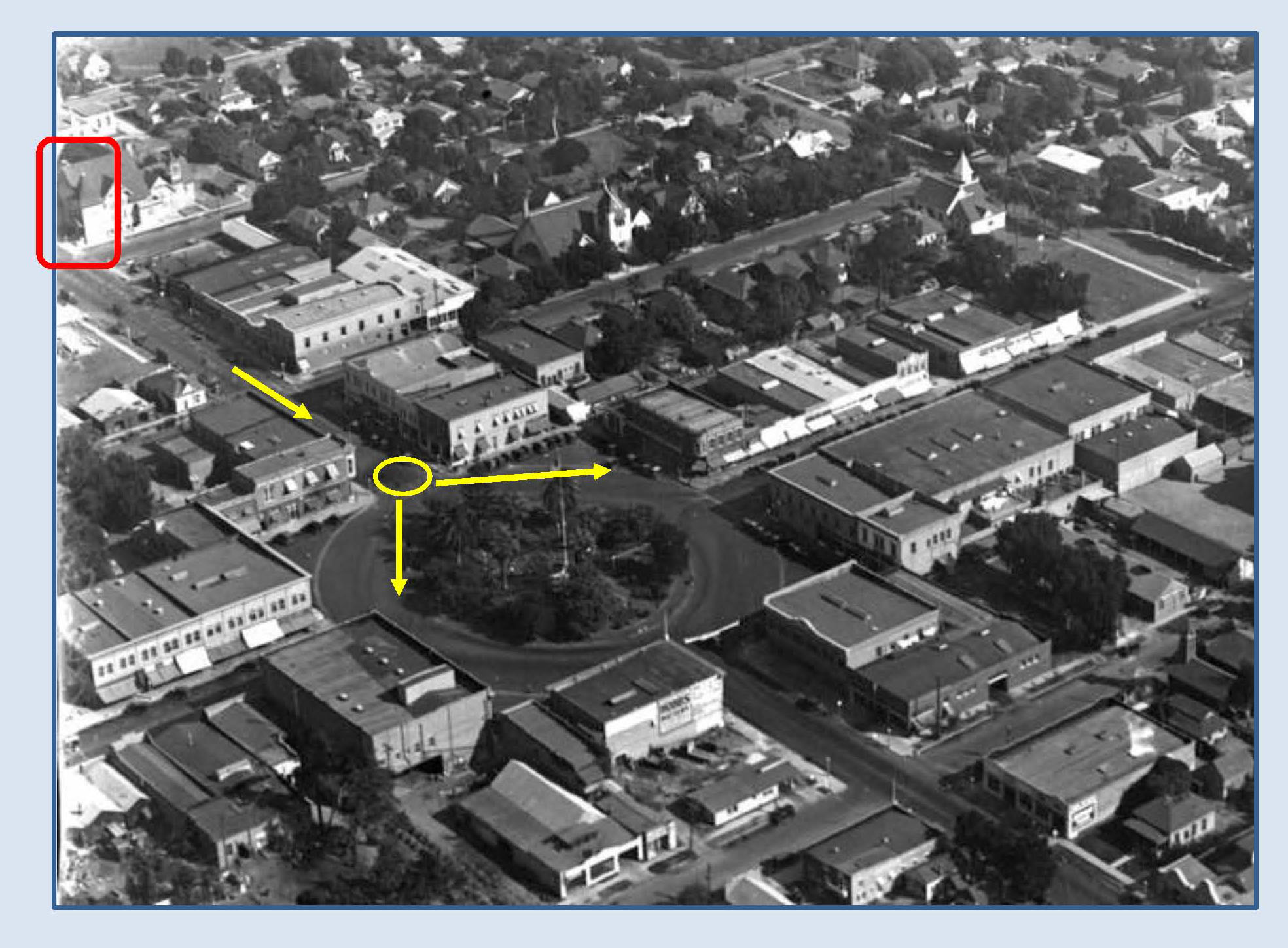
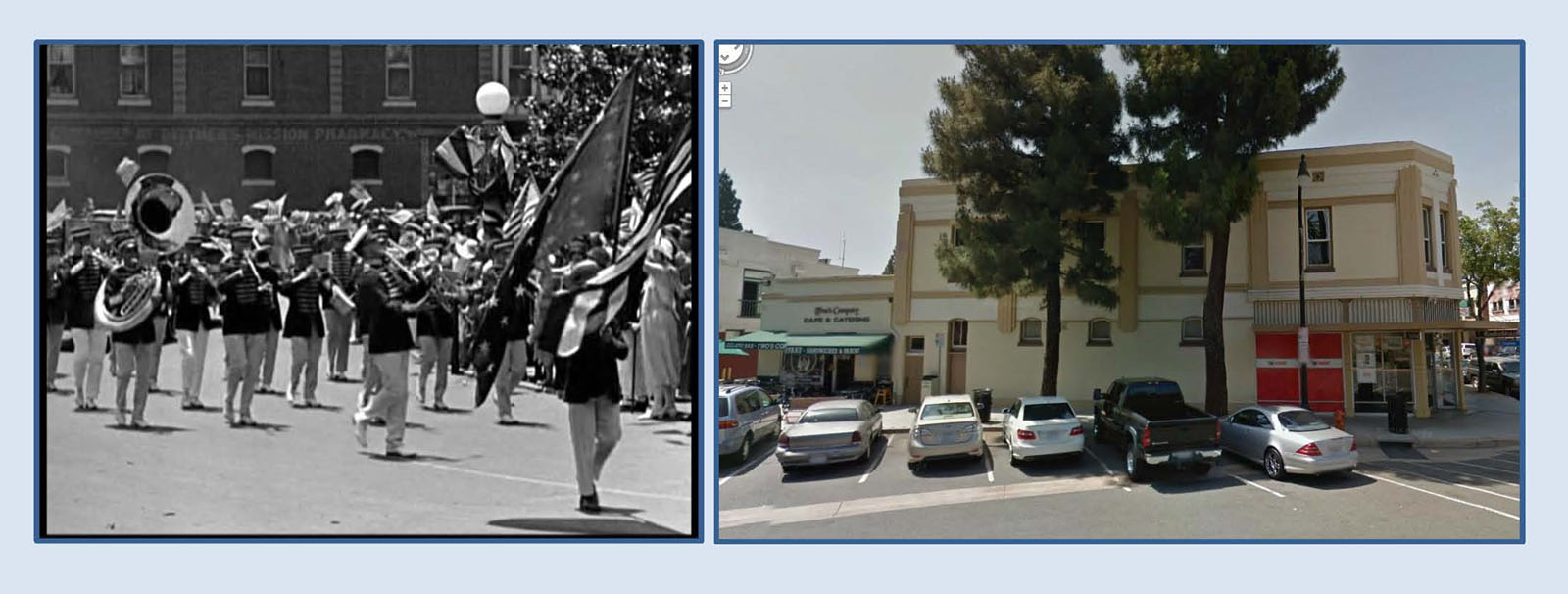
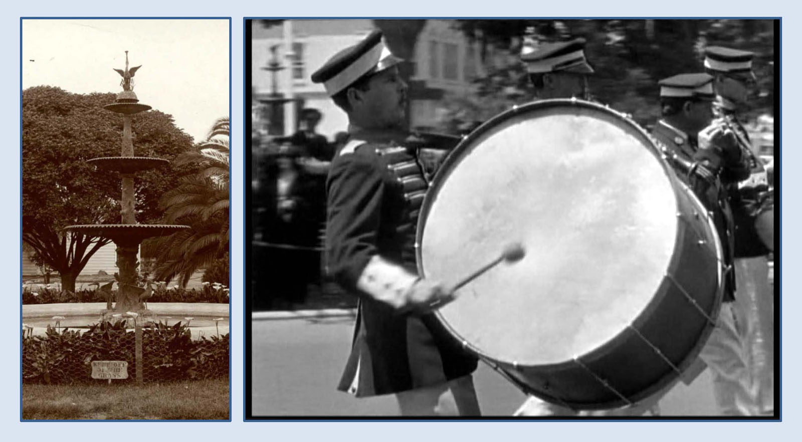
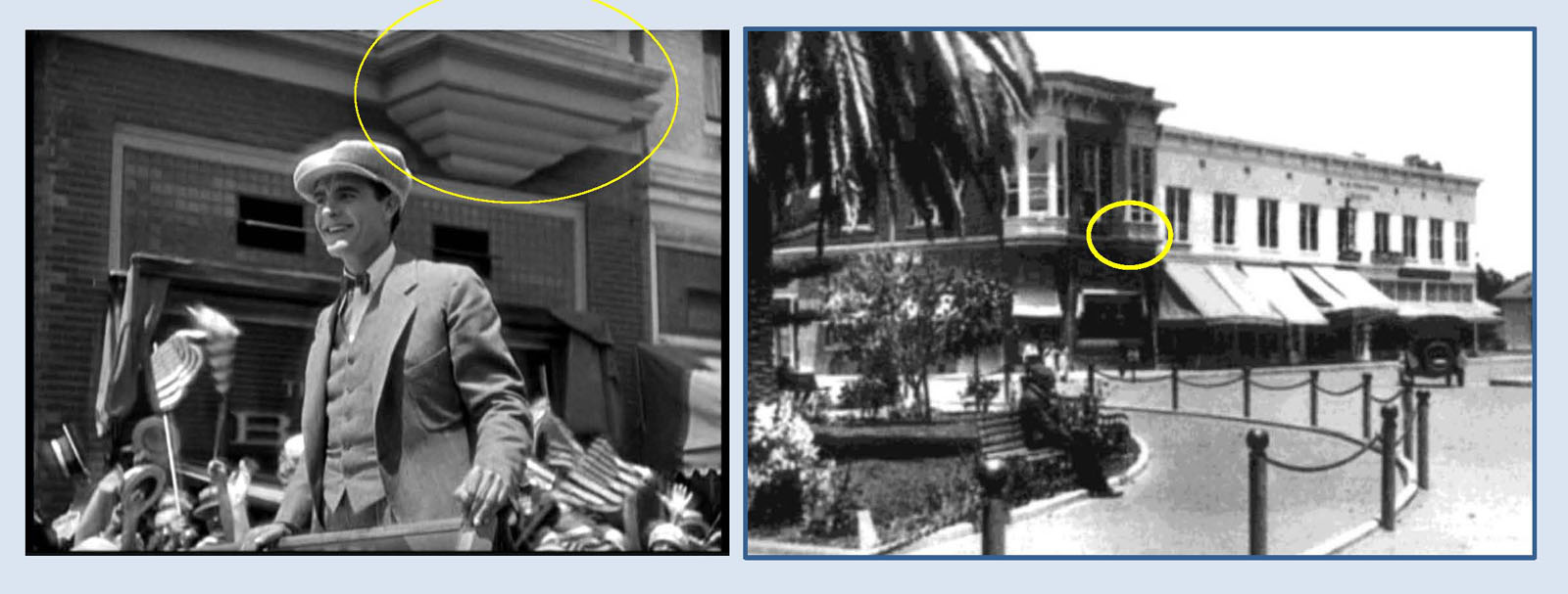
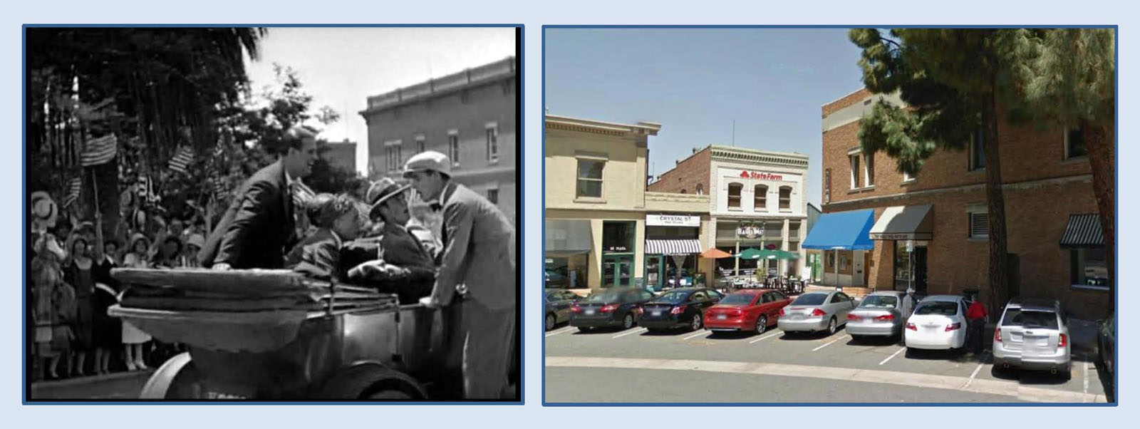
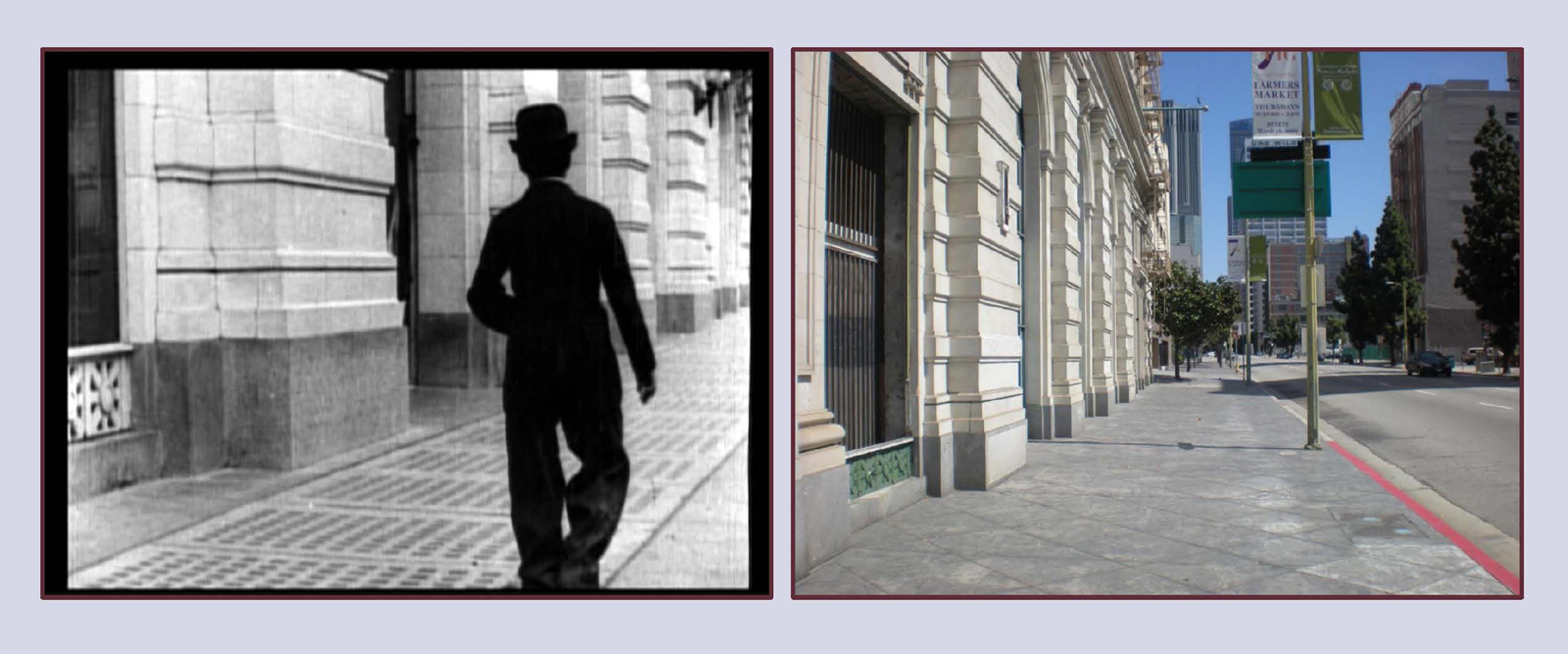
![[Here's a frame grab from the new Blu-ray release. You can see a man at the far left watching Chaplin.]](https://silentlocations.com/wp-content/uploads/2014/11/the-bank-blu-ray-01.jpg)
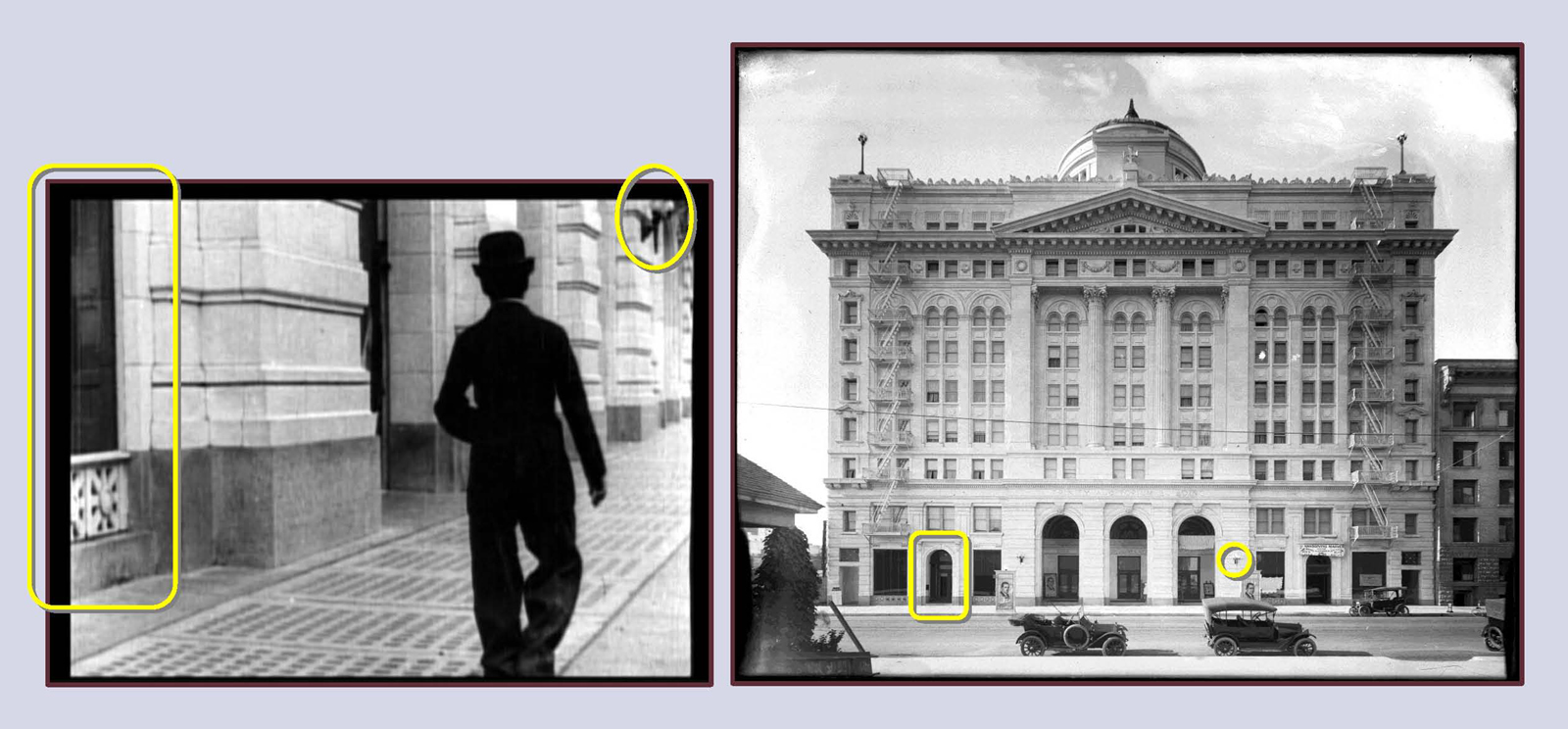
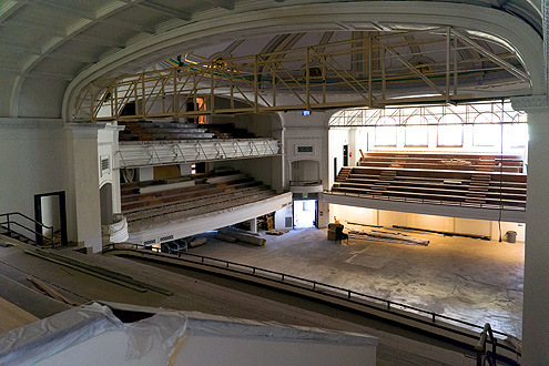

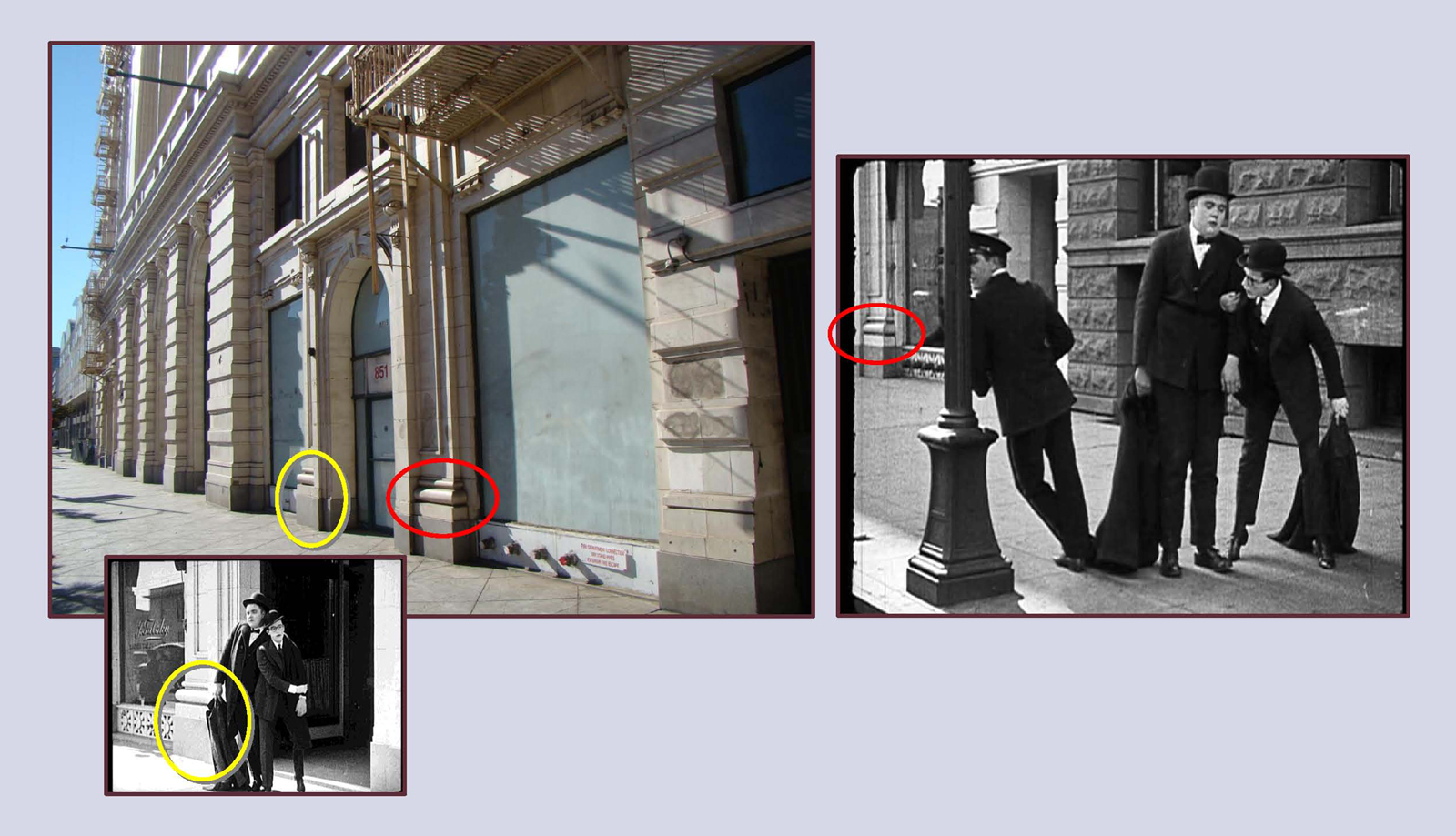
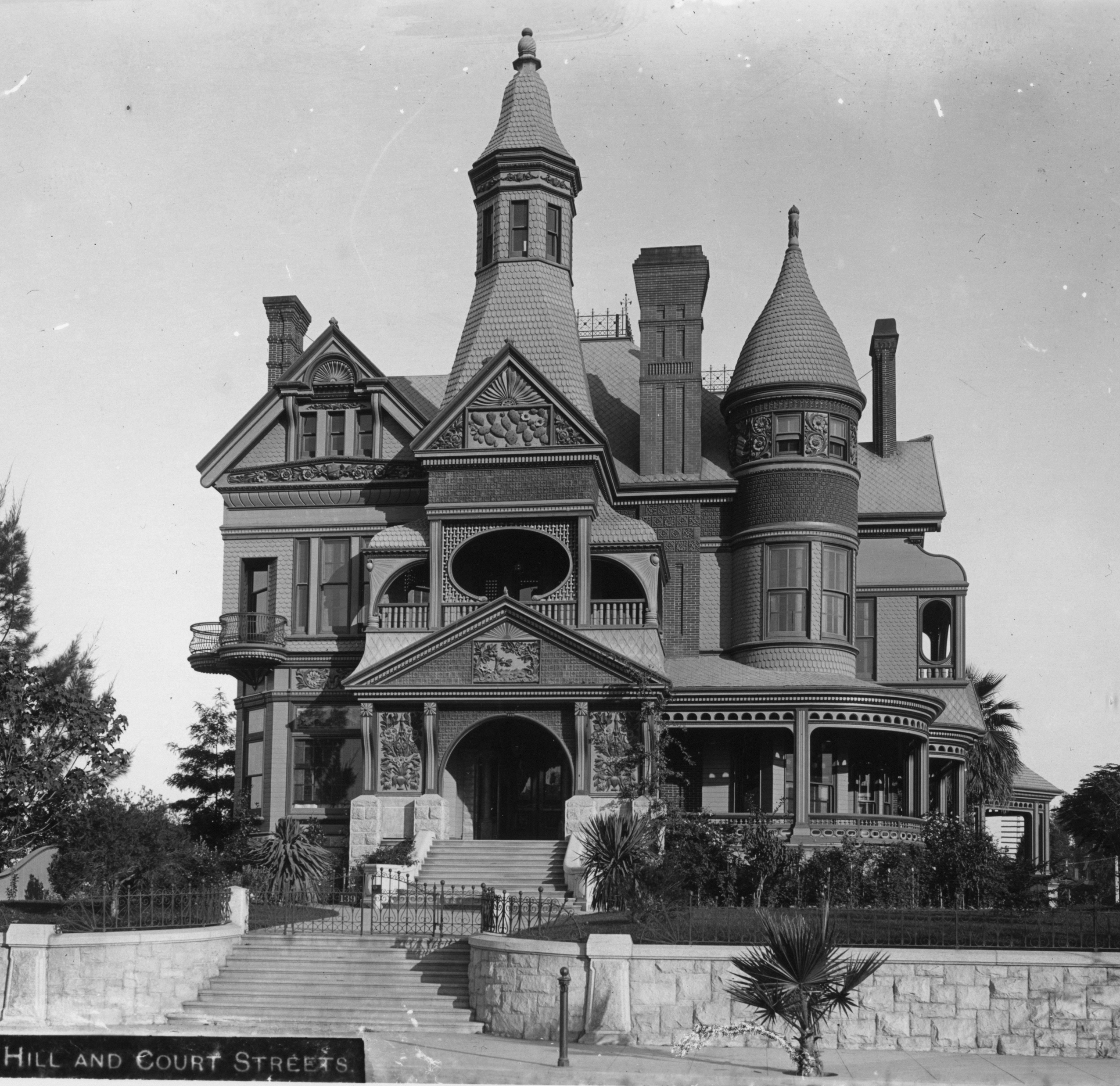
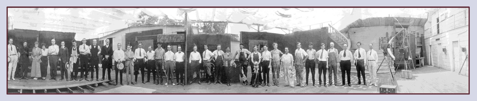


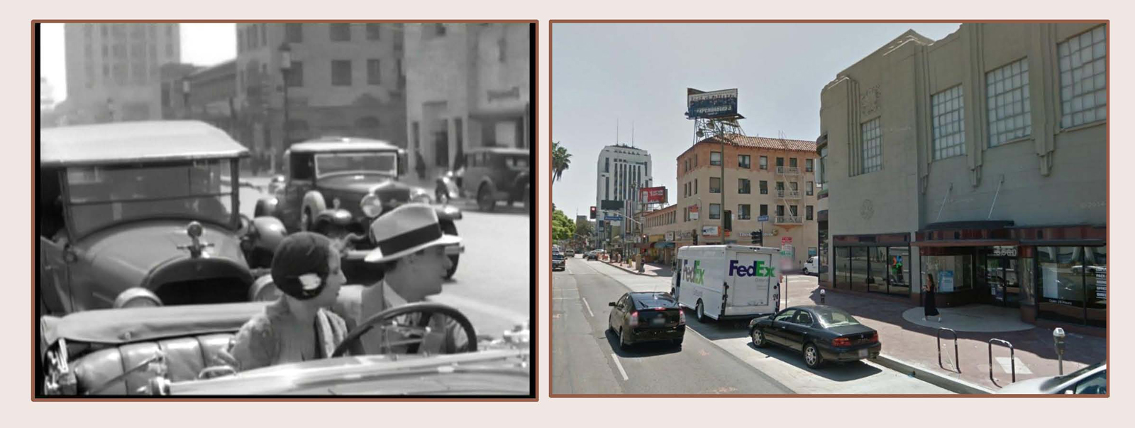
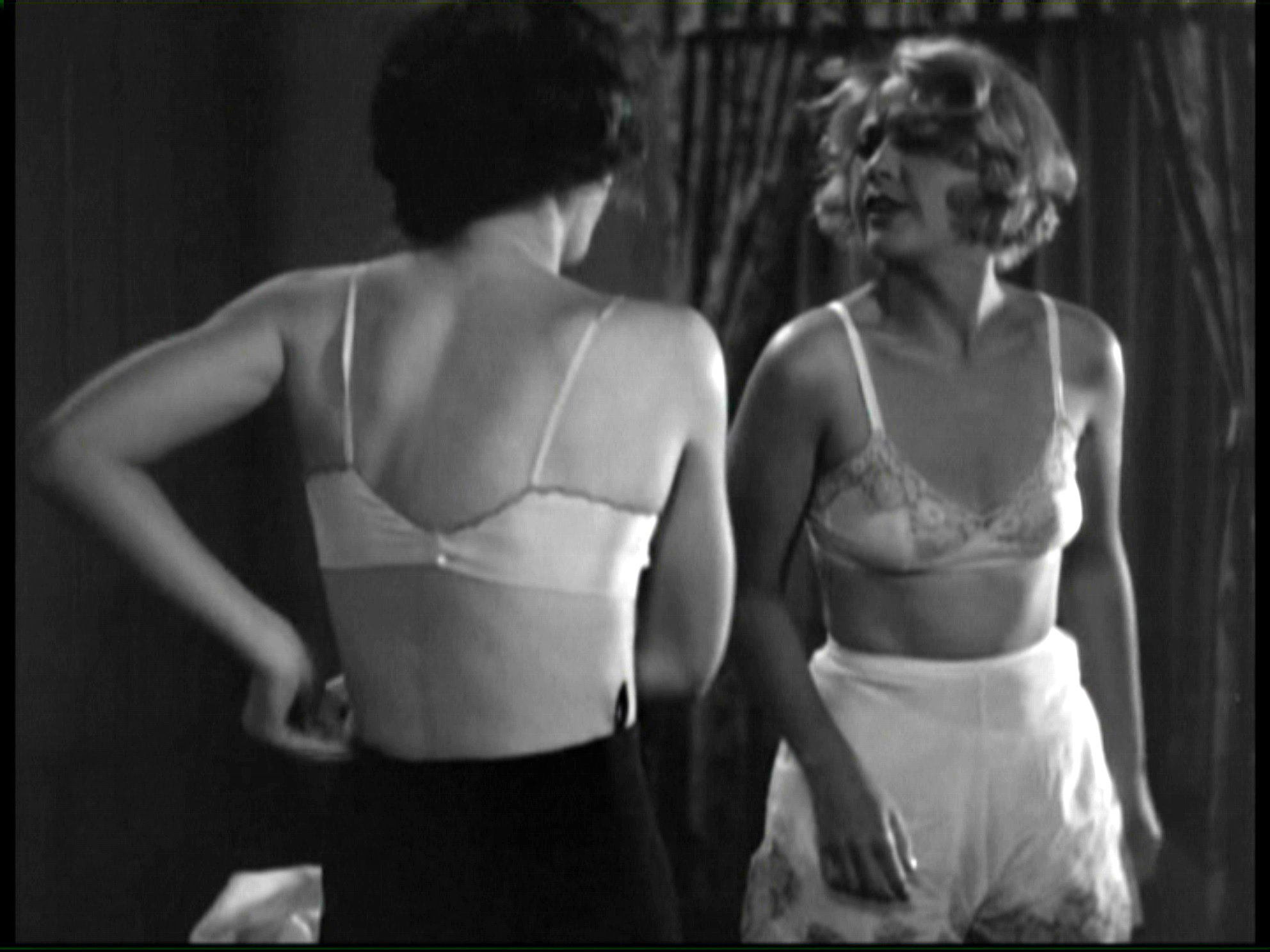
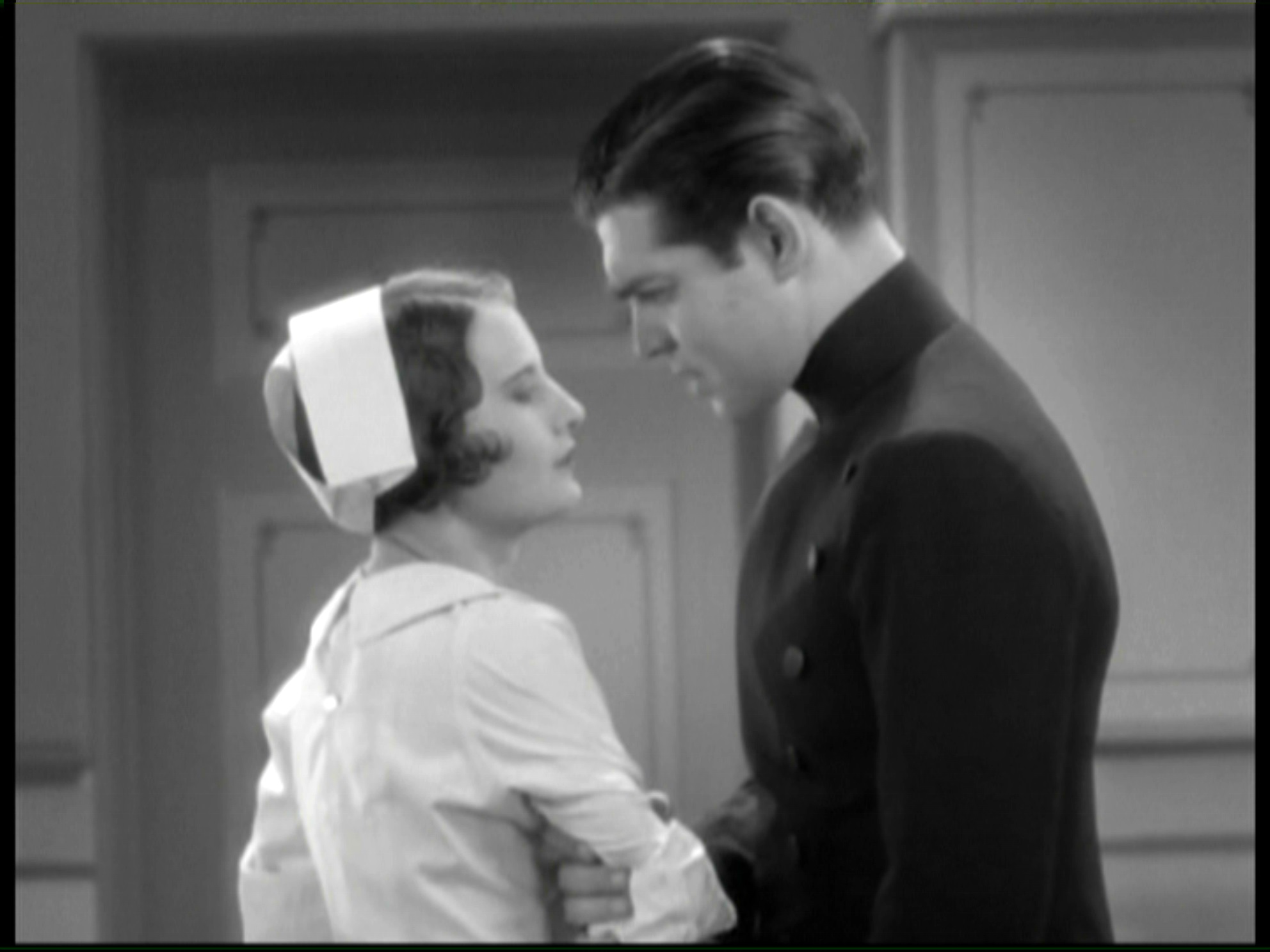

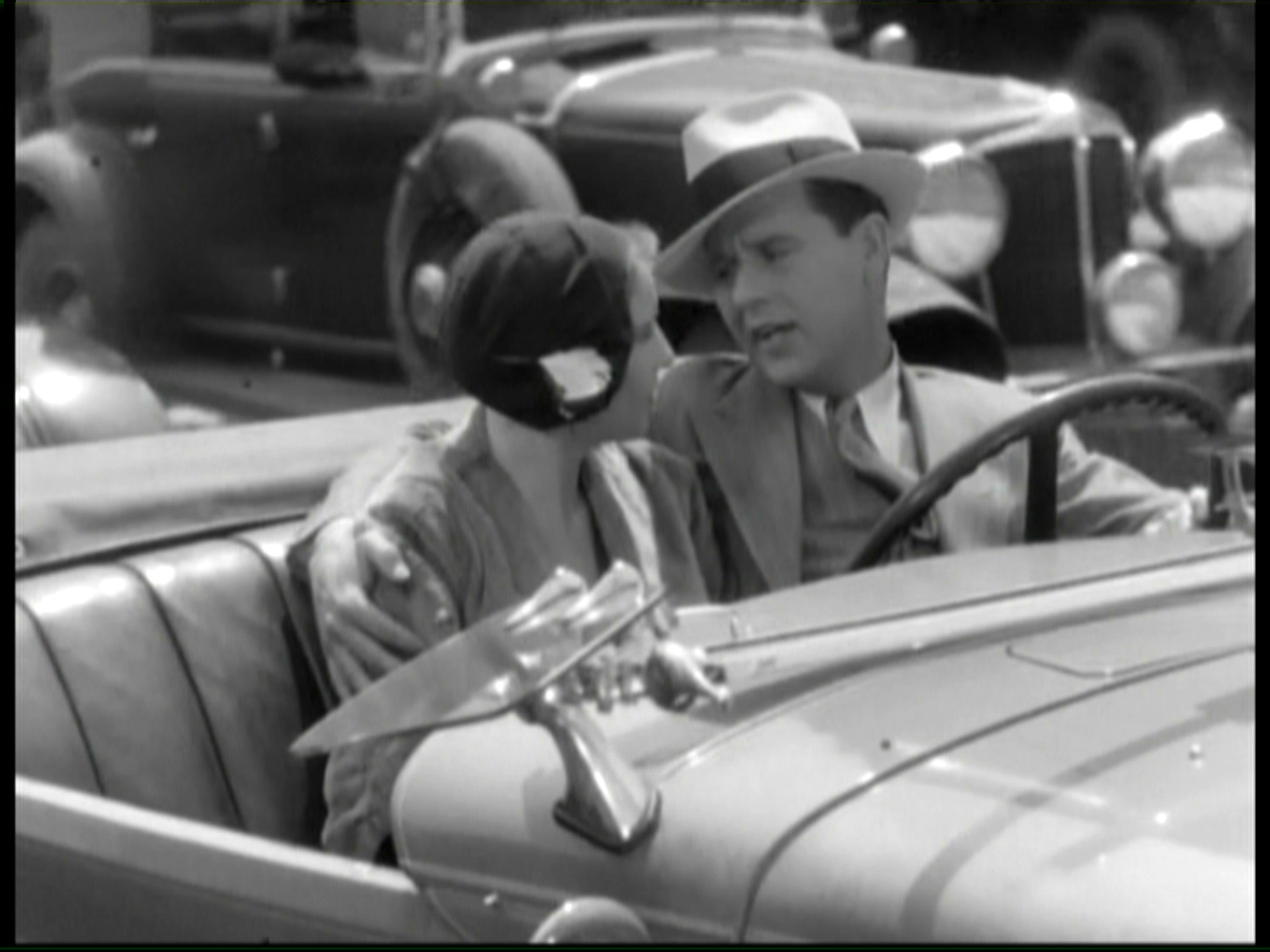

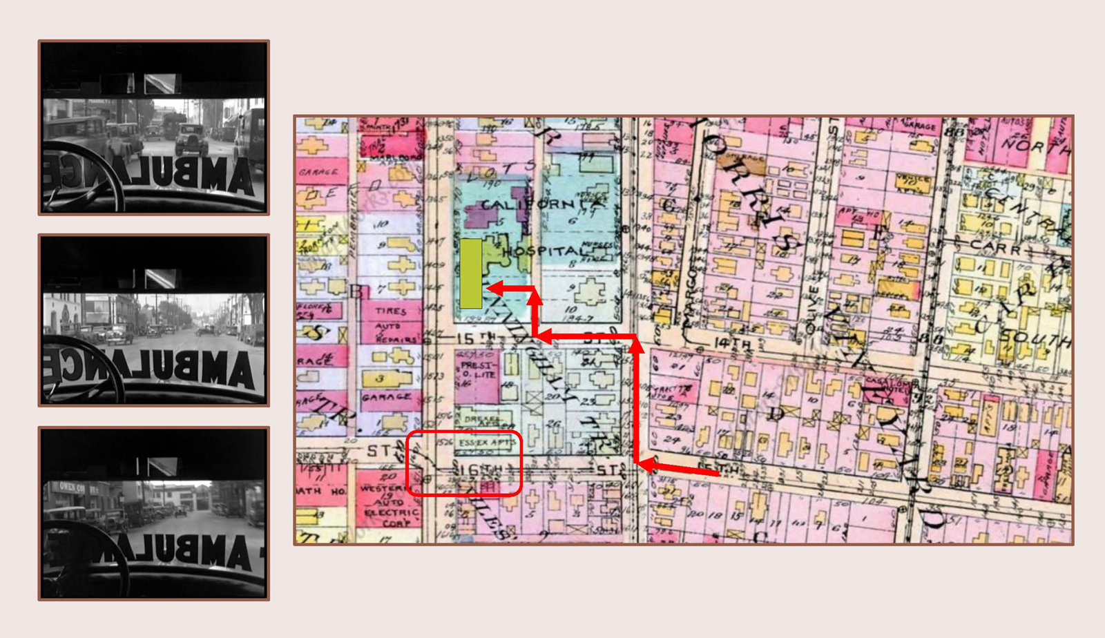
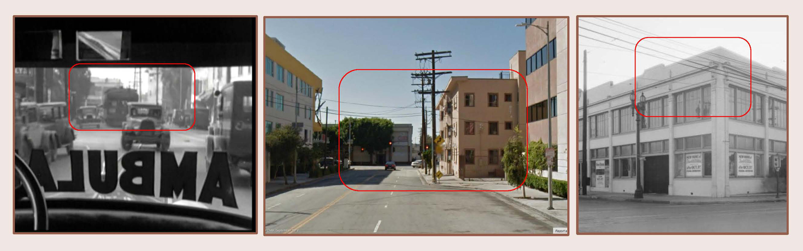

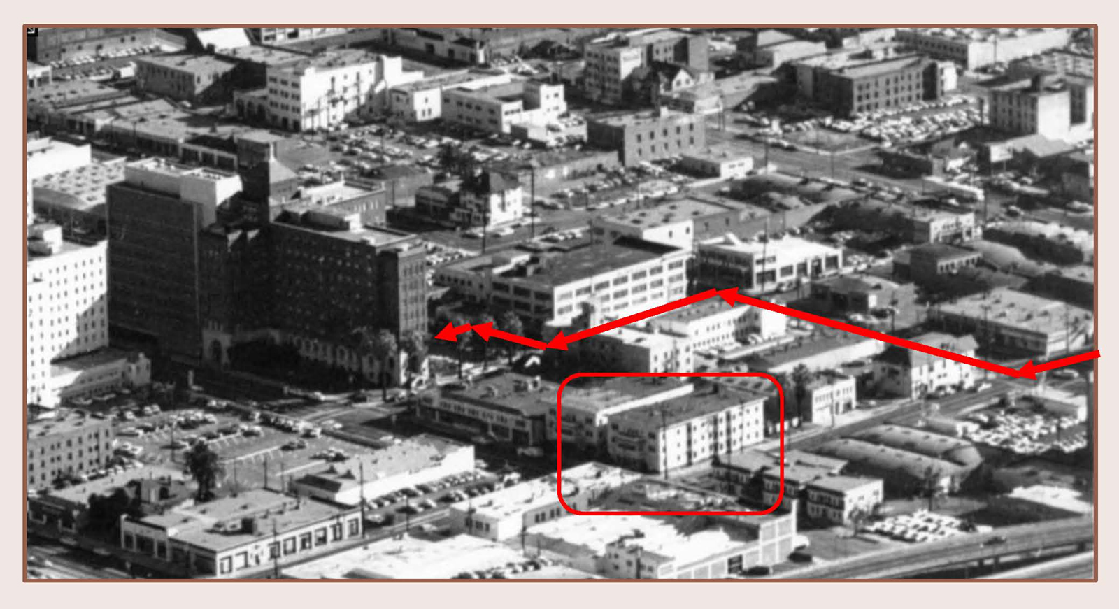

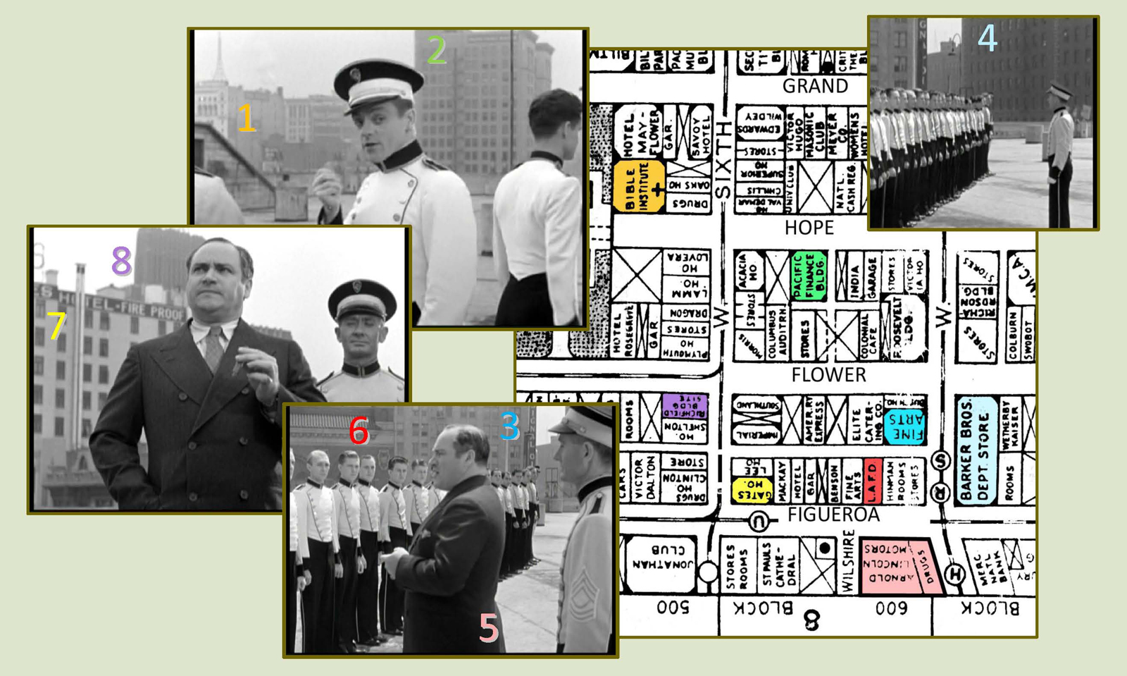
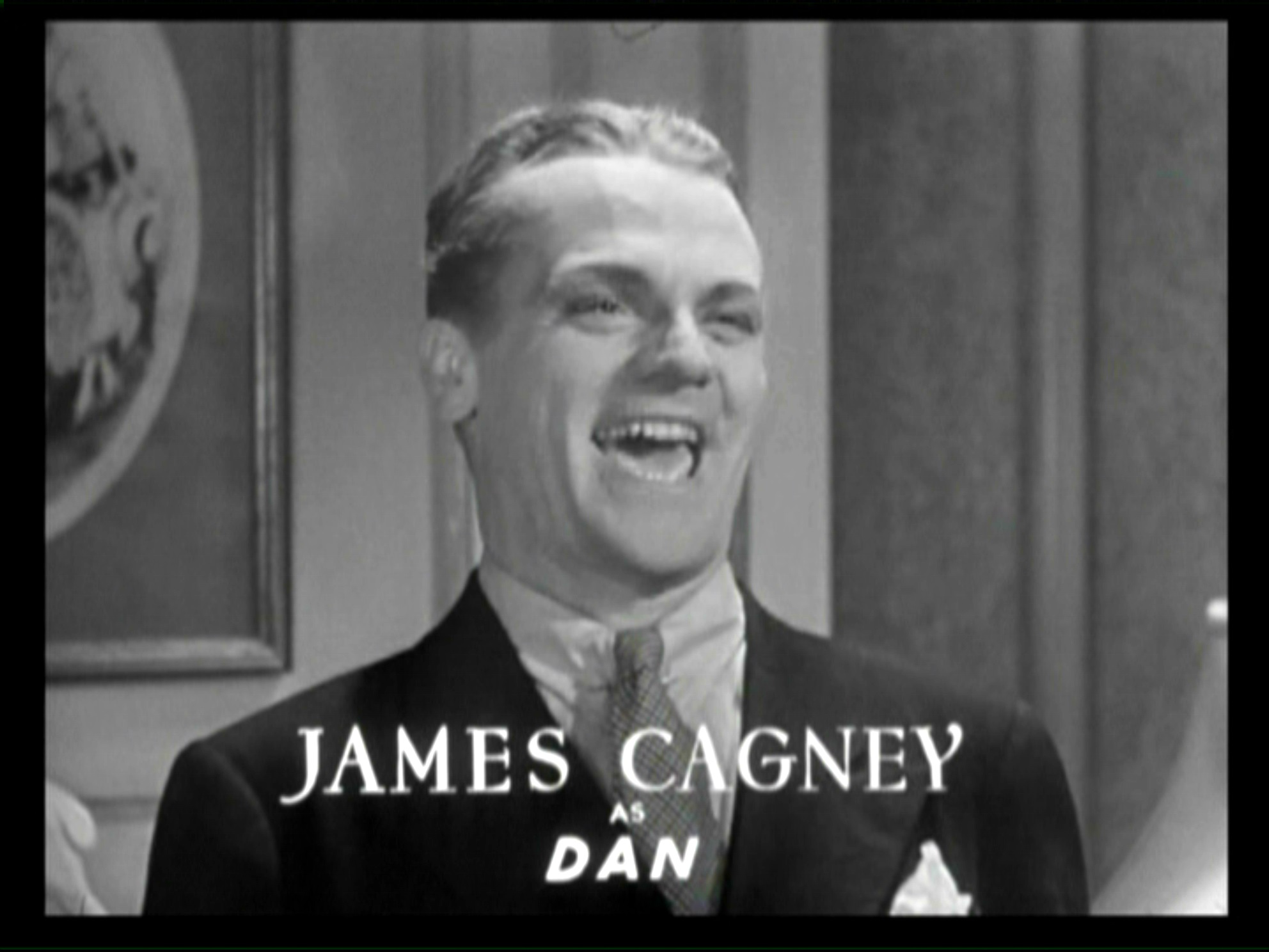

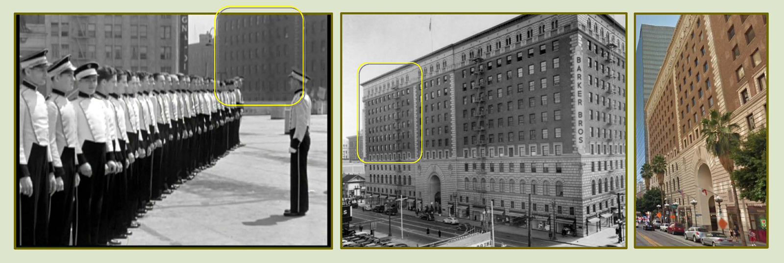
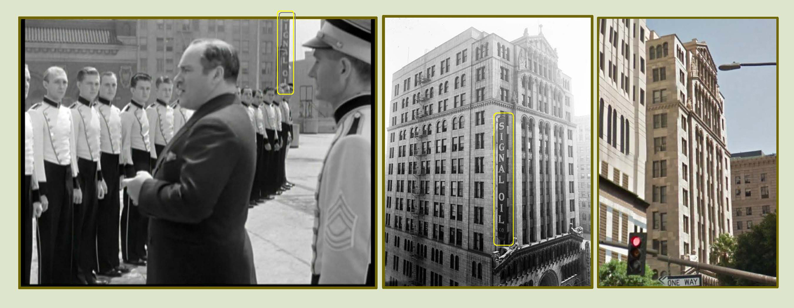

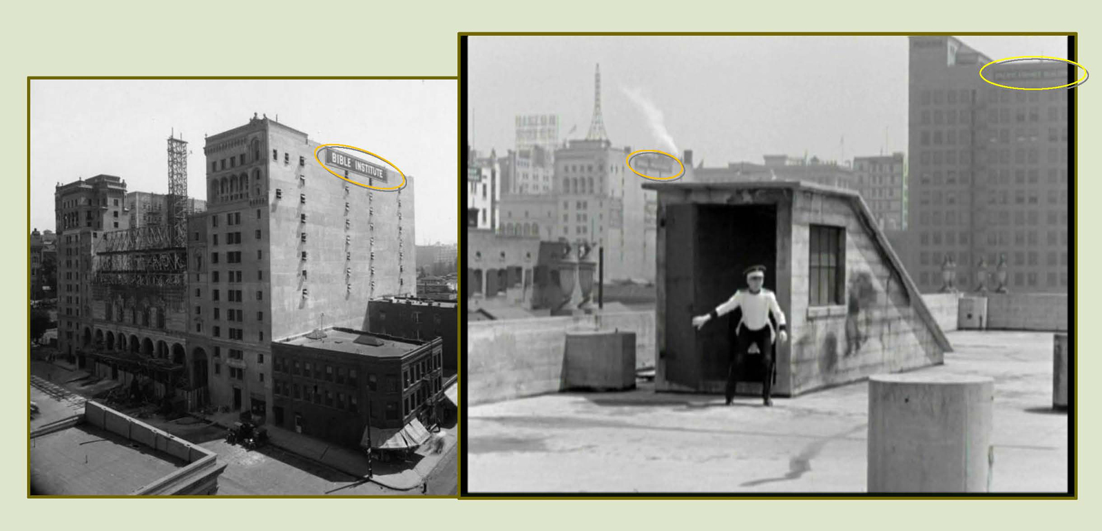
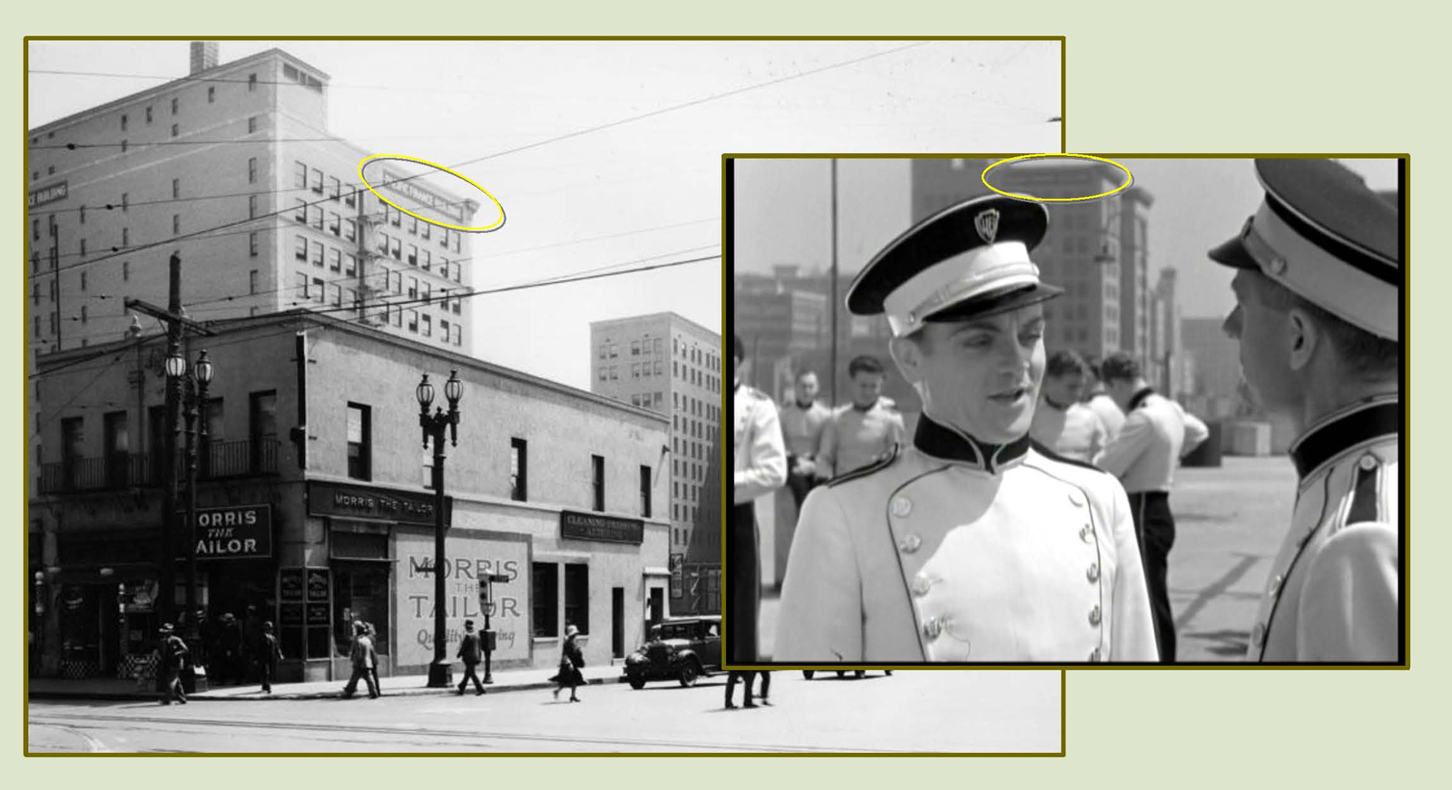
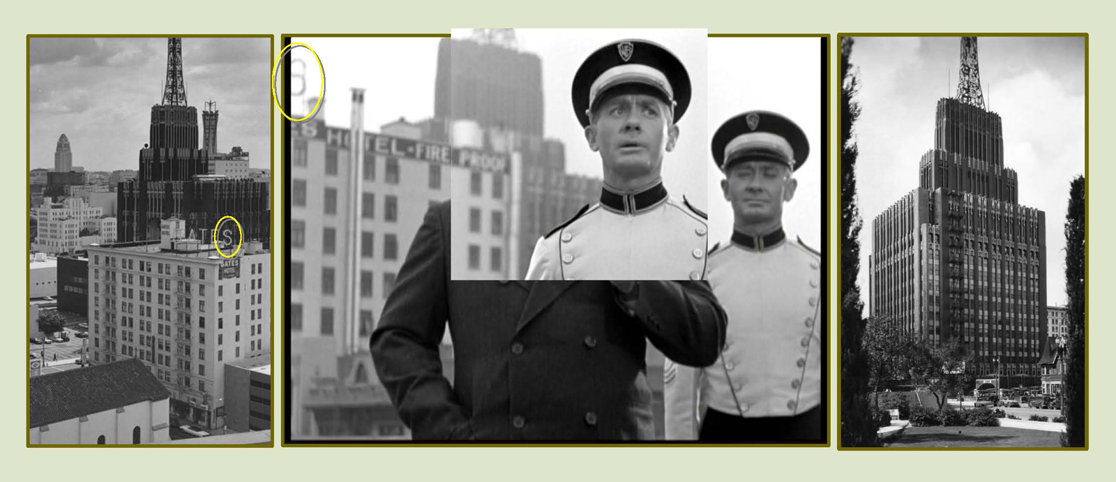
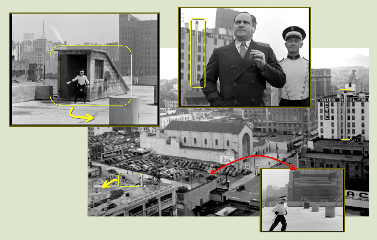
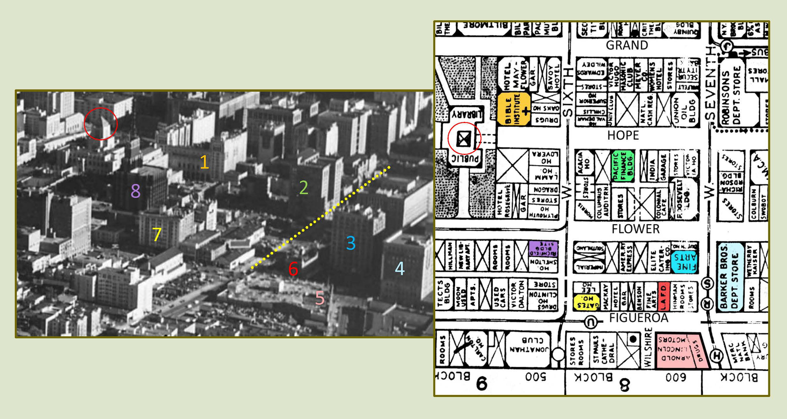
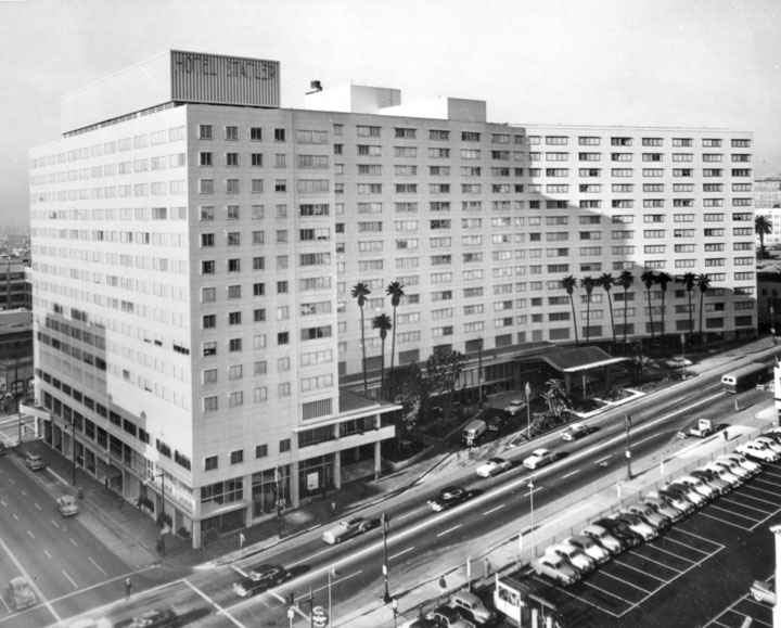

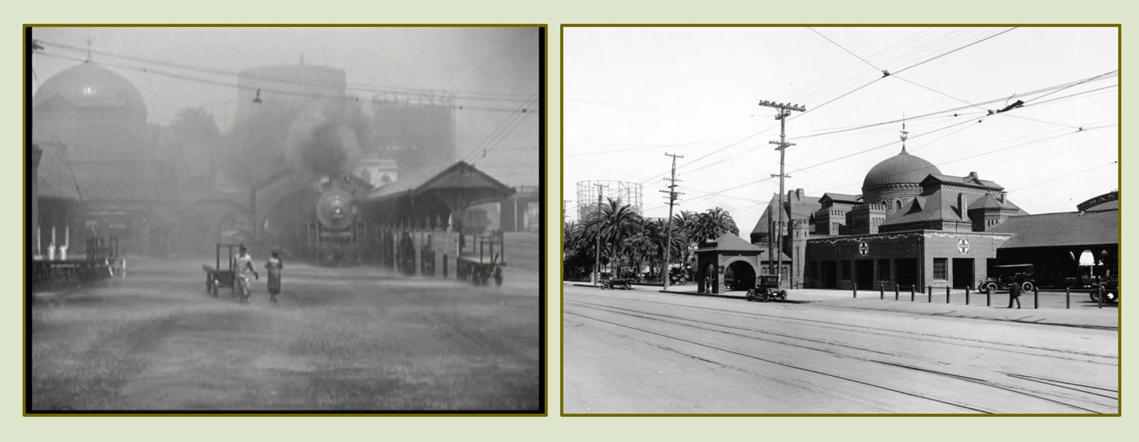
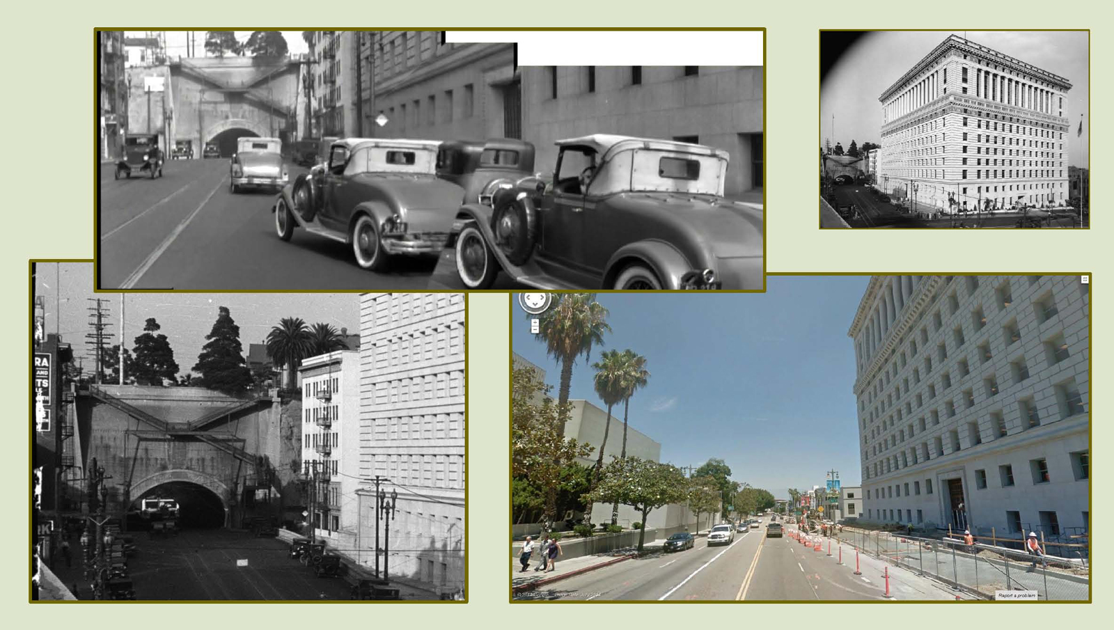
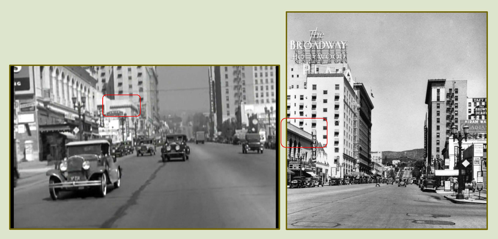

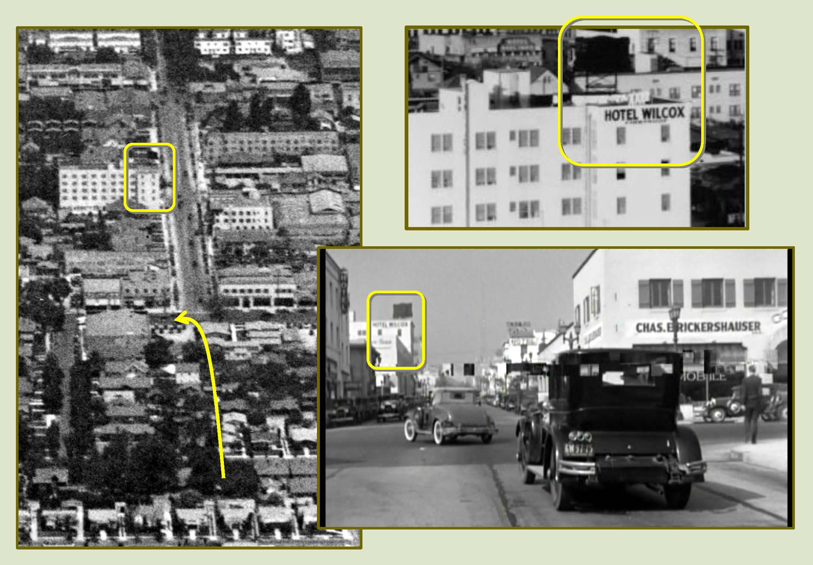
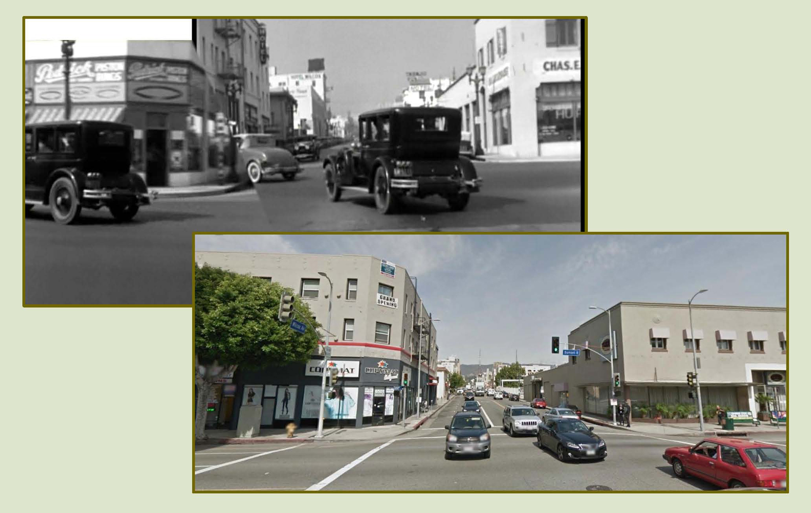


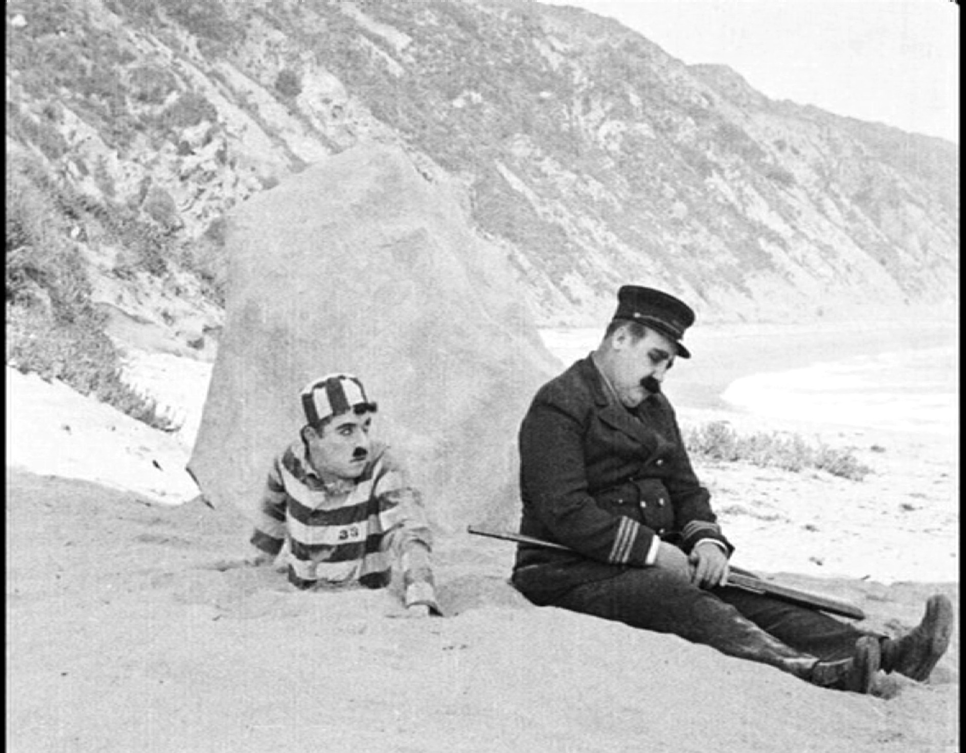

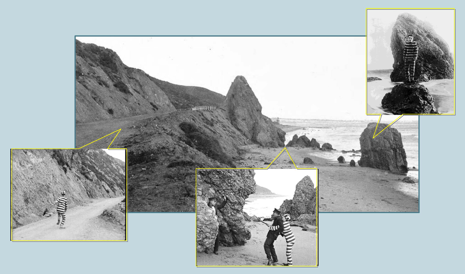


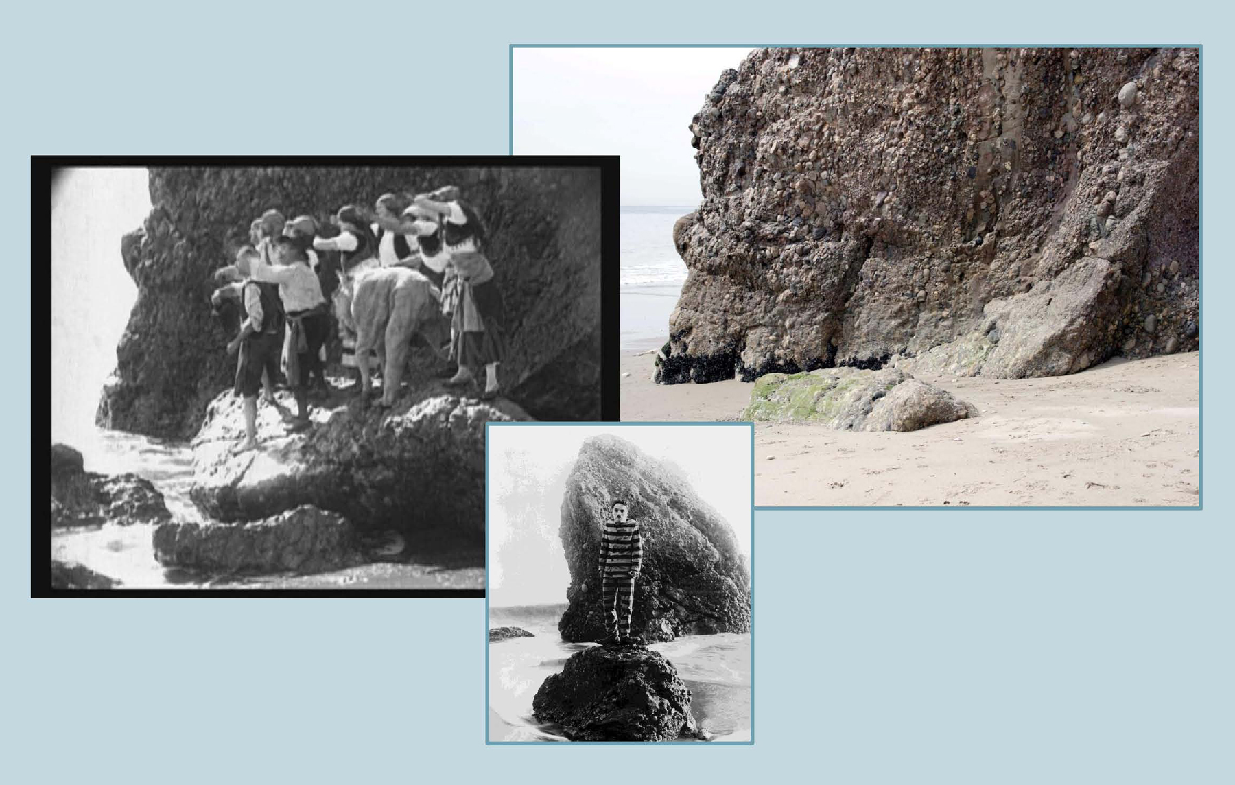


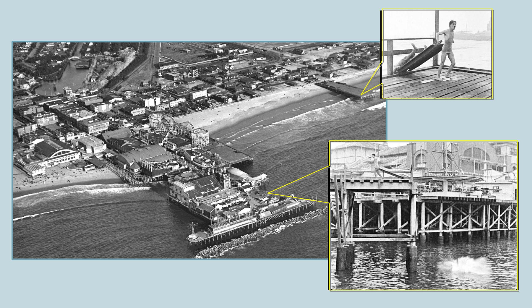
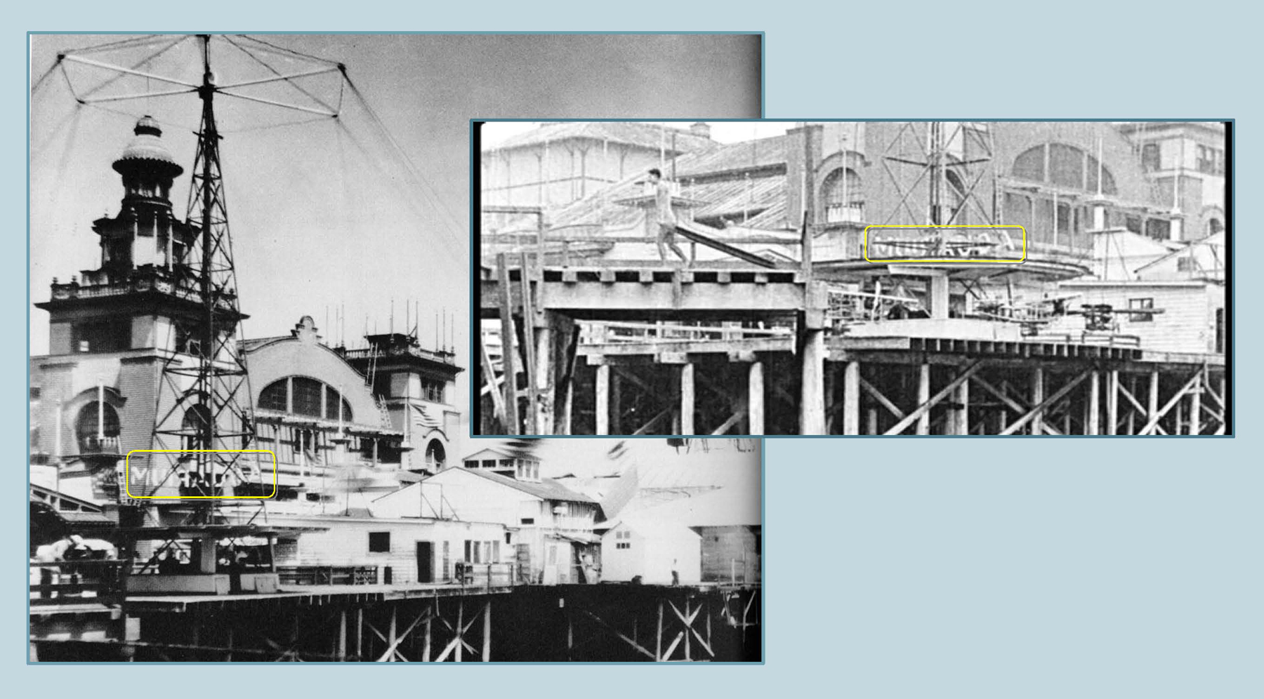

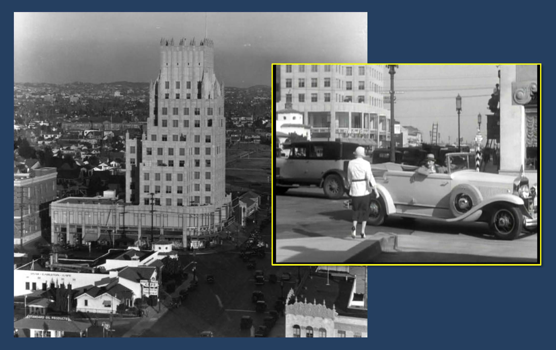


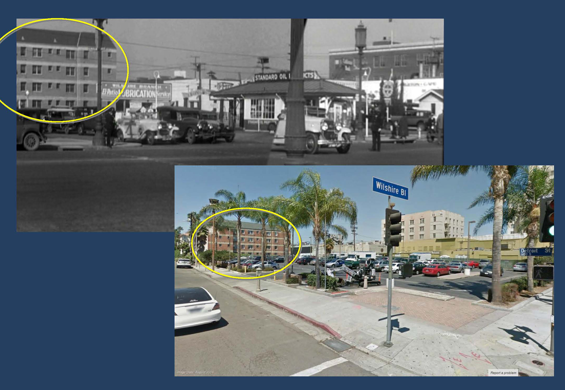
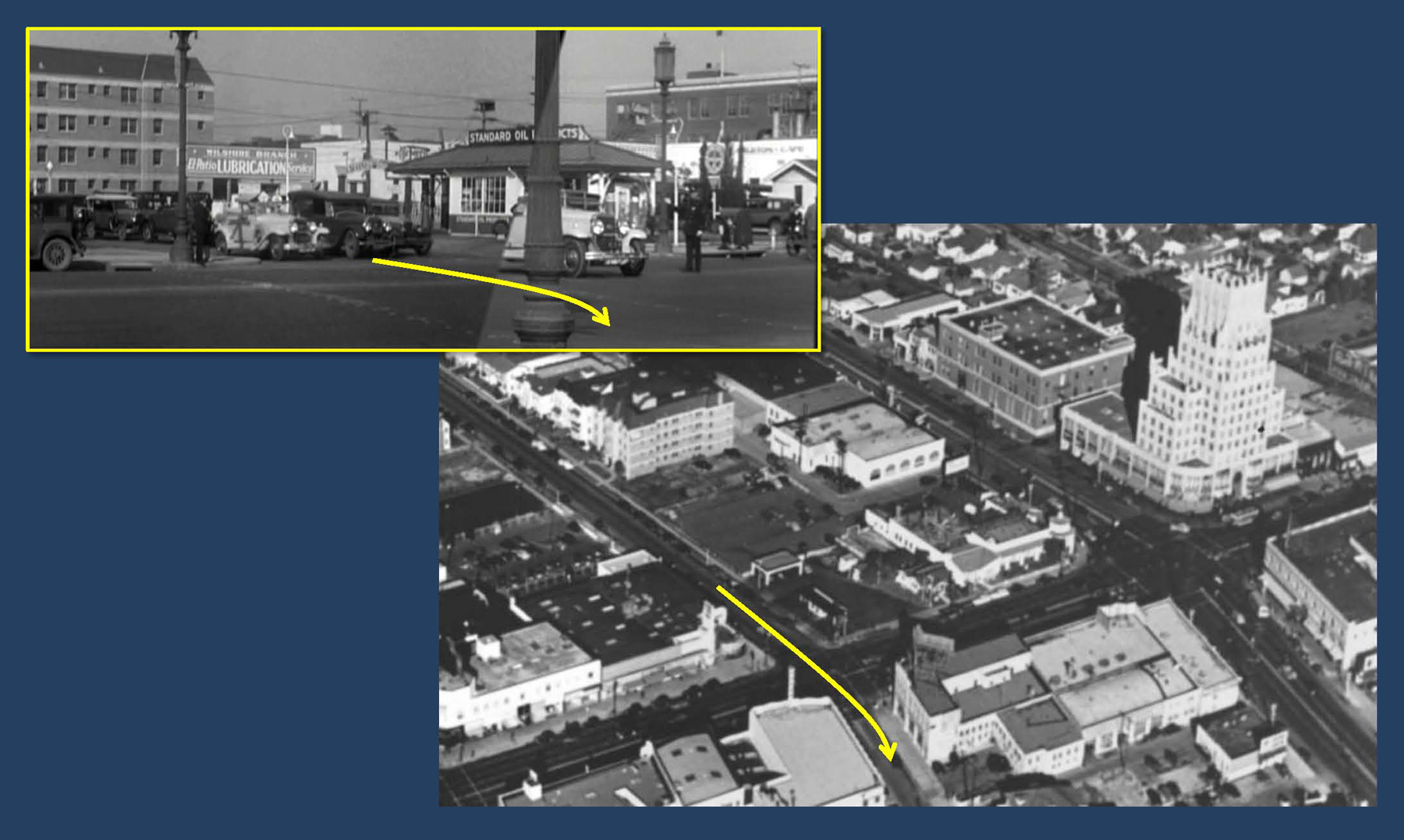

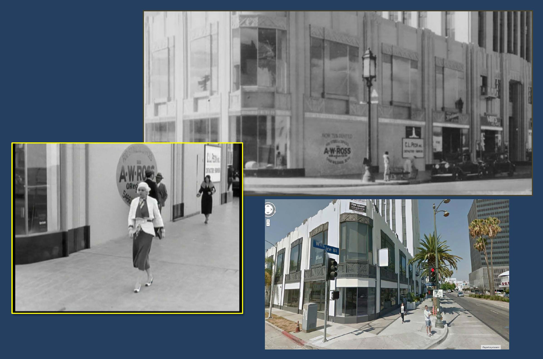


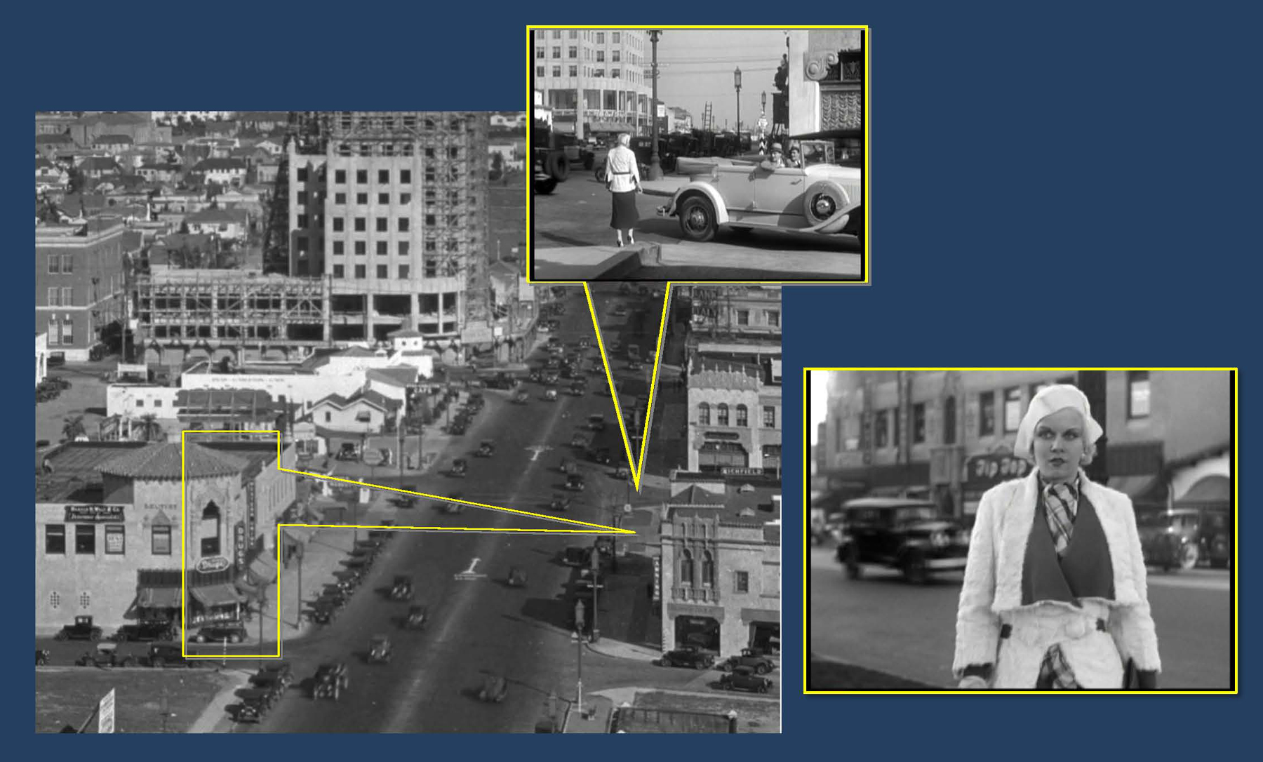


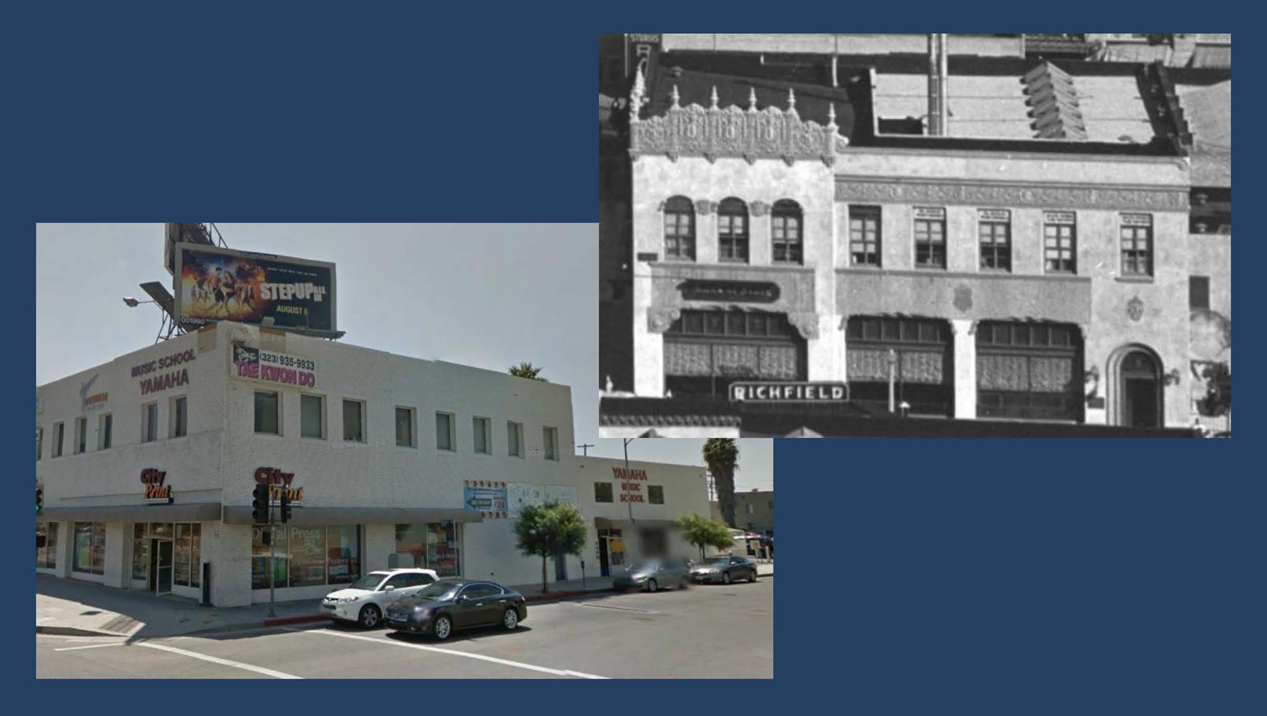

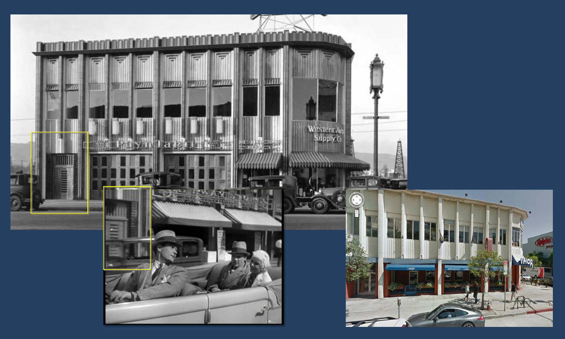
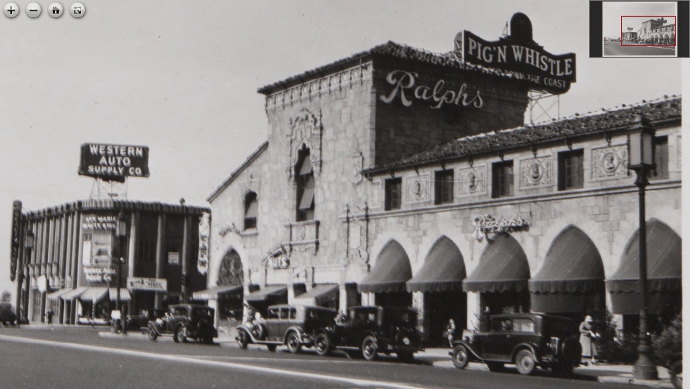
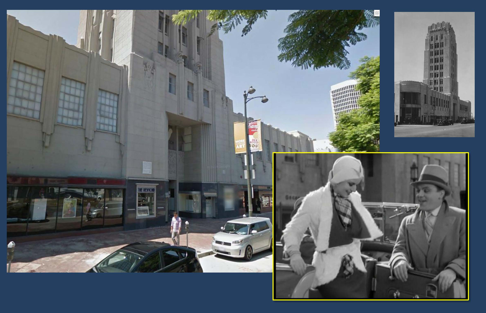
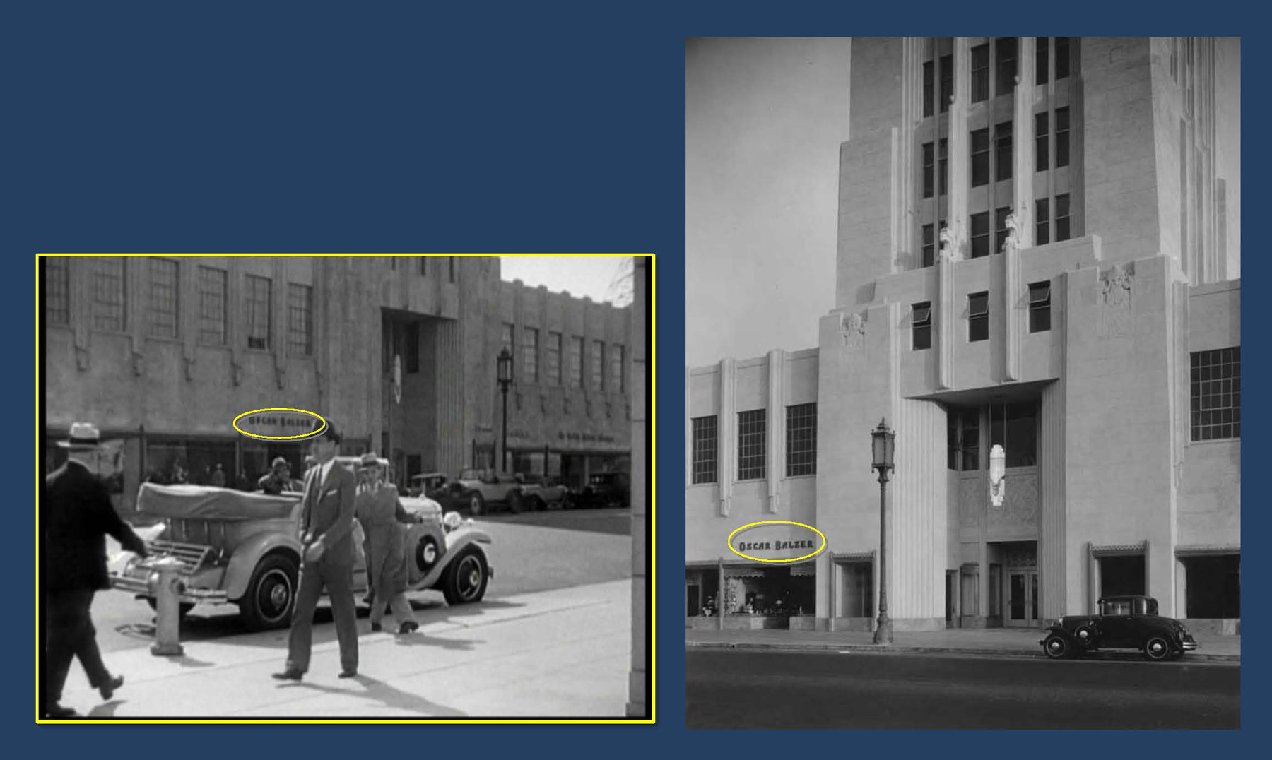


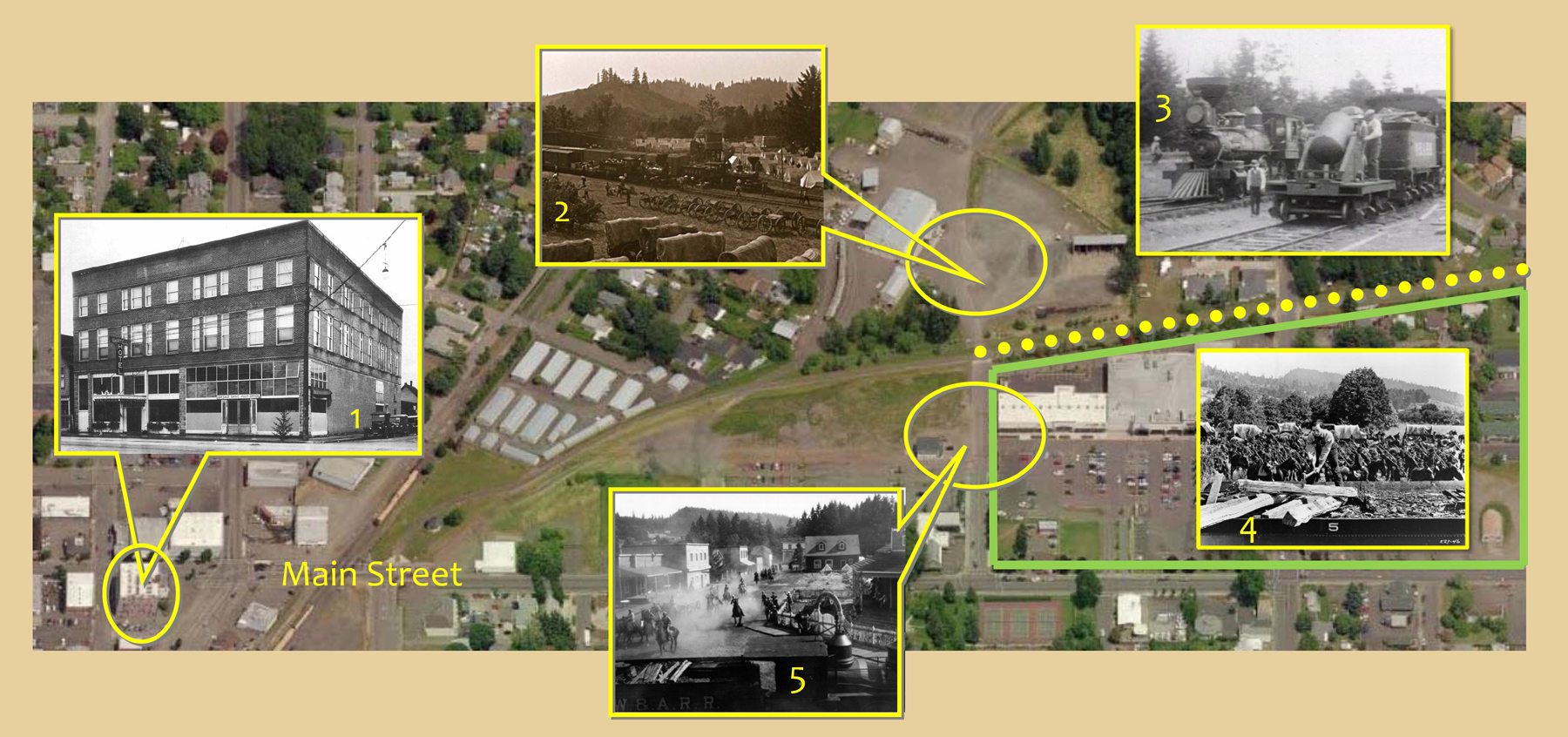


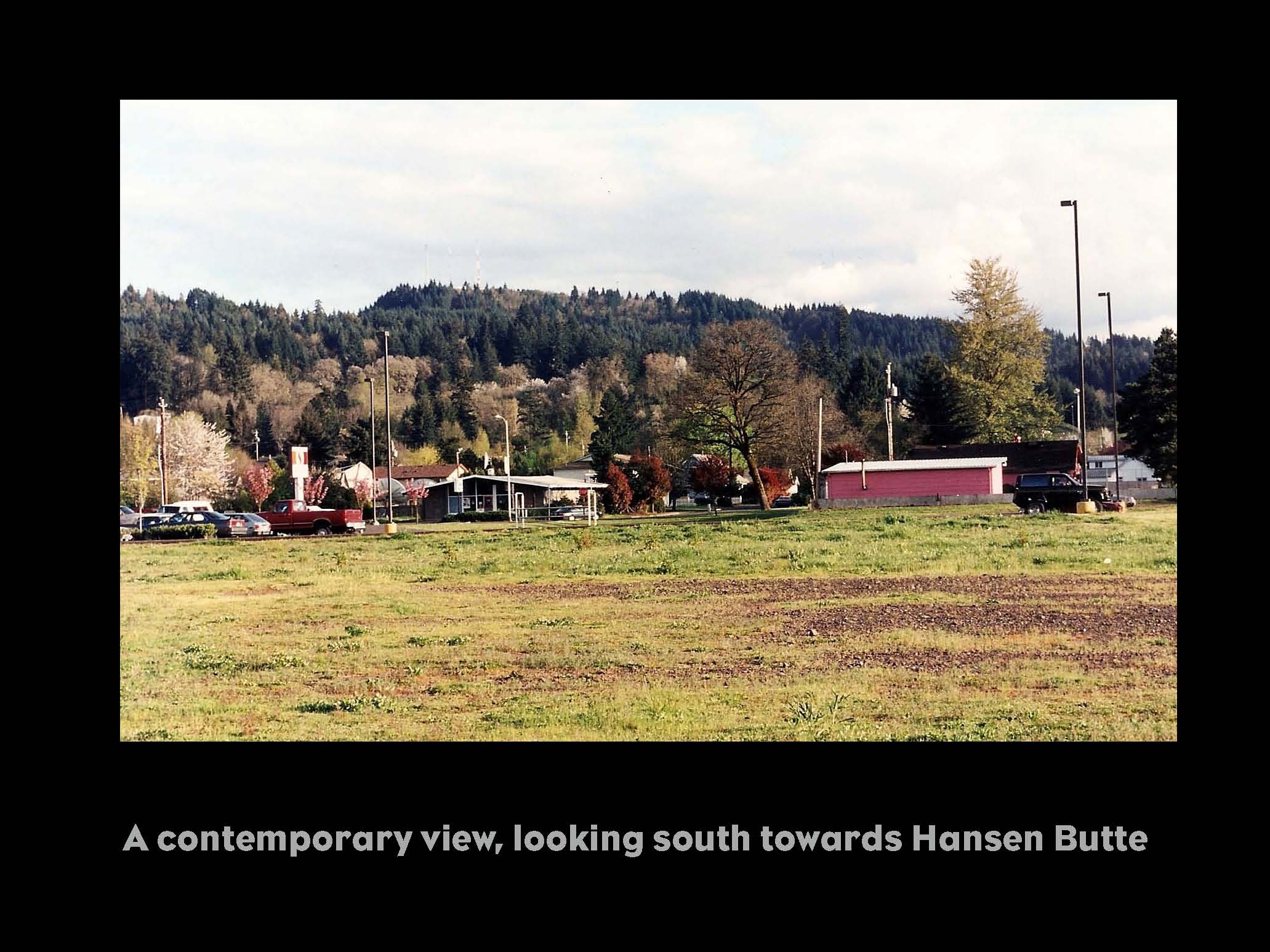

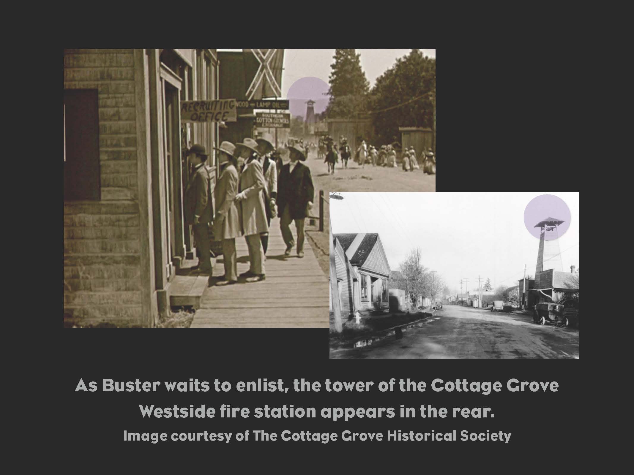
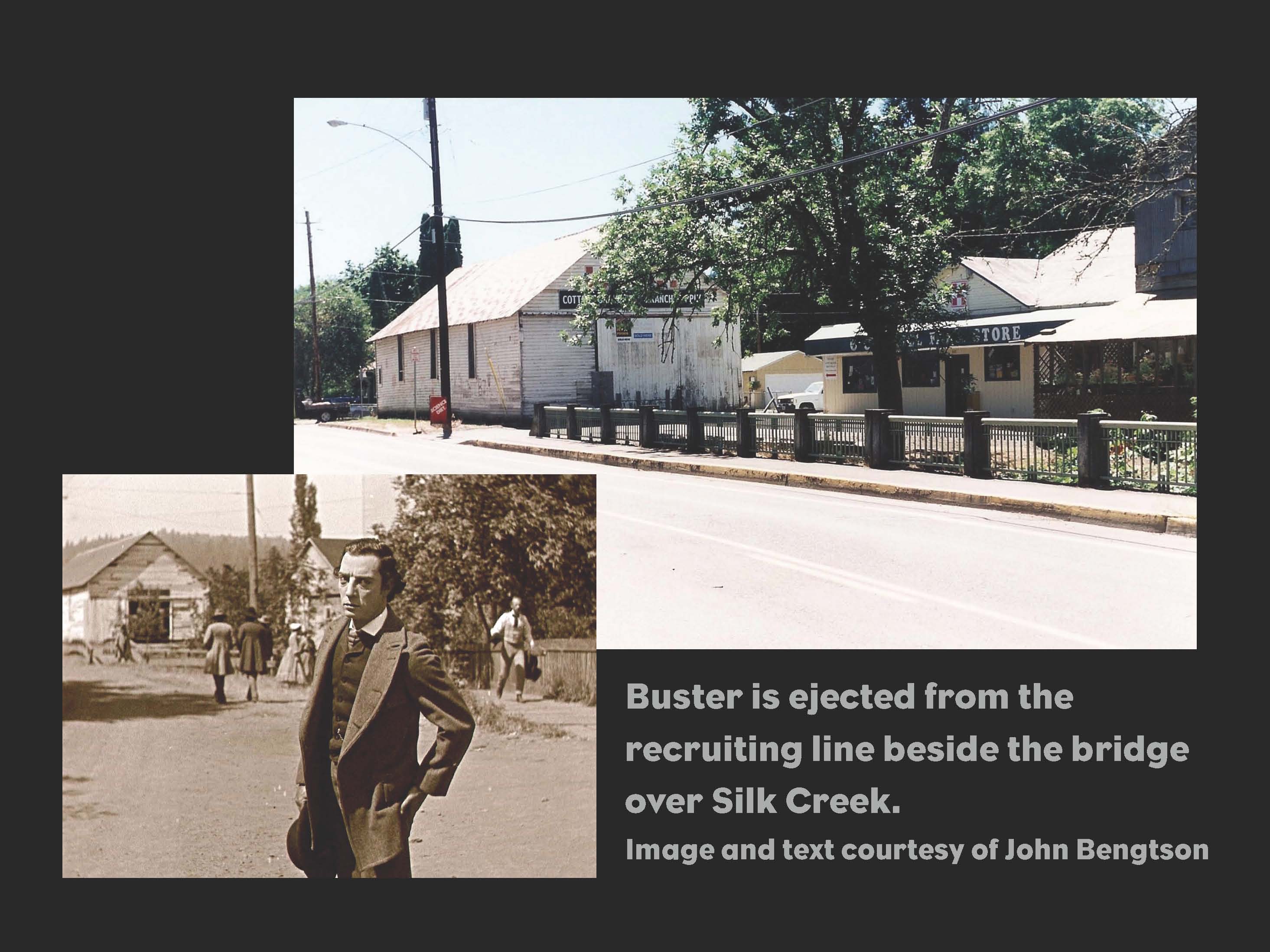
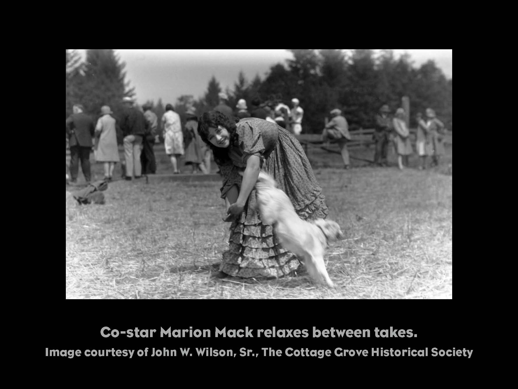
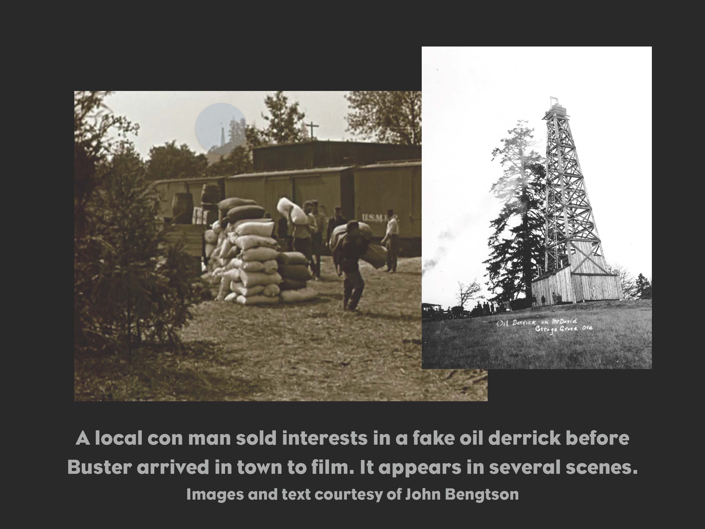


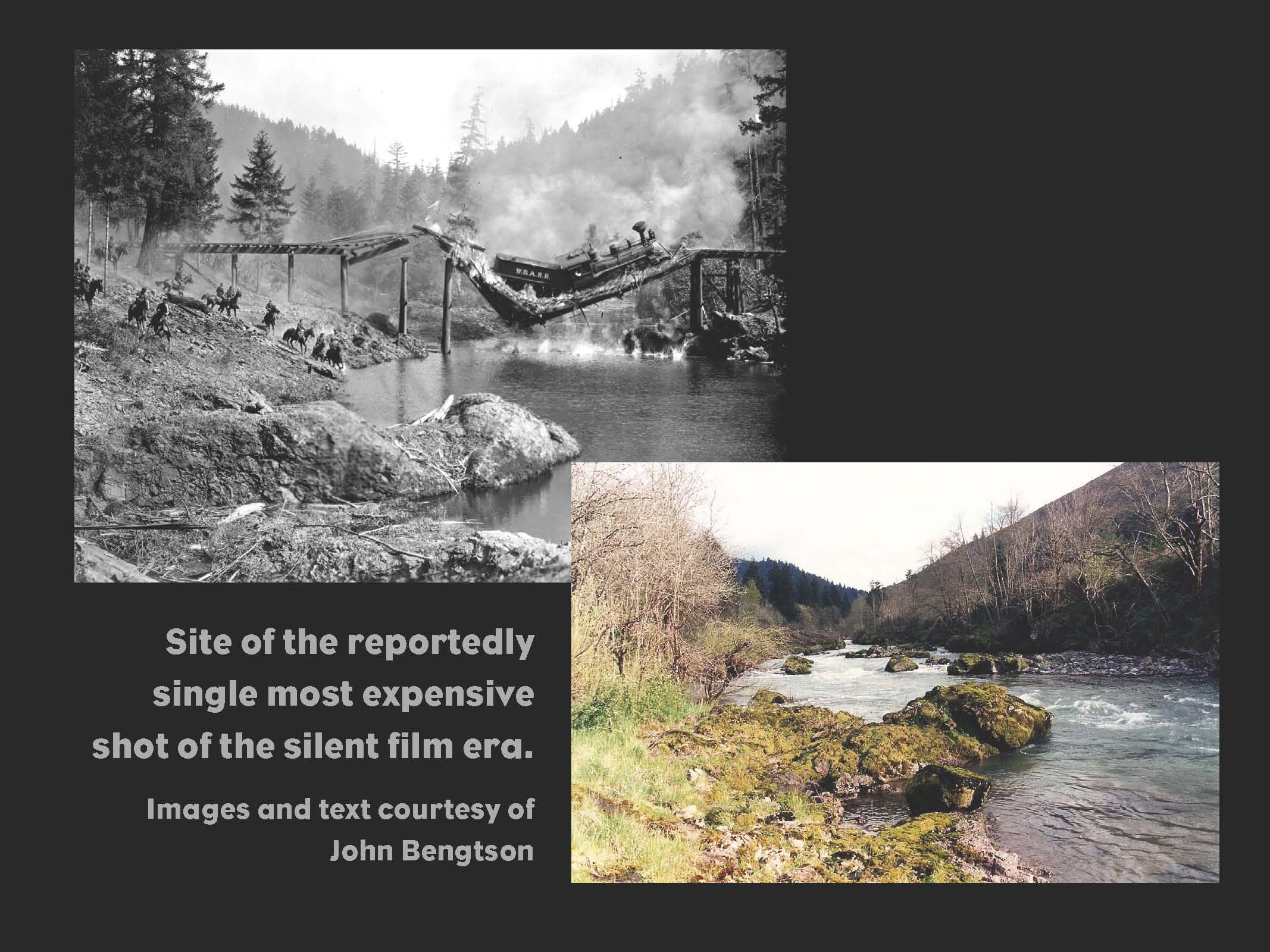
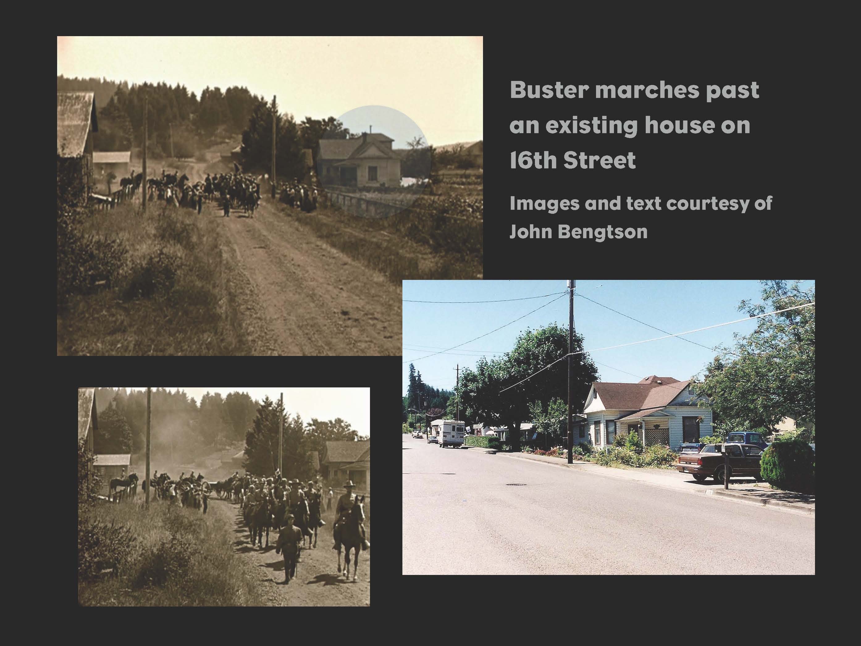


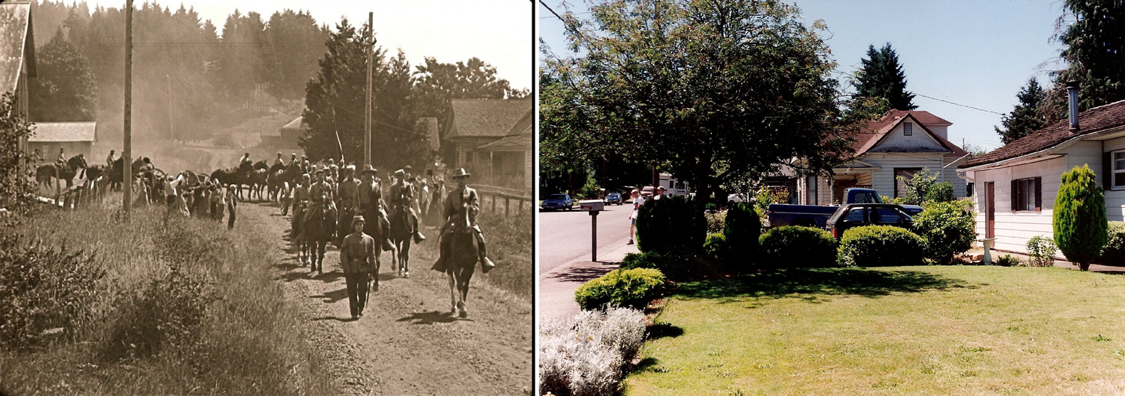


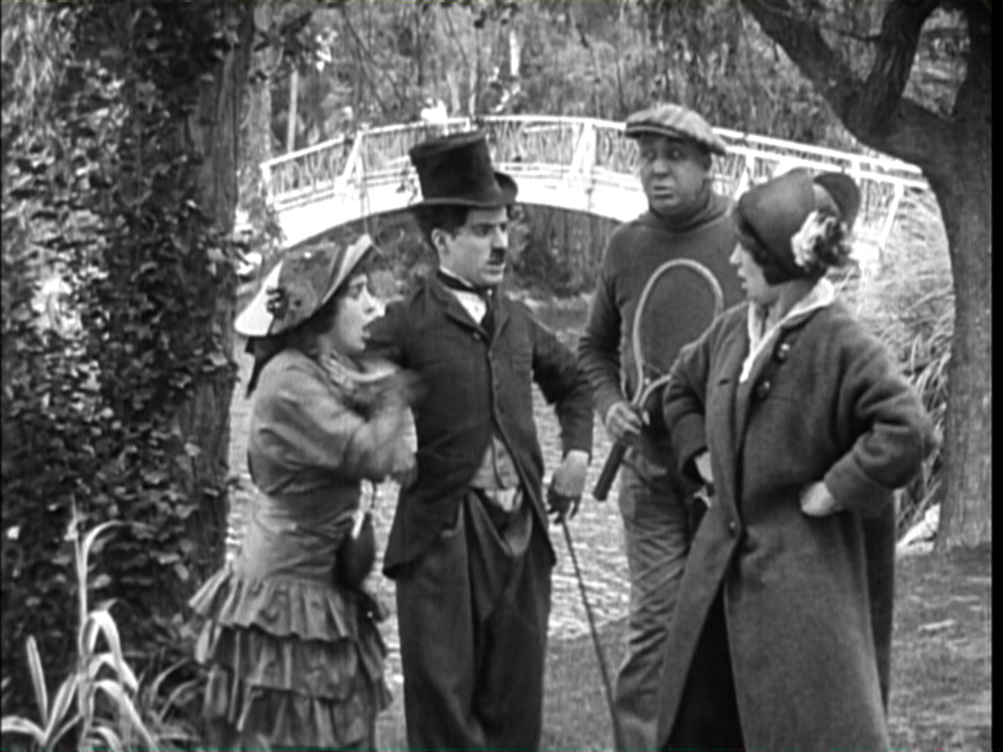


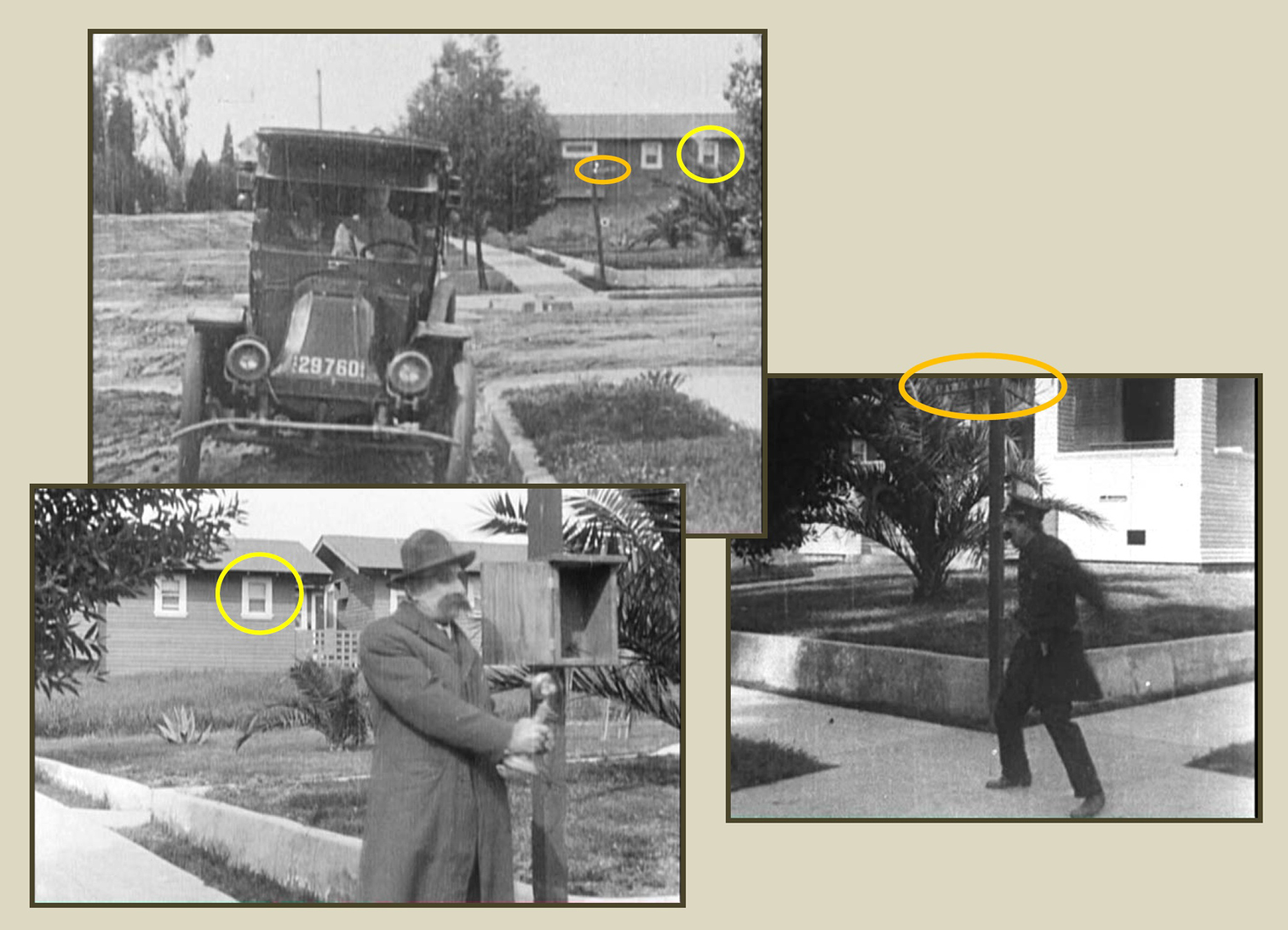


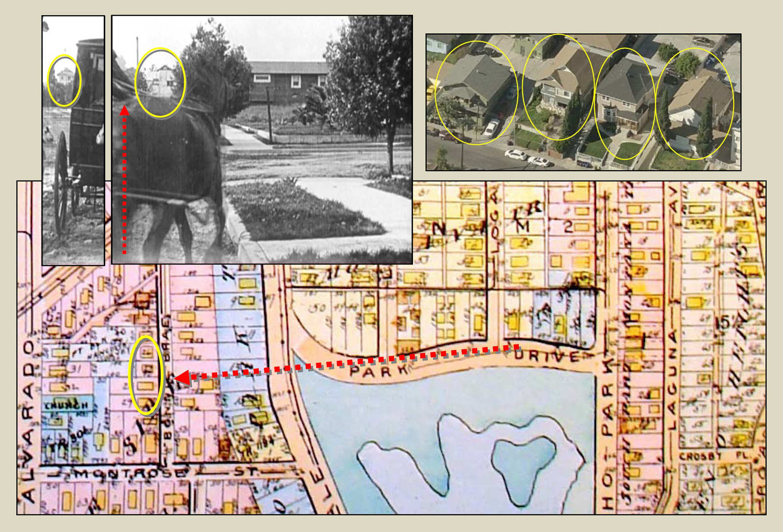
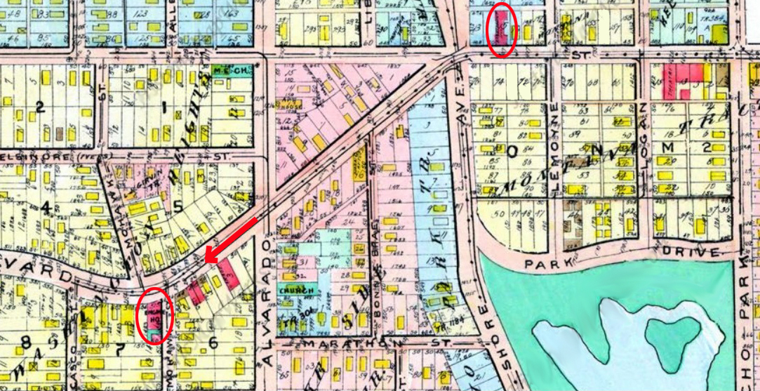
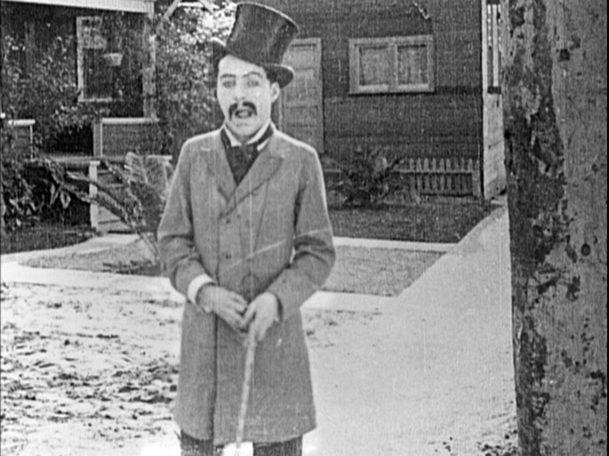

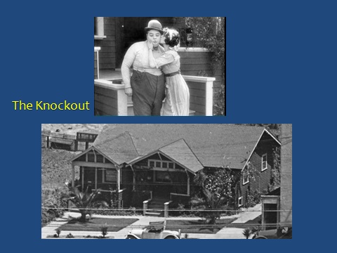
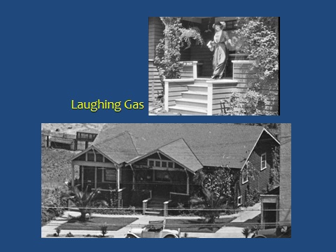
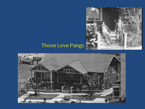


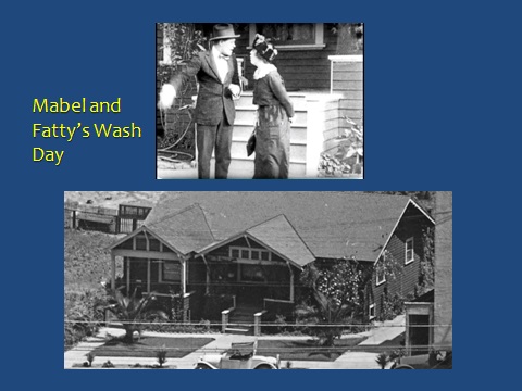

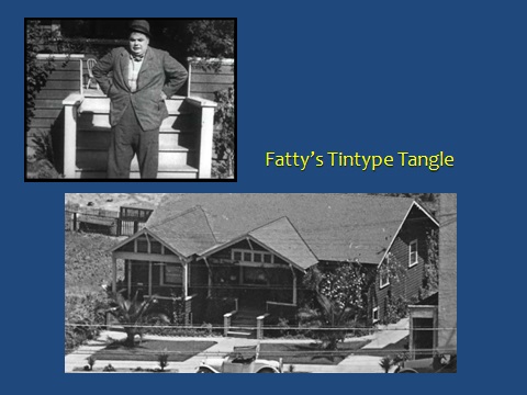
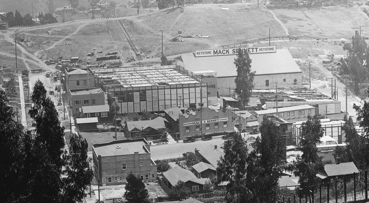
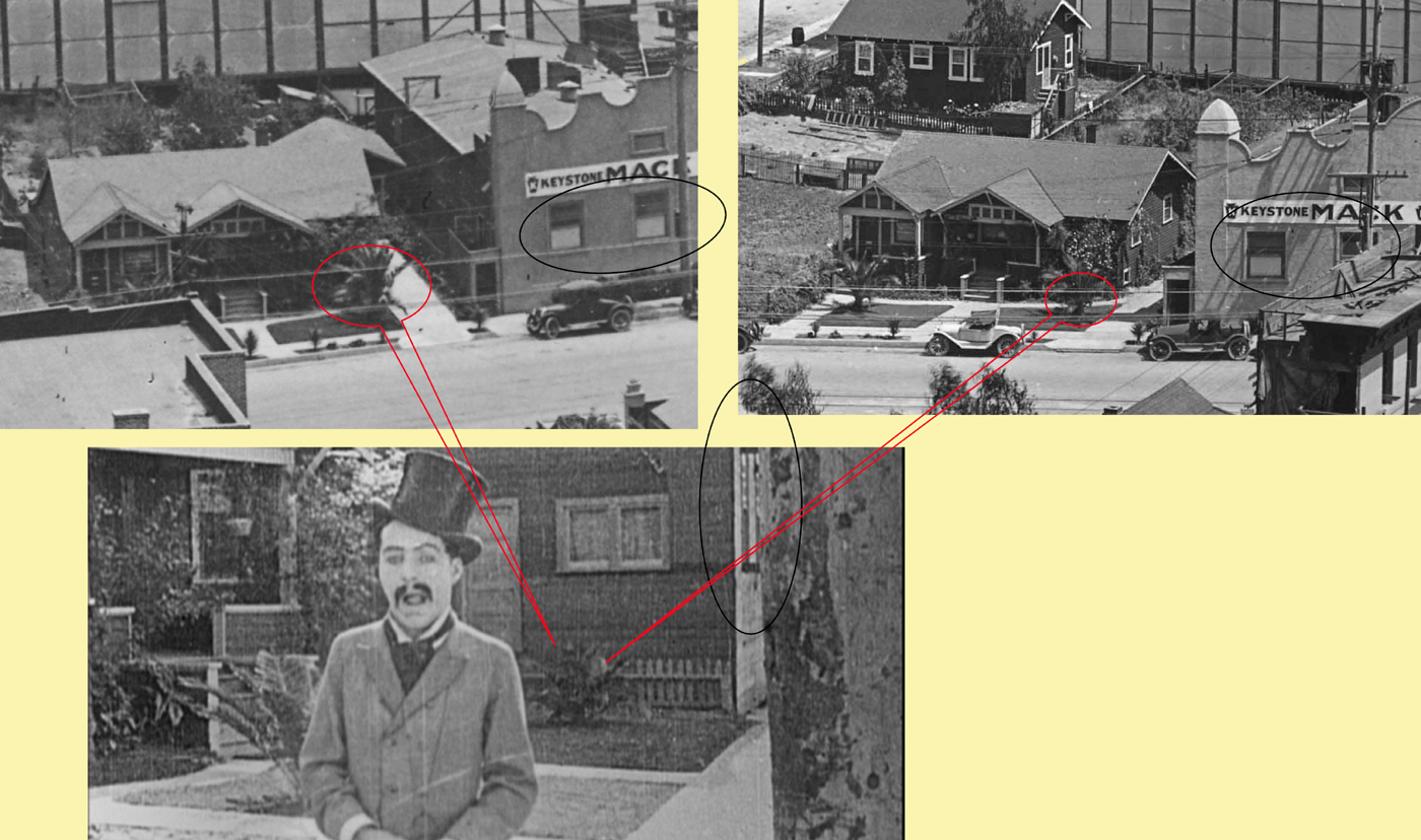
")
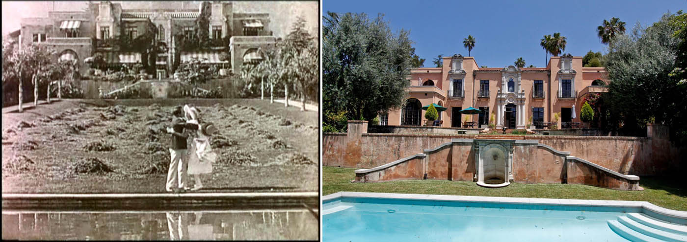

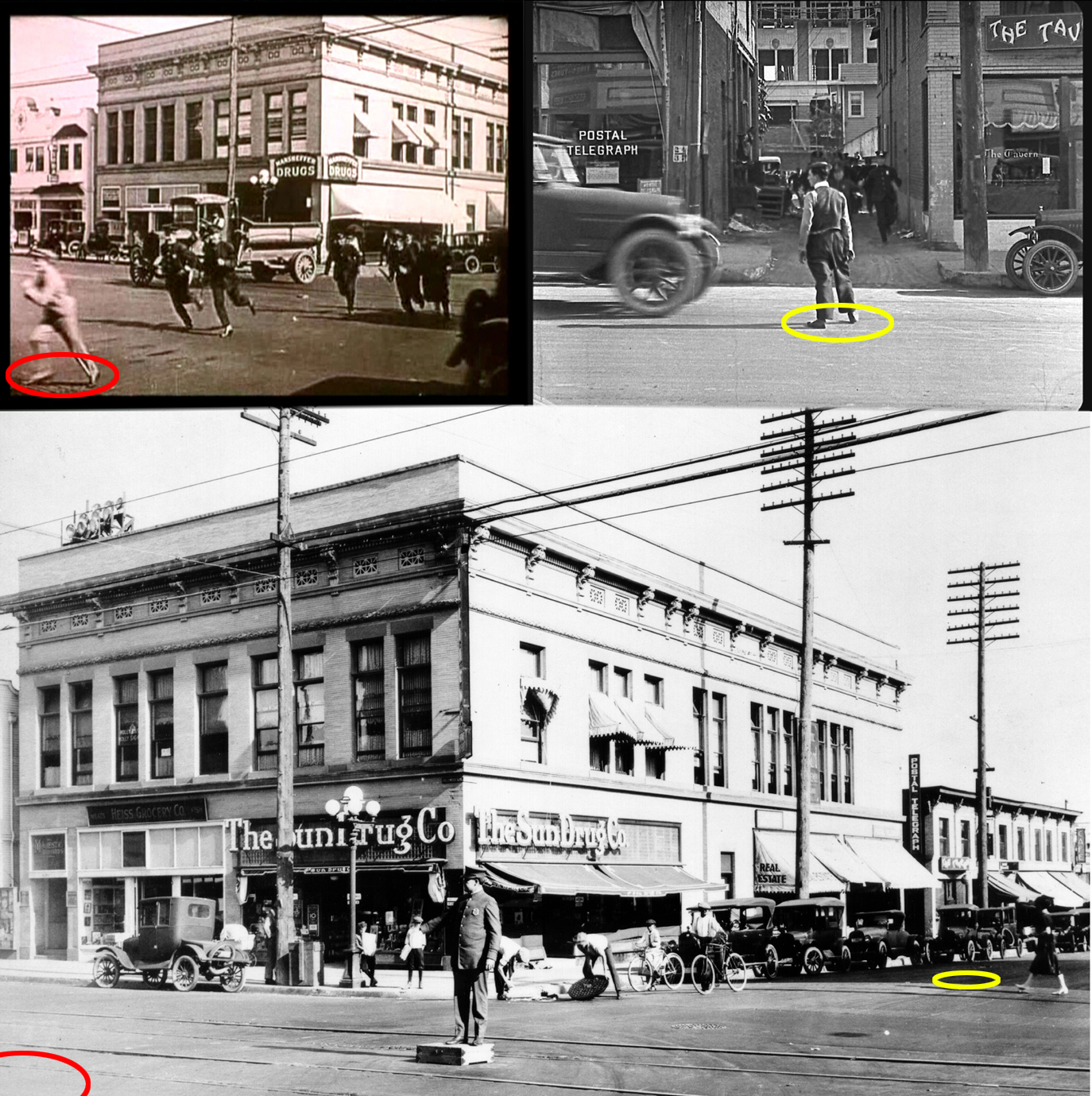
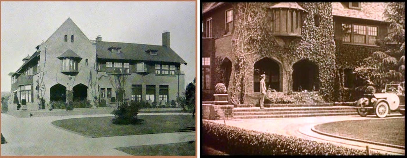
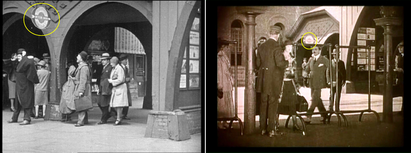


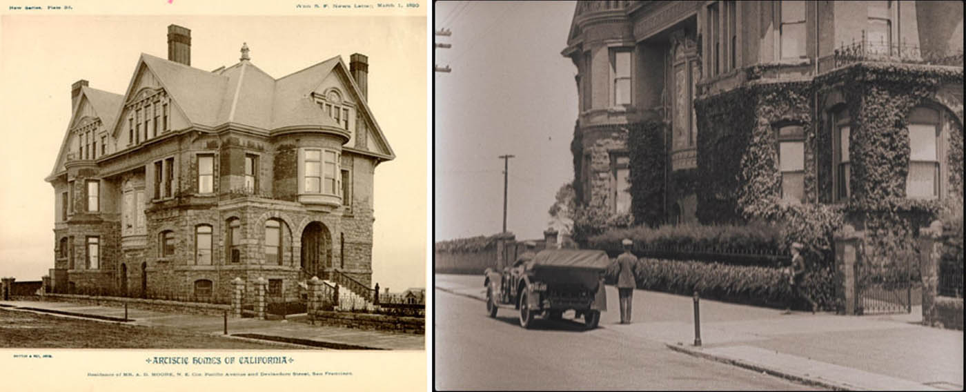


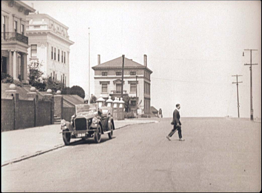
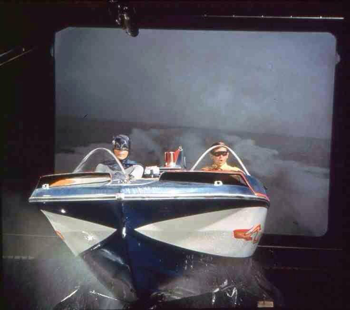


